
Yellowstone seismic network
By Yellowstone Volcano Observatory
October 2025 (approx.)
Detailed Description
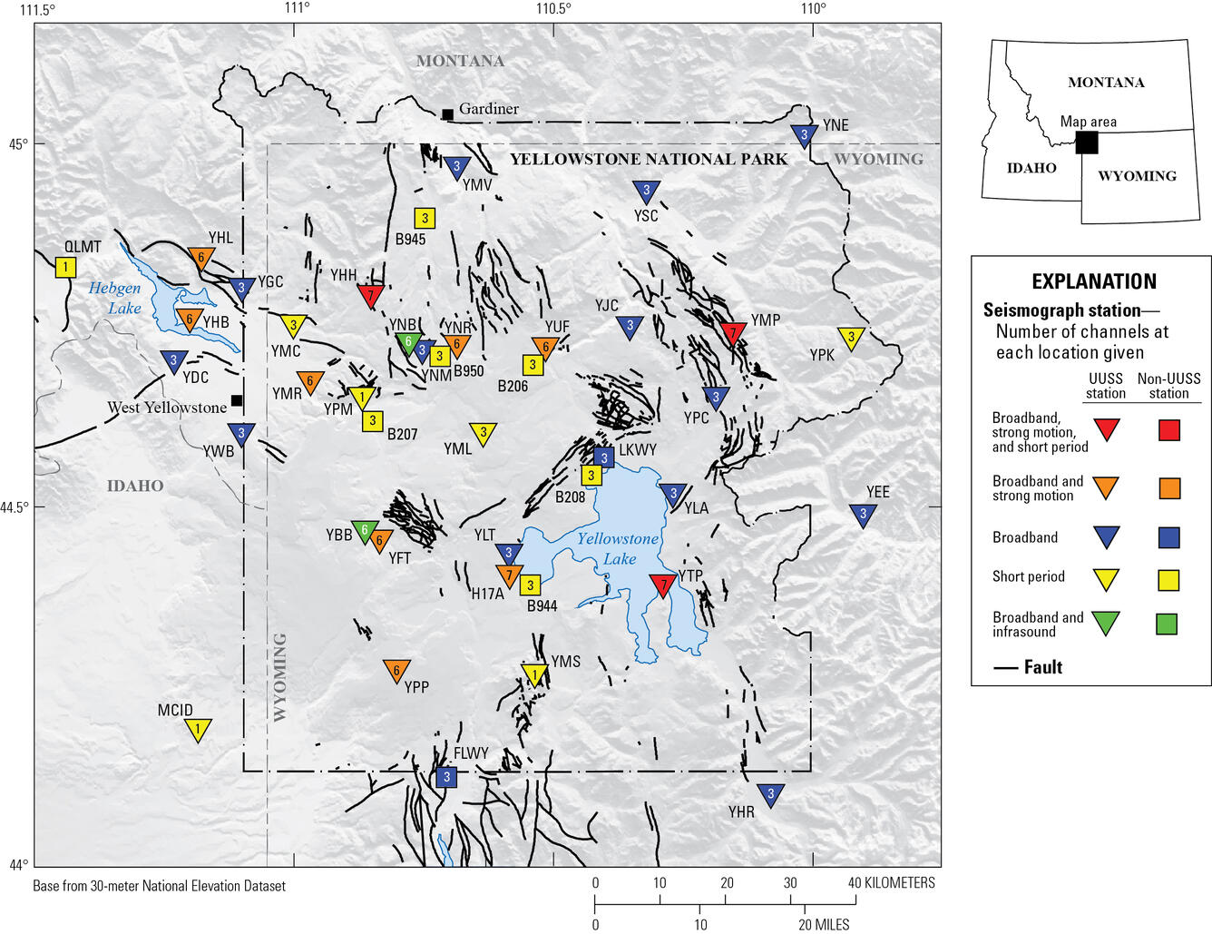
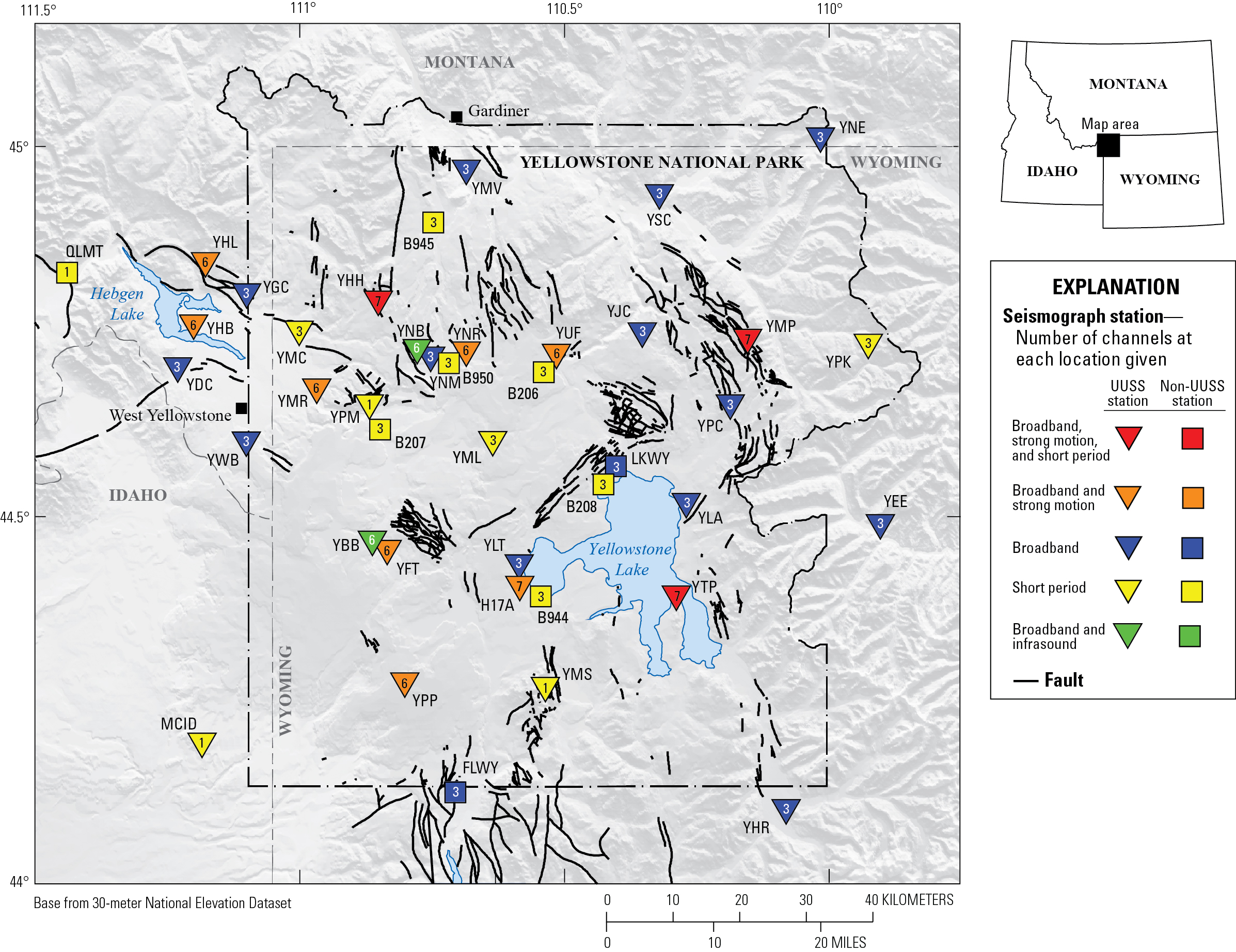
Map of seismic stations in the Yellowstone region, with numbers of channels indicated by number and sensor type by color. Inverted triangles indicate stations operated by University of Utah Seismograph Stations (UUSS), and squares indicate stations operated by other agencies.
Sources/Usage
Public Domain.
Related

Questions About Monitoring Yellowstone
Answers to questions about monitoring at Yellowstone.
Related
Questions About Monitoring Yellowstone
Answers to questions about monitoring at Yellowstone.