
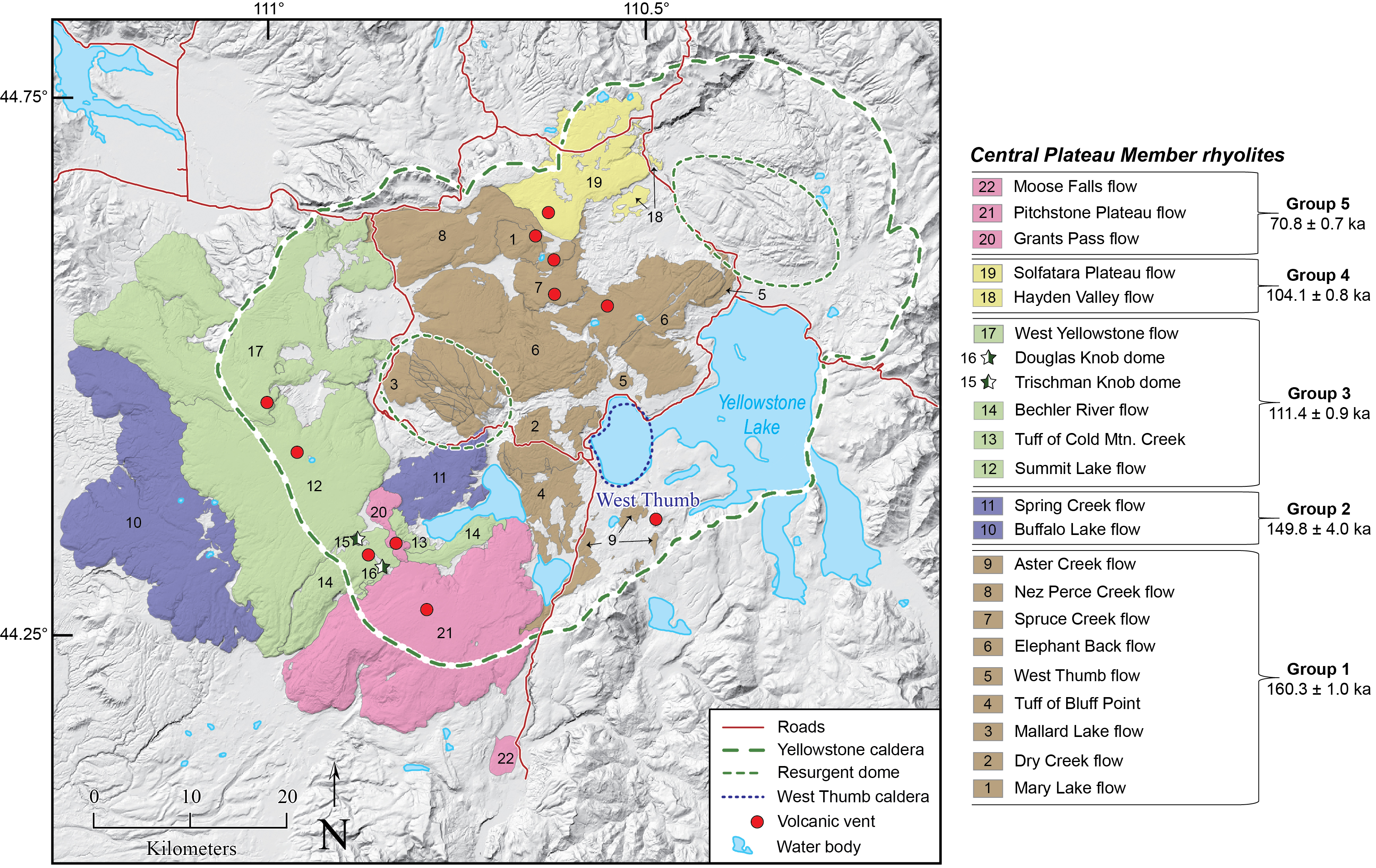
Map of Yellowstone caldera showing the locations and ages of the Central Plateau Member rhyolites
By Yellowstone Volcano Observatory
October 2023 (approx.)

Detailed Description
Map of Yellowstone caldera showing the locations and ages of the most recent rhyolite eruptions at Yellowstone, the Central Plateau Member rhyolites. Unit boundaries are from Christiansen (2001). The West Thumb region of Yellowstone Lake is indicated because it is thought to be the location of an explosive eruption and the source vent for the Tuff of Bluff Point. The Central Plateau Member rhyolites are broken into five informal groups based on new 40Ar/39Ar eruption ages. Each informal eruption group is shown in the same color. Numbers on the map and legend are included to indicate the location of different lava flows. Group mean ages and their 95% confidence intervals are included next to the list of units.
Sources/Usage
Public Domain.