Bienvenidos Puerto Rico! (English)
Since August 2013, all 50 states have been available for editing under the USGS The National Map Corps Volunteer Geographic Information project. Starting this month, TNMCorps is pleased to add Puerto Rico to that list.
Since August 2013, all 50 states have been available for editing under the USGS The National Map Corps Volunteer Geographic Information project. Starting this month, TNMCorps is pleased to add Puerto Rico to that list.
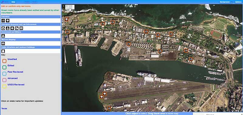
Using crowd-sourcing techniques, TNMCorps encourages citizen volunteers to collect data about manmade structures in an effort to provide accurate and authoritative spatial map data for the USGS National Geospatial Program’s web-based The National Map.
Through an online map editor, volunteers use aerial imagery and other resources to improve structures data by adding new features, removing obsolete points, and correcting existing data. Points available to edit include schools, hospitals, post offices, police stations and other important public buildings. Volunteers may find editing structures in Puerto Rico quite challenging, as some source data points shown in the map editor may be out of date, and some structure types are missing entirely.
"I appreciate the opportunity to participate with The National Map Corps and, from time to time, field verify USGS structures in my community”, said Reuben, a crowd-sourcing volunteer from Washington state. “The National Map has provided for some enjoyable weekend trips... with a bit of a purpose.
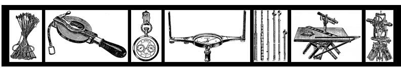
In an effort to show appreciation to our volunteers, TNMCorps has instituted a recognition program that awards "virtual" badges" based on the number of points edited. Badges consist of a series of antique surveying instruments ranging from the Circle of the Surveyor's Chain (25 – 50 points) to the Theodolite Assemblage (2000+ points). Additionally, volunteers are publically recognized (with permission) via Twitter, Google+, and Facebook.
Volunteers only need access to a computer and the Internet to participate. The National Map Corps’ website explains how volunteers can edit any area, regardless of their familiarity with the selected structures. Registration is simple and requires only an email address and self-selected username.
Participants make a significant addition to the USGS's ability to provide accurate information to the public. Data collected by volunteers become part of The National Map structures dataset which is available to users free of charge.
See for yourself how much fun participating can be. Go to The National Map Corps home page and give it a try.