



Media Alert: Low-level Flights to Image Geology over U.S. Virgin Islands
USGS airborne survey will help inform response to natural hazards and resource management issues
RESTON, Va. – The U.S. Geological Survey will begin low-level airplane flights in November over the U.S. Virgin Islands to image geology using airborne geophysical technology.
As the first airborne geophysical surveys of their kind in the region, these data will help build understanding of geologic hazards such as earthquakes, tsunamis, and landslides, while also supporting natural resource assessments and other research applications.
This cutting-edge, high-resolution survey over the U.S. Virgin Islands and surrounding waters is an extension of a recent airborne geophysical survey over Puerto Rico. The broader region is at high risk for large earthquakes as well as tsunamis due to complex tectonics in the region.
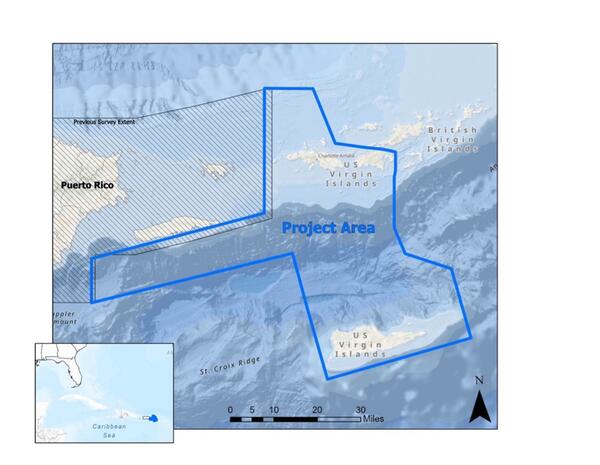
The flights are a collaborative effort between two USGS programs, USGS Earth Mapping Resources Initiative and the Coastal and Marine Hazards and Resources Program. Earth MRI is an effort to modernize the nation’s maps of geology and mineral resources, and to identify energy and groundwater resources and geologic hazards. The focus of the Virgin Islands survey is increasing knowledge of geologic hazards. The USGS Coastal and Marine Hazards and Resources Program studies coastal and ocean processes from shorelines to the deep sea, helping identify hazards including offshore earthquakes and tsunamis and providing critical information on our nation’s resources.
"Mapping the geology of the U.S. Virgin Islands and surrounding offshore areas will provide critical information about earthquake and tsunami hazards. This knowledge builds the scientific foundation for resilient communities and informed resource management,” said Jamey Jones, science coordinator for the U.S. Geological Survey's Earth Mapping Resources Initiative.
"A better understanding of offshore geology is essential to assess hazards and improve community resilience. Airborne magnetic mapping of rocks under the shallow seas surrounding the U.S. Caribbean territories is a powerful tool to identify active tectonic faults offshore and to understand the distribution of potential natural resources such as marine minerals," said Brita Jessen, director of the USGS Woods Hole Coastal and Marine Science Center.
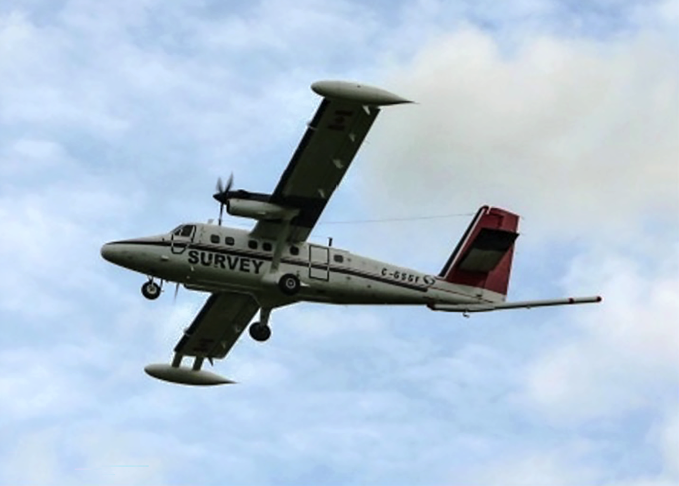
The survey includes magnetic data collection from fixed wing aircraft along pre-planned flight lines at a nominal terrain clearance of 330 feet (100 meters). The spacing of flight lines varies depending on the water depth and local geology, from 820 feet (250 meters) over shallow water to 6500 feet (2000m) over deep water. The USGS has contracted Sander Geophysics and Dewberry to collect the airborne magnetic data. Their fixed-wing aircraft will be equipped with an elongated “stinger” that extends from the tail of the aircraft and houses sensors collecting data. These scientific instruments are completely passive with no emissions that pose a risk to humans, animals, or plant life. No photography or video data will be collected. The aircraft will be flown by experienced pilots who are specially trained and approved for low-level flying. These pilots work with the FAA to ensure flights are safe and in accordance with U.S. law. The surveys will be conducted during daylight hours only.
Flights will be based out of Jose Aponte de La Torre Airport (TJRV in Puerto Rico), Cyril E. King Airport (TIST in St. Thomas), and Henry E. Rohlsen Airport (TISX in St. Croix). The aircraft tail number is C-GSGP.
Earth MRI includes airborne geophysical surveys like this one, geochemical reconnaissance surveys, topographic mapping using LiDAR technology, hyperspectral surveys, and geologic mapping projects. The data collected are made freely available to the public on the USGS ScienceBase website.
###
The USGS provides science for a changing world. Learn more at https://www.usgs.gov or follow us on Facebook @USGeologicalSurvey, YouTube @USGS, Instagram @USGS, or X at @USGS.