
25K Recreational OnDemand Topo Cartographic Specifications - Version History
This page highlights version history and details the refinements made to the published 25K Recreational Topo Cartographic Specifications.
Click a version number to jump to the associated history notes:
1.0 | 1.01 | 1.02 | 1.03 | 1.04 | 1.05 | 1.06 | 1.1 | 2.0 |
2026:
Version 2.0
Published: 7/1/2026
Summary: Completed a content review of all cartographic specifications themes to verify accuracy of published information.
Elevation
- Reviewed and revised cartographic specifications consistent with current release.
- Addition of halo transparency specifications for labels.
Geographic Names
- Reviewed and revised cartographic specifications consistent with current release.
- Addition of halo transparency specifications for labels.
Government Units
- Reviewed and revised cartographic specifications consistent with current release.
- Addition of halo transparency specifications for labels.
Hydrography
- Reviewed and revised cartographic specifications consistent with current release.
- Addition of halo transparency specifications for labels.
Elevation
- Reviewed and revised cartographic specifications consistent with current release.
- Addition of halo transparency specifications for labels.
Land Cover
- Reviewed and revised cartographic specifications consistent with current release.
Structures
- Reviewed and revised cartographic specifications consistent with current release.
- Addition of halo transparency specifications for labels.
Transportation
- Reviewed and revised cartographic specifications consistent with current release.
- Addition of halo transparency specifications for labels.
Version 1.1
Published: 4/13/2026
Summary: Completed the conversion of cartographic specifications themes to a bullet-list format including Hydrography and general specifications refinements.
Hydrography
- Reformatted cartographic specifications to a bullet-list format
- Refinements to grammar, spelling, images and feature descriptions
- Bullet-list conversion complete for all cartographic specifications themes
Version 1.06
Published: 3/20/2026
Summary: Conversion of cartographic specifications themes to a bullet-list format including Transportation and general specifications refinements.
Transportation
- Reformatted cartographic specifications to a bullet-list format
- Refinements to grammar, spelling, images and feature descriptions
Version 1.05
Published: 3/18/2026
Summary: Conversion of cartographic specifications themes to a bullet-list format including Government Units (Boundaries) and refinements to specifications for Federally Managed Lands and Military.
Government Units
- Reformatted cartographic specifications to a bullet-list format
- Refined specifications for "Donut Effect" and "Hatch Line" for Federally Managed Lands
- Refined specifications for "Donut Effect" and "Hatch Line" for Military
Version 1.04
Published: 3/13/2026
Summary: Conversion and standardization of cartographic specifications themes to a bullet-list format including Geographic Names and Government Units (Boundaries).
Geographic Names
- Reformatted cartographic specifications to a bullet-list format
Government Units
- Standardized the naming convention across products from Governmental Units (Boundaries) to Government Units (Boundaries)
Version 1.03
Published: 3/5/2026
Summary: Conversion of cartographic specifications themes to a bullet-list format including Structures.
Structures
- Reformatted cartographic specifications to a bullet-list format
Version 1.02
Published: 2/25/2026
Summary: Conversion of cartographic specifications themes to a bullet-list format including Elevation and Land Cover.
Elevation
- Reformatted cartographic specifications to a bullet-list format
Land Cover
- Reformatted cartographic specifications to a bullet-list format
Version 1.01
Published: 2/3/2026
Summary: Public release of a Version History tracking page.
Version History
- New Version History tracking page publicly released for 25K Recreational Topo
Data Sources
- The Protected Areas Database of the United States (PAD-US) is now being used as the official source of federal lands shown in OnDemand Topo products.
2025:
Version 1.0
Published: 7/29/2025
Summary: Complete set of cartographic specifications for Elevation, Geographic Names, Government Units (Boundaries), Hydrography, Land Cover, Structures, Transportation and Map Symbol Guide published on 9/30/2025 concurrent with product release in the topoBuilder application.
Related Information
Related Information
-
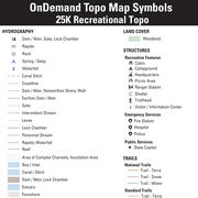
25K Recreational OnDemand Topo Cartographic Specifications - Map Symbol Guide 25K Recreational OnDemand Topo Cartographic Specifications - Map Symbol Guide
25K Recreational OnDemand Topo cartographic specifications Map Symbol Guide.
25K Recreational OnDemand Topo Cartographic Specifications 25K Recreational OnDemand Topo Cartographic Specifications
This page and associated links define the U.S. Geological Survey (USGS) 25K Recreational OnDemand Topo cartographic specifications including feature symbology and labels. The specifications are organized by data sets and themes listed within.
25K Recreational OnDemand Topo Cartographic Specifications - Elevation 25K Recreational OnDemand Topo Cartographic Specifications - Elevation
25K Recreational OnDemand Topo cartographic specifications including feature symbology and labels for elevation generated contours and shaded relief.
25K Recreational OnDemand Topo Cartographic Specifications - Geographic Names 25K Recreational OnDemand Topo Cartographic Specifications - Geographic Names
25K Recreational OnDemand Topo cartographic specifications including feature symbology and labels for natural features, landforms, and populated places.
25K Recreational OnDemand Topo Cartographic Specifications - Government Units 25K Recreational OnDemand Topo Cartographic Specifications - Government Units
25K Recreational OnDemand Topo cartographic specifications including feature symbology and labels for Government Units including Counties or equivalent, Designated Areas, Federally Managed Lands (Bureau of Land Management, Forest Service, Grassland, National Monument, National Park, U.S. Fish and Wildlife Service, and Wilderness), International, Military, National Cemetery, and State boundaries.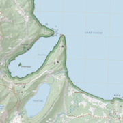
25K Recreational OnDemand Topo Cartographic Specifications - Hydrography 25K Recreational OnDemand Topo Cartographic Specifications - Hydrography
25K Recreational OnDemand Topo cartographic specifications including feature symbology and labels for Hydrography including NHDArea, NHDFlowline, NHDLine, NHDPoint, NHDWaterbody, and National Wetland Inventory (NWI).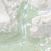
25K Recreational OnDemand Topo Cartographic Specifications - Land Cover 25K Recreational OnDemand Topo Cartographic Specifications - Land Cover
25K Recreational OnDemand Topo cartographic specifications including feature symbology and labels for Land Cover including Woodlands.-
25K Recreational OnDemand Topo Cartographic Specifications - Structures 25K Recreational OnDemand Topo Cartographic Specifications - Structures
25K Recreational OnDemand Topo cartographic specifications including feature symbology and labels for Structures including emergency services, medical services, public services, recreation, and shelters. 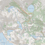
25K Recreational OnDemand Topo Cartographic Specifications - Transportation 25K Recreational OnDemand Topo Cartographic Specifications - Transportation
25K Recreational OnDemand Topo cartographic specifications including feature symbology and labels for Transportation including Airport, National Trails, Standard Trails, Roads, Road Shields, and Forest Service Shields.