
Elevation derived-Hydrography Delineation and Attribution Error Examples and Solutions
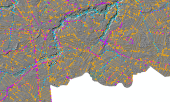
EDH delineation and attribution errors are described in detail accompanied by visual representations with solutions provided.
Roadside ditches and culverts through driveways
Ancillary data feature capture
Error: Incorrect schema.
Issue: Data delivered in schema that does not match EDH schema provided in Elevation-derived Hydrography Acquisition Specifications.
Solution: Finalize geodatabase and distribute with all task orders.
Error: Isolated polygon feature.

Issue: If a lake or pond is part of the stream network, it should be connected by a connector or culvert.
Solution: If there is an isolated polygon, it should be investigated to determine if there is an inflow or outflow from the pond.
Error: Canal density.
Issue: Too many small ditches and canals were captured.
Solution: See Elevation-derived Hydrography Acquisition Specifications for more information on canal density.
Error: Incorrect outflow from a dam.
Issue: Outflow of water from a dam should cross the dam. Not the emergency / overflow spillway.
Solution: Where a dam is located, a “connector” (EDH FCode 33400) should be added across the dam, and the stream should continue downstream through the obvious stream channel.
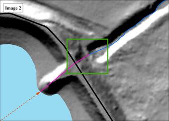
Error: Hanging artificial paths.

Issue: Artificial paths with no connection to a stream/river outside the waterbody.
Solution: If a larger scale dataset is used to generate a smaller scale dataset, care should be taken to remove features that are no longer pertinent. For instance, if artificial path connections were included in a 1:5,000 scale dataset, but some of the connecting stream segments were pruned for the 1:24,000-scale dataset, the connecting artificial paths should be removed as well.

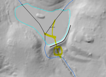
Error: Roadside ditches and culverts through driveways.

Issue: Automated processes may delineate roadside ditches and culverts through driveways as part of the stream network that are outside of the capture requirements.
Solution: QA linework and remove extraneous features that are automatically generated. See Elevation-derived Hydrography Acquisition Specifications for more information on canal density.
Error: Ancillary data feature capture.

Issue: When DEM is inconclusive but, in order to maintain network connectivity, ancillary data sources may used to determine feature placement.
Solution: Features captured based on information gathered from ancillary data must have ancillary data usage noted in the attribute table for the feature class. The data source must be noted for reproducibility.
Error: Dam connector length.
Issue: Connectors through dams or berms that extend too far in one or both directions across the obstruction.
Solution: If a connector feature is required through a dam or berm, it should only extend the distance across the dam structure, and no further (but be sure to connect low points on both sides).
Error: User defined code.

Issue: Features were delineated for a special project and have no EDH FCode available in Elevation-derived Hydrography Acquisition Specifications.
Solution: All NHD FTypes may be used as codes, as well as other user defined codes. These must be placed in the “UserCode” field for the feature class.