
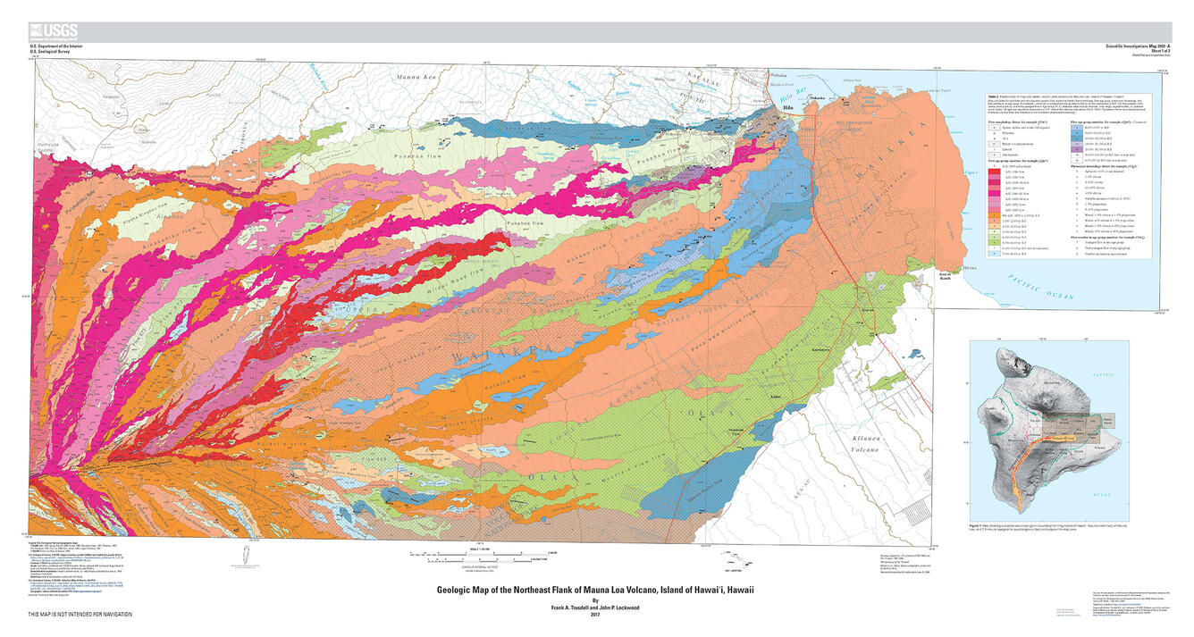
July 13, 2017—New map reveals geologic history: Mauna Loa Volcano's NE flank
January 1, 2018
Media
Sources/Usage: Public Domain. View Media Details