
New map reveals geologic history: Mauna Loa Volcano's NE flank
Detailed Description
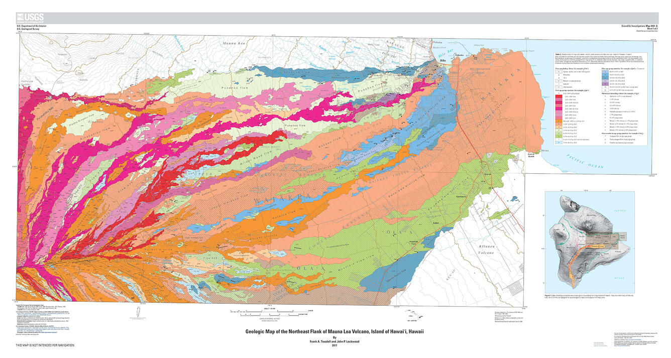
"Geologic map of the northeast flank of Mauna Loa volcano, Island of Hawai‘i," published by the U.S. Geological Survey in May 2017, shows the distribution of lava flows and other deposits covering an area from Pu‘u‘Ula‘ula ("Red Hill") on the southwest to Hilo on the northeast. Ages of the geologic units are indicated by color: reds and oranges are younger, blues and purples are older. The largest salmon-colored lava flow on the map is the Pana‘ewa flow, which erupted from Mauna Loa about 1,470 years ago. This USGS map is freely available at https://doi.org/10.3133/sim2932A.
Sources/Usage
Public Domain.