U.S. flag

An official website of the United States government

February 19, 2026

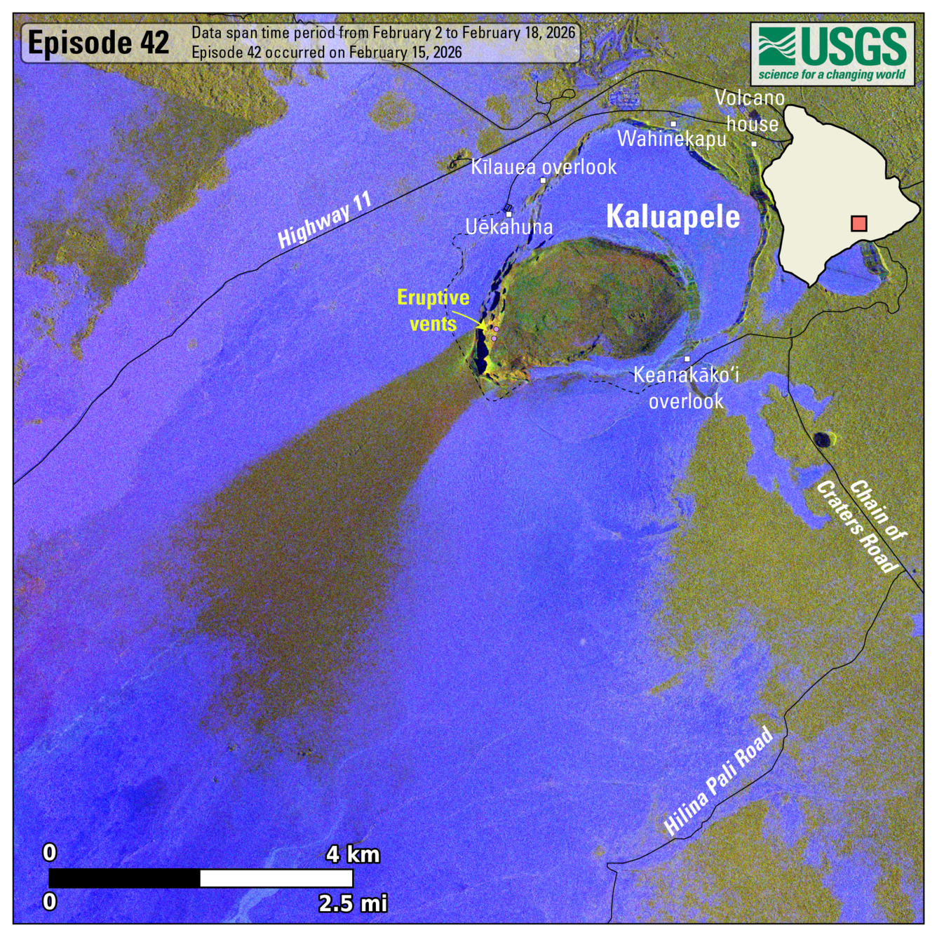
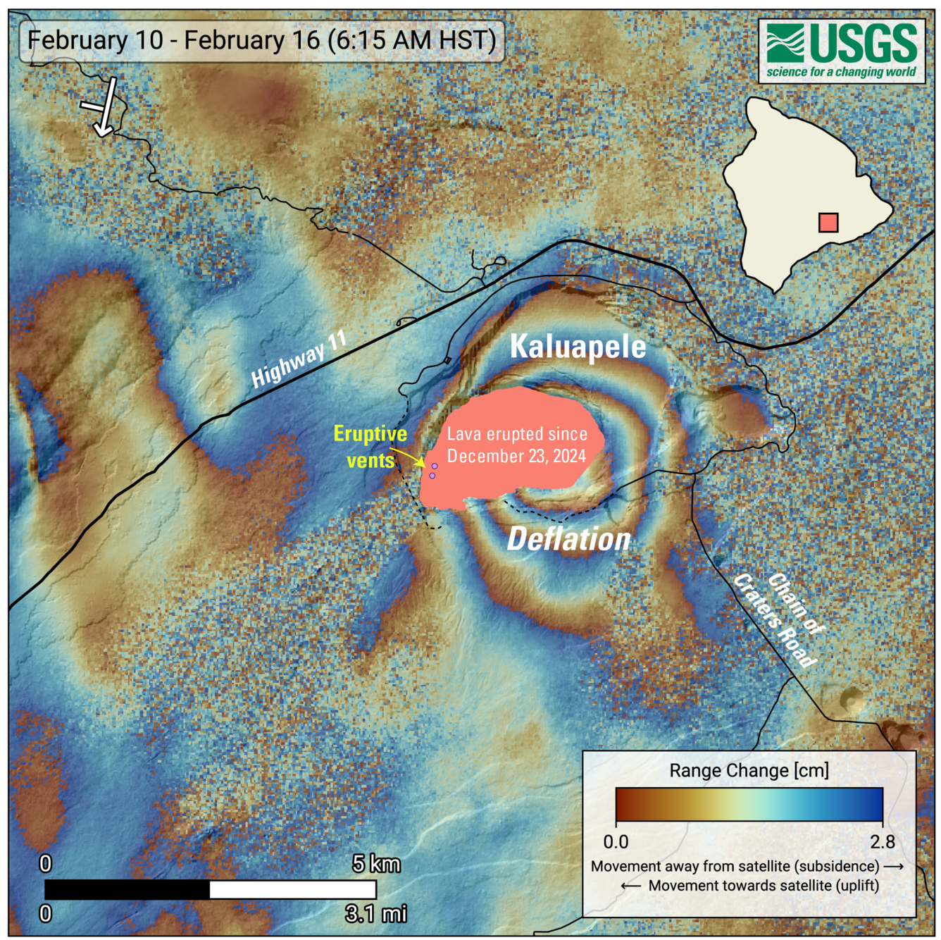
Episode 42 of lava fountaining in Halemaʻumaʻu at the summit of Kīlauea lasted for just under 10 hours on February 15, 2026. These maps show lava flow and tephra accumulation during episode 42, as well as ground deformation spanning the eruptive episode. 

Media
Color photograph showing fallout area from volcanic eruption
This map shows lava flow and tephra accumulation at the summit of Kīlauea volcano associated with episode 42 of the ongoing eruption in Halemaʻumaʻu that started on December 23, 2024, using data recorded by the Italian Space Agency's (ASI) COSMO-SkyMed Second Generation satellite constellation. These maps combine cross-polarized radar amplitude images taken on two different dates (on February 2 and 18, 2026), along with interferometric coherence from the time between those dates. In the maps, unchanged barren areas are represented in blue/purple, vegetated areas appear in yellow/light green, and new deposits over barren land are shown in dark green. These new deposits were formed on February 15, 2026, during episode 42 of the eruption. Public viewing areas within Hawaiʻi Volcanoes National Park are indicated with white squares; these can be temporarily closed for public safety. 
Media
Color annotated satellite image showing ground deformation at summit of volcano
This map shows recent deformation at Kīlauea, over the timeframe of February 10–16, 2026. Data were acquired by the European Space Agency's Sentinel-1A/C satellites. Each color cycle represents 2.8 cm (1.1 in) of ground movement in the direction between the satellite and the ground (range change). The symbol in the upper left indicates the satellite's orbit direction (arrow) and look direction (bar). The lava flows covering the crater floor are represented by the pink polygon, the two vents (circles) are marked in purple. This radar interferogram spanning episode 42 shows round fringes within and around Kaluapele (Kīlauea summit caldera) indicating ground surface deflation over the time period spanned by the images as magma was withdrawn from the Halemaʻumaʻu magma chamber at a depth of approximately 1.5 kilometers (1 mile) below the ground surface.
Was this page helpful?