
February 16, 2026—InSAR image of Kīlauea deformation associated with episode 42 of ongoing summit eruption
Detailed Description
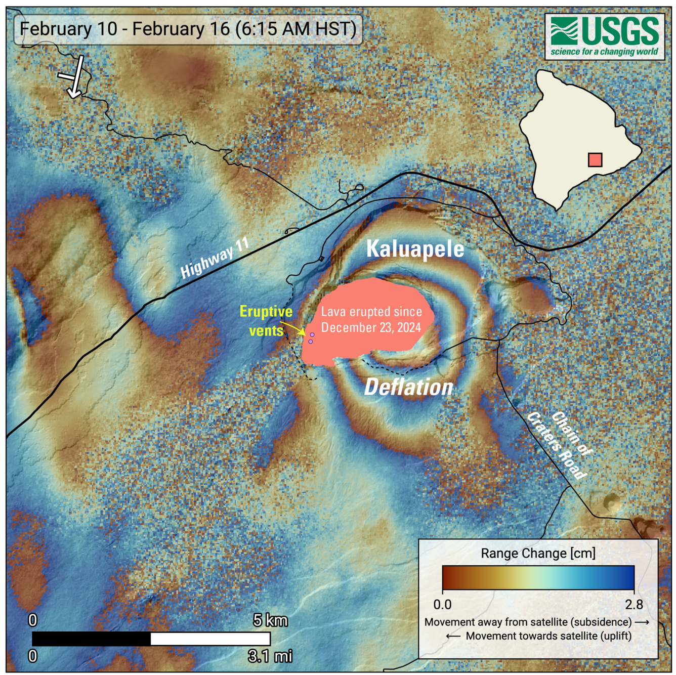
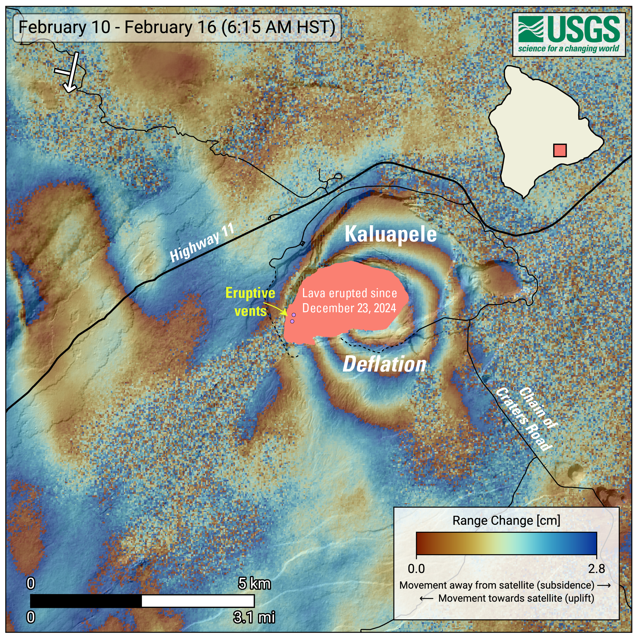
This map shows recent deformation at Kīlauea, over the timeframe of February 10–16, 2026. Data were acquired by the European Space Agency's Sentinel-1A/C satellites. Each color cycle represents 2.8 cm (1.1 in) of ground movement in the direction between the satellite and the ground (range change). The symbol in the upper left indicates the satellite's orbit direction (arrow) and look direction (bar). The lava flows covering the crater floor are represented by the pink polygon, the two vents (circles) are marked in purple.
This radar interferogram spanning episode 42 shows round fringes within and around Kaluapele (Kīlauea summit caldera) indicating ground surface deflation over the time period spanned by the images as magma was withdrawn from the Halemaʻumaʻu magma chamber at a depth of approximately 1.5 kilometers (1 mile) below the ground surface.
Sources/Usage
Public Domain.