
Photo & Video Chronology — February 26, 2026 — Kīlauea summit fieldwork and overflight
By Hawaiian Volcano Observatory
February 26, 2026
On February 26, 2026, USGS Hawaiian Volcano Observatory staff serviced the V3 livestreaming camera at the summit of Kīlauea, and conducted a monitoring helicopter overflight.
Media
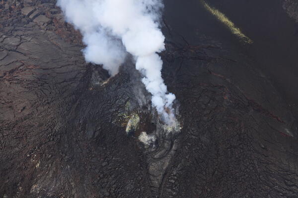
Despite hazy conditions on Thursday, February 26, the USGS Hawaiian Volcano Observatory monitoring overflight crew had clear views of the Kīlauea summit eruptive vents during a low pass over western Halema‘uma‘u crater. No lava or incandescence was visible in either the north (lower-right) or south (upper-left) vent. USGS photo by M. Zoeller.
Sources/Usage: Public Domain. View Media Details
Media
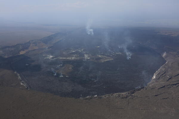
On Thursday, February 26, USGS Hawaiian Volcano Observatory scientists completed a monitoring helicopter overflight of Halema‘uma‘u crater at the summit of Kīlauea. As seen in this overview photo of the crater looking to the west-southwest, conditions were extremely hazy during the flight, presenting a challenge as the scientists attempted to capture mapping photos. USGS photo by M. Zoeller.
Sources/Usage: Public Domain. View Media Details
Media
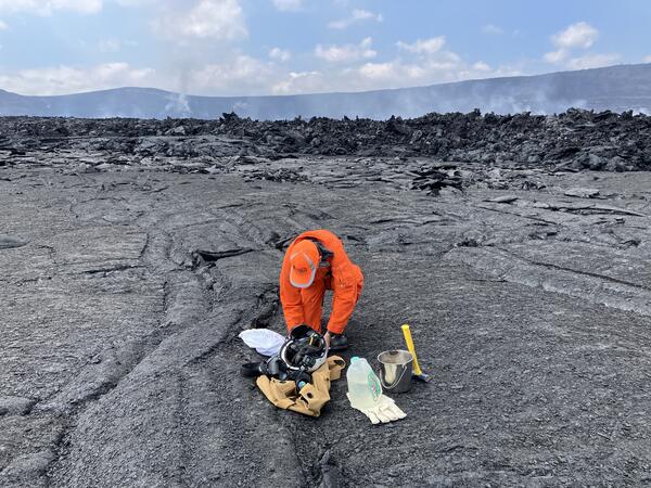
At the end of their Kīlauea summit overflight on Thursday, February 26, two USGS Hawaiian Volcano Observatory geologists were dropped off on the floor of Halema‘uma‘u crater to sample lava from summit eruption episode 42 on February 15. Here, one of the geologists works to bag the cooled lava fragments, surrounded by typical sampling gear: a small sledgehammer, water and a bucket for cooling the samples (if necessary), and fabric sample bags labelled with key details: date/time, type of sample, and GPS coordinates. These monitoring and sampling overflights of Kīlauea summit region are done with permission from and in coordination with Hawai‘i Volcanoes National Park. USGS photo by M. Zoeller.
Sources/Usage: Public Domain. View Media Details
Media
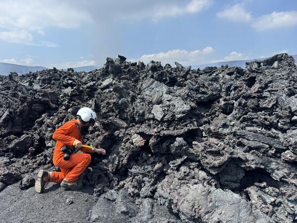
A USGS Hawaiian Volcano Observatory geologist collects a cooled lava sample from the front of the episode 42 lava flow on Halema‘uma‘u crater floor at Kīlauea summit. The chemistry of these lava samples is analyzed to better understand the magmatic plumbing system and inform our understanding of eruptive hazards. USGS photo by M. Patrick.
Sources/Usage: Public Domain. View Media Details
Media
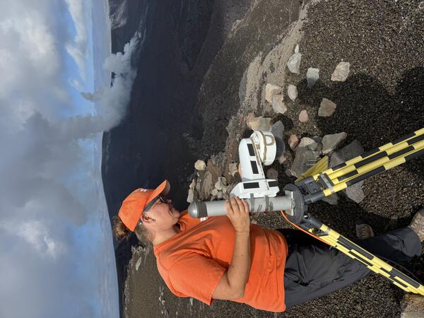
On February 26, 2026, USGS Hawaiian Volcano Observatory staff visited and serviced the V3 livestreaming camera on the south rim of Halemaʻumaʻu crater, at the summit of Kīlauea. USGS photo by M. Patrick.
Sources/Usage: Public Domain. View Media Details