



Photo & Video Chronology — Kīlauea summit intrusion cracks and ground deformation
By Hawaiian Volcano Observatory
October 7, 2026
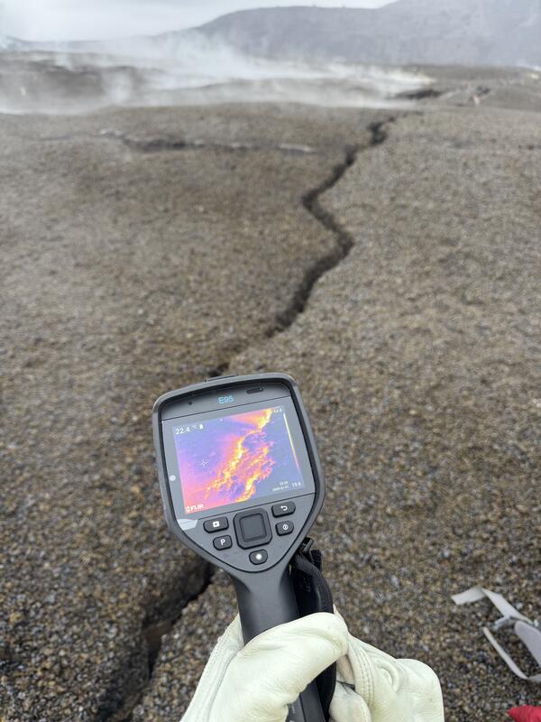
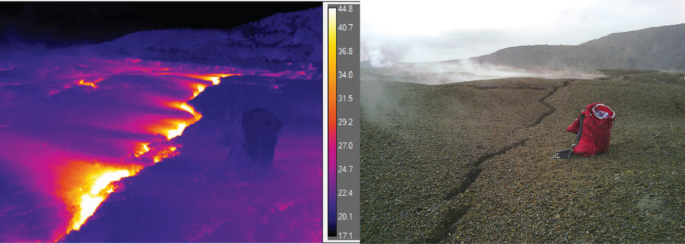
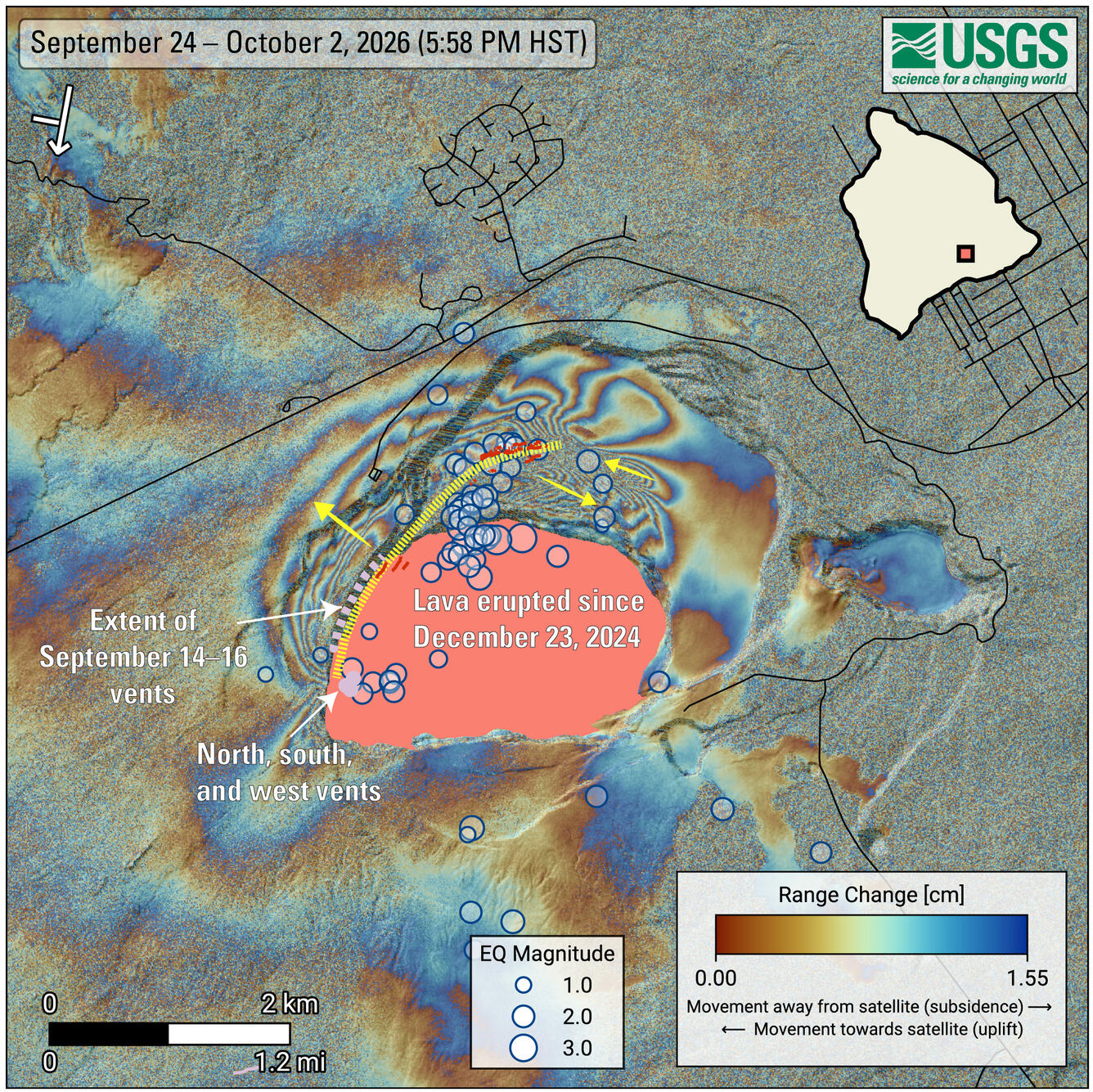
As flames, spatter, and lava flows erupted from the north and south vents in Halemaʻumaʻu at the summit of Kīlauea on the night of September 30, 2026, magma was also making a new path below the surface of the caldera. This intrusive activity, which caused earthquakes and ground deformation, resulted in the formation of new cracks on the north part of the floor of Kaluapele, Kīlauea summit caldera.
Media
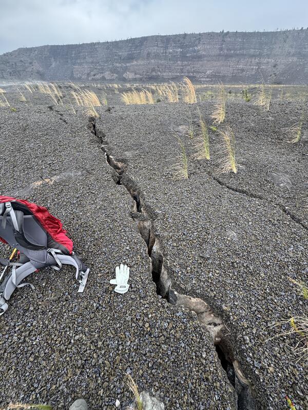
The largest new crack observed on the northern part of Kīlauea caldera floor during a field visit on October 6, 2026, was measured at 15 cm (6 inches) wide. The sharp edge of the tephra deposit above the crack, as well as delicate suspended roots that were pulled apart in the crack, help indicate that this is a new crack and not an older, existing one. USGS photo by M. Patrick.
Sources/Usage: Public Domain. View Media Details
Media
Sources/Usage: Public Domain. View Media Details
Media
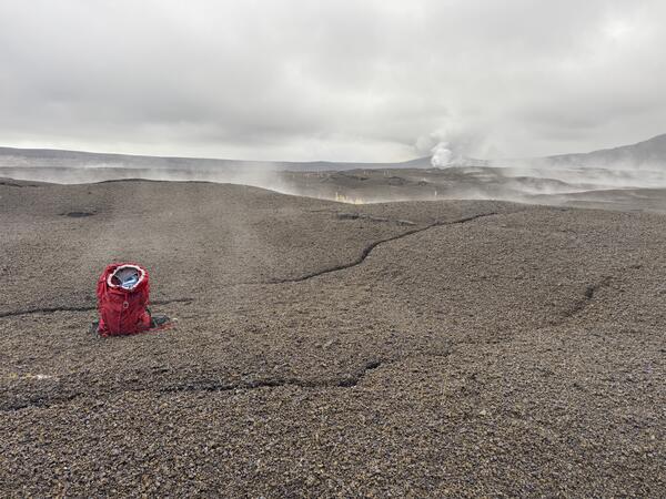
Another view of the new ground cracks in the north part of Kaluapele, Kīlauea summit caldera, cutting through the recent tephra deposits on the caldera floor. New cracks were up to about 6 inches (15 cm) wide. The active vents of the ongoing eruption are visible in the upper right portion of the photo. USGS photo by M. Patrick.
Sources/Usage: Public Domain. View Media Details
Media
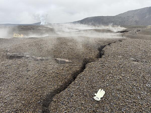
The September 30-October 1 intrusion of magma into the northern portion of Kaluapele, Kīlauea summit caldera, created scattered ground cracks on the surface. This portion of the caldera floor has been covered in steaming cracks for decades, but the new cracks were identifiable because they cut through the fresh tephra deposits from the episodic ongoing summit eruption. In this photo, the active vents of the ongoing eruption are visible in the upper left, and Uēkahuna overlook is in the upper right portion of the photo. USGS photo by M. Patrick.
Sources/Usage: Public Domain. View Media Details
Media
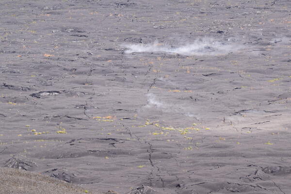
Telephoto view of the northern part of Kīlauea's upper caldera floor the Uēkahuna overlook. While some of the ground cracking in this area occurred during the 2018 caldera collapse, there is evidence of new ground cracking associated with the dike intrusion that occurred during the night of September 30 to October 1. Long-lived, persistent steaming areas have been noted on the caldera floor for many years, such as the larger steaming area in the background shown here. The fainter, wispy steam in the foreground could be related to the intrusive activity, with steam exploiting the new ground cracks to get to the surface. USGS photo by D. Downs.
Sources/Usage: Public Domain. View Media Details
Media
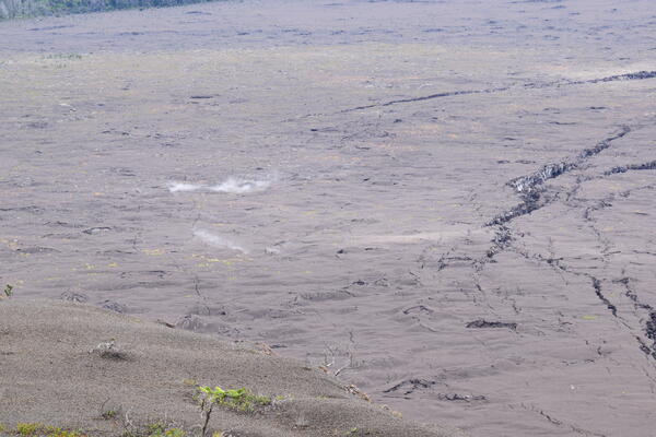
Photograph from the Uēkahuna overlook in Hawai‘i Volcanoes National Park looking at the northern part of Kīlauea's upper caldera floor. This is the area where increased seismicity and ground deformation occurred during the night of September 30 to October 1. The bottom right shows a semi-permanent GPS station on the caldera floor, and the middle of the photo shows what appear to be new ground cracking from the dike intrusion. The large steaming area has been present on the caldera floor for many years, with the new ground cracks likely providing new sources for the more faint, wispy steam to escape from the subsurface. USGS photo by D. Downs.
Sources/Usage: Public Domain. View Media Details
Media
Sources/Usage: Public Domain. View Media Details
Media
Sources/Usage: Public Domain. View Media Details