



October 7, 2026—InSAR image showing Kīlauea summit deformation and earthquakes between September 24–October 2, 2026


Detailed Description
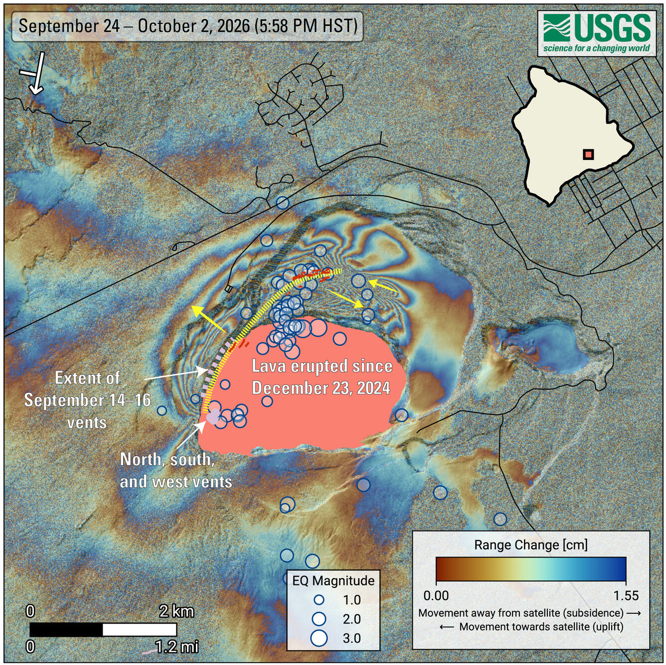
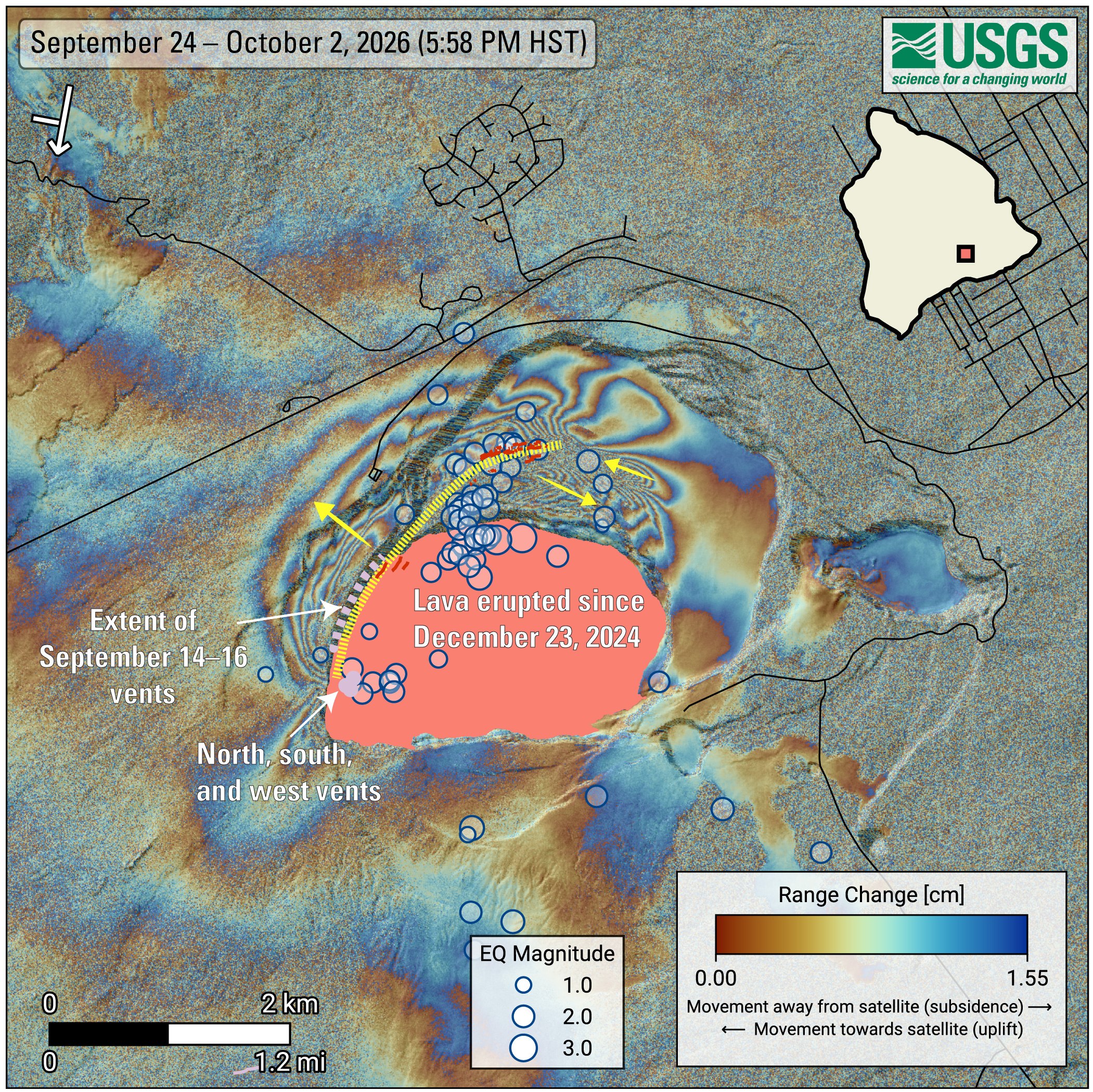
COSMO-SkyMed Second Generation (CSG) interferogram showing deformation of the ground surface around the summit of Kīlauea volcano from September 24 to October 2, 2026. Blue circles mark earthquakes recorded during this period, with larger circles representing stronger earthquakes. Most of the earthquakes occurred between September 30 and October 1, 2026.
The yellow dotted line and arrows show the main path of the underground intrusion and the relative motion of the ground surface, respectively. New cracks, which likely opened around September 30, were identified through various remote-sensing methods, and are shown in red. The pattern of deformation is consistent with a shallow, nearly vertical sheet of magma—called a dike—located about 1 kilometer (~0.6 miles) or less beneath the yellow line.
The symbol in the upper-left corner shows the satellite’s flight direction with an arrow and its viewing direction with a bar. The pink polygon represents the lava flows covering the crater floor. Main vents are shown as light-purple circles, while the extent of vents and fissures that opened between September 14 and 16, 2026, is shown as a light-purple dashed-line. Roads are shown in black.
The satellite data used to generate the interferogram were provided by the Italian Space Agency (ASI, Agenzia Spaziale Italiana).
Sources/Usage
Public Domain.