
By Hawaiian Volcano Observatory
June 24, 2026
USGS Hawaiian Volcano Observatory scientists conducted a misty monitoring overflight of Halemaʻumaʻu at Kīlauea summit on June 24, 2026.
Media
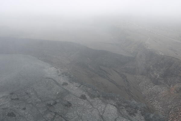
The vent structure that has built up in Halemaʻumaʻu is approaching the elevation of the crater rim, but several hundred feet remain between it and the top of the tephra cone built up on the crater rim by the fountaining episodes since December 2024. In the bottom left of this aerial photograph, a portion of Crater Rim Drive that collapsed into the crater in 2018 remains visible, though lava flows are getting close to covering it. USGS photo by K. Mulliken.
Sources/Usage: Public Domain. View Media Details
Media
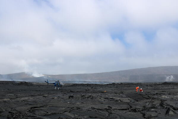
This photograph, which was taken from the ground in the southeastern portion of Halemaʻumaʻu at the summit of Kīlauea, shows USGS Hawaiian Volcano Observatory scientists collecting samples of a lava flow from episode 49 that took place on June 14, 2026. On the left side of the photo in the background, the vent and cone complex on the west rim of Halemaʻumaʻu is visible, with the vents degassing. On the right side of the photo in the background, the sloping crater rim rises to the summit, or highest point, on Kīlauea: Uēkahuna bluff. This photograph shows the difference in elevation between these two points well. All landing and sampling in Halemaʻumaʻu, with is culturally significant being the home of Pele, is done with permission from Hawaiʻi Volcanoes National Park. Analyses of samples will aid in eruption monitoring and hazard assessment, providing information on magma temperature and storage depths. USGS photo by K. Mulliken.
Sources/Usage: Public Domain. View Media Details
Media
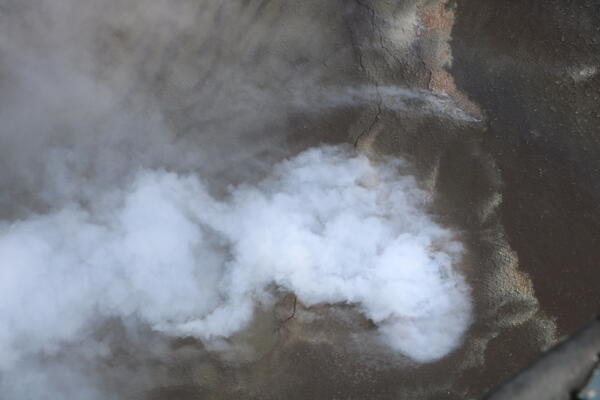
Volcanic gas emitting from the Halemaʻumaʻu south vent at the summit of Kīlauea obscured views during a USGS Hawaiian Volcano Observatory monitoring flight on June 24, 2026. Glow from the molten lava within the vent is vaguely visible in this view. USGS photo by K. Mulliken.
Sources/Usage: Public Domain. View Media Details
Media
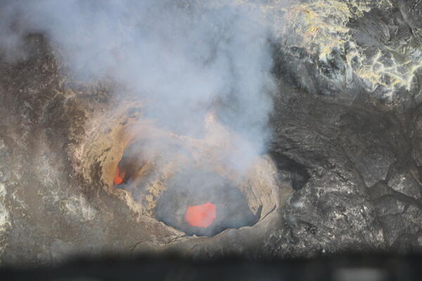
During a USGS Hawaiian Volcano Observatory monitoring overflight of Kīlauea summit on June 24, 2026, scientists captured this view looking down into the bifurcated structure within the north vent in Halemaʻumaʻu crater. Magma was visible roiling within the vent. USGS photo by K. Mulliken.
Sources/Usage: Public Domain. View Media Details
Media
At the eastern margin of Halemaʻumaʻu, where the episodic lava fountaining eruption has been taking place since December 2024, lava flows have encroached on nearly the entire surface of the "down-dropped block." This feature lowered during the 2018 collapse and while most of its surface has been covered with new lava flows, much of the volume of the 2018 collapse remains to be filled with lava flows. USGS photo by K. Mulliken.
Sources/Usage: Public Domain. View Media Details
Media
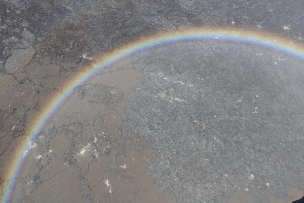
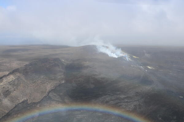
In Halemaʻumaʻu crater, a patchwork of lava flows of different ages from different eruptive episodes at Kīlauea summit have paved the crater floor. In the northeastern area of the crater floor, newer lava flows (black-colored in this photograph) have covered lava flows that were blanketed with tephra (brown-colored in this photograph) when lava fountained during westerly winds in January and March of this year. A rainbow (ānuenue) frames the photo, which was taken during a misty USGS Hawaiian Volcano Observatory monitoring overflight on June 24, 2026. USGS photo by K. Mulliken.
Sources/Usage: Public Domain. View Media Details
Media
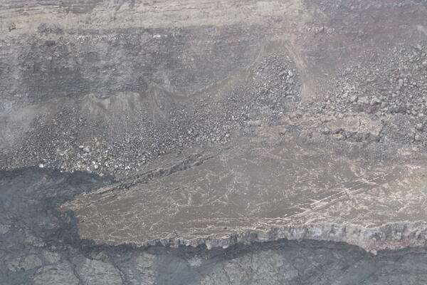
Along the south portion of Halemaʻumaʻu crater, a portion of Crater Rim Drive that fell into the crater during the 2018 Kīlauea summit collapse is close to being covered with lava flows. The block that the road is located on is tilted, allowing lava flows to traverse up it like a ramp from the lower left part of the photo. Though tephra partially covers this area, the yellow center-line strip of the road remains visible. USGS photo by K. Mulliken.
Sources/Usage: Public Domain. View Media Details
Media
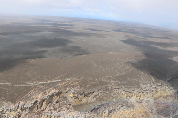
On the south rim of Halemaʻumaʻu crater, bulldozers were used to create mounds, visible in the center portion of the image, in an effort to prevent planes from landing in this area of Kīlauea during World War II. The episodic lava fountaining eruption in Halemaʻumaʻu has partially blanketed this area in tephra, but these features remain visible. Photograph taken during a USGS Hawaiian Volcano Observatory monitoring overflight of Kīlauea's summit on June 24, 2026. USGS image by K. Mulliken.
Sources/Usage: Public Domain. View Media Details
Media
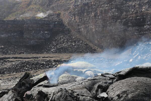
Numerous fumaroles, or degassing areas, dot the floor of Halemaʻumaʻu at the summit of Kīlauea. These features are ephemeral, being covered with lava flows and then reappearing, and are often surrounded with bright yellow sulfur deposits. USGS photo by K. Mulliken.
Sources/Usage: Public Domain. View Media Details
Media
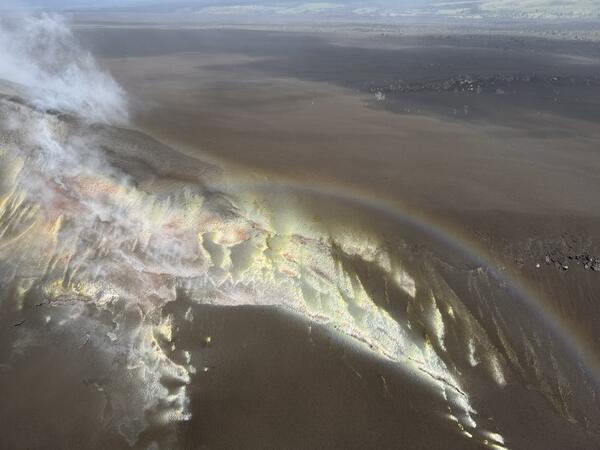
A rainbow (ānuenue) frames altered and sulfur-coated tephra on the rim of Halemaʻumaʻu crater at the summit of Kīlauea. These deposits often form in between lava fountaining episodes in Halemaʻumaʻu, as degassing and heat release continues. During lava fountaining episodes, new deposits coat the crater rim and bury the existing ones. After the lava fountaining episode ends, degassing and heat release continues and the deposits re-form. USGS photo by K. Mulliken.
Sources/Usage: Public Domain. View Media Details