



Photo & Video Chronology — Kīlauea summit monitoring overflight
By Hawaiian Volcano Observatory
October 23, 2026
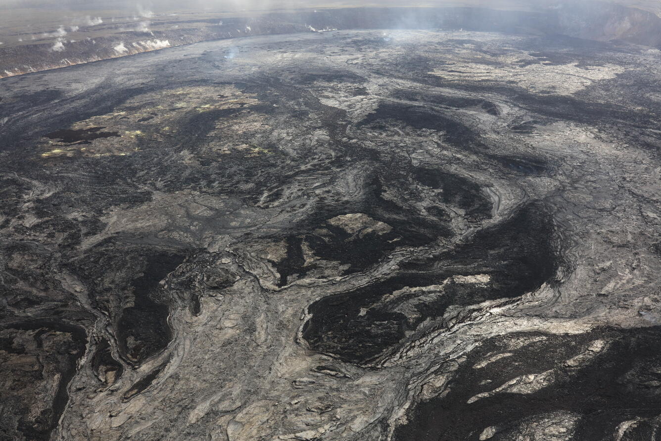
USGS Hawaiian Volcano Observatory staff conducted a lava sampling mission and monitoring overflight of Halemaʻumaʻu at the summit of Kīlauea the morning of October 22, 2026, following episode 55 which occurred on October 17, 2026.
Media
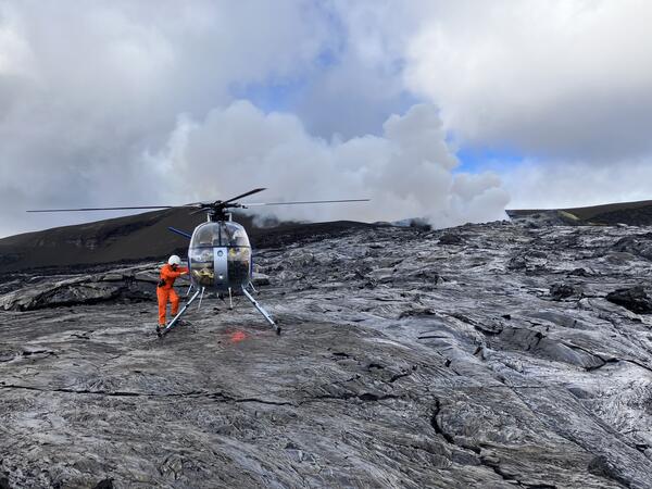
On October 22, 2026, a crew of USGS Hawaiian Volcano Observatory geologists traveled via helicopter to the Halema‘uma‘u crater floor to collect lava samples from Kīlauea summit eruption episode 55, which occurred on October 17. Here, one of the geologists is seen loading into the aircraft with the eruptive vent complex visible to the right about 1,000 feet (300 meters) away. USGS photo by M. Zoeller.
Sources/Usage: Public Domain. View Media Details
Media
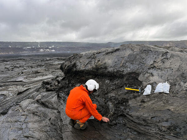
A USGS Hawaiian Volcano Observatory geologist collects cooled lava samples from episode 55 lava flows on the Halema‘uma‘u crater floor. During a helicopter overflight, HVO scientists landed on the crater floor to collect samples from an episode 55 lava channel for chemical analysis. Episode 55 occurred on October 17 and lasted for about 6 hours with maximum fountain heights from the north vent reaching about 720 feet (220 meters). USGS photo taken by L. DeSmither on October 22, 2026.
Sources/Usage: Public Domain. View Media Details
Media
Sources/Usage: Public Domain. View Media Details
Media
An aerial view of the vent complex within Halema‘uma‘u crater at the summit of Kīlauea, taken during a helicopter overflight on October 22, 2026. Deep within the north vent (lower left) a small area of incandescence was visible during the flight but isn’t visible in this photo. A lava surface was visible within the west vent, which is near the center of this image, but only some weak incandescence is visible through the plume in this image. The south vent, which was buried at the surface by episode 55 lava, is completely obscured by the gas plume in this photo. USGS photo taken by L. DeSmither.
Sources/Usage: Public Domain. View Media Details
Media
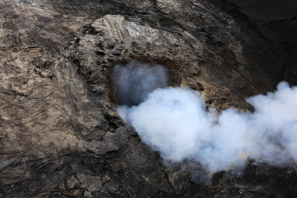
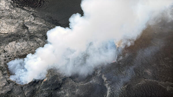
A close-up aerial view of the north vent within Halema‘uma‘u crater taken during a Hawaiian Volcano Observatory helicopter overflight on October 22, 2026. During the flight, a small area of incandescence was visible deep within the vent but can’t be seen in this image. In the ongoing episodic eruption at Kīlauea summit, lava fountains from the north vent during episode 55 reached maximum heights of about 720 feet (220 meters). USGS photo taken by L. DeSmither.
Sources/Usage: Public Domain. View Media Details
Media
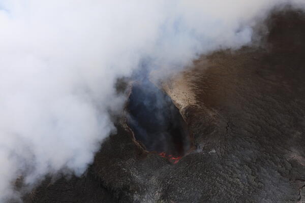
This close-up view of the west vent within Halema‘uma‘u crater was taken during a USGS Hawaiian Volcano Observatory helicopter overflight on October 22, 2026. A portion of the lava surface is visible deep within the vent following episode 55 which occurred on October 17. The thick white volcanic gas plume from the north vent (which is out of view to the lower left) covers the upper left part of the image. USGS photo taken by L. DeSmither.
Sources/Usage: Public Domain. View Media Details
Media
Sources/Usage: Public Domain. View Media Details