
Photo & Video Chronology — Kīlauea summit overflight
By Hawaiian Volcano Observatory
May 22, 2026
USGS Hawaiian Volcano Observatory scientists conducted a monitoring overflight of Kīlauea summit on May 22, 2026. Forecast models suggest that episode 48 will occur sometime between Sunday, May 24 and Wednesday, May 27.
Media
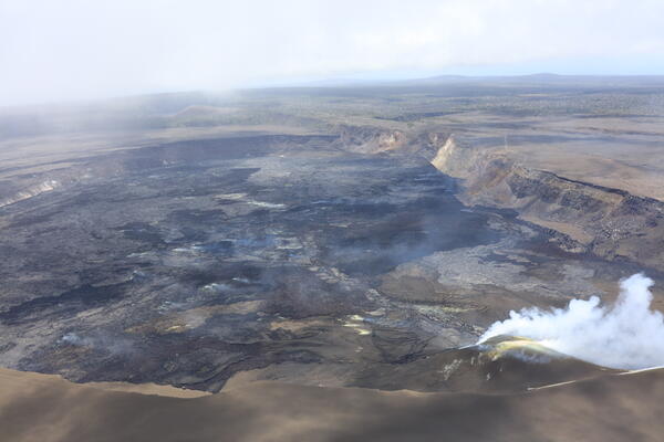
USGS Hawaiian Volcano Observatory scientists conducted a monitoring overflight of Kīlauea summit the morning of May 22, 2026. During the overflight, they collected imagery to create a three-dimensional model of the crater floor, thermal imagery to determine the extent of episode 47 lava flows, and traversed beneath the volcanic plume to measure emission rates. Sulfur dioxide emission rates were an average of about 2,000 tonnes per day, which is on par for what is expected during pauses during the ongoing eruption of Kīlauea. USGS photo by D. Downs.
Sources/Usage: Public Domain. View Media Details
Media
This view, from the floor of Halemaʻumaʻu crater at the summit of Kīlauea, shows the north and south vents degassing with the slope of the tephra cone on the crater rim visible in the background. USGS photo by M. Cappos.
Sources/Usage: Public Domain. View Media Details
Media
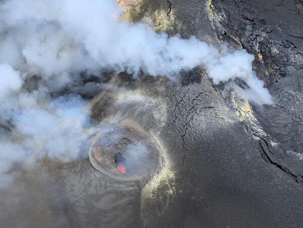
During a monitoring overflight on May 22, 2026, USGS Hawaiian Volcano Observatory scientists captured this aerial view looking down into the south vent in Halemaʻumaʻu at the summit of Kīlauea. Magma was visible within both the south and north vents during the overflight; the north vent is visible degassing on the right side of this image. Forecast models suggest that episode 48 of lava fountaining will occur sometime between Sunday, May 24 and Wednesday, May 27. USGS photo by M. Cappos.
Sources/Usage: Public Domain. View Media Details
Media
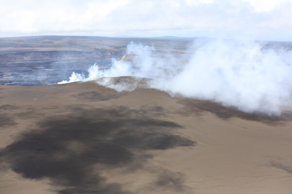
An aerial view from the west side of Halemaʻumaʻu shows the 150-foot (45 meter) high tephra cone that has formed on the rim of the crater during the 2024–ongoing eruption at the summit of Kīlauea. Gas emitted from the north and south vents, not currently erupting, is visible wafting over the rim of the crater. USGS photo by D. Downs.
Sources/Usage: Public Domain. View Media Details
Media
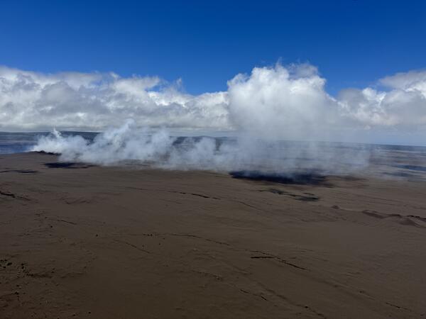
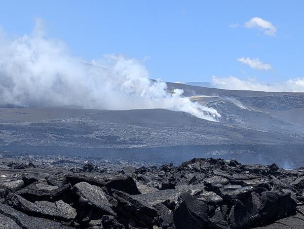
A view of the volcanic plume from the degassing north and south vents in Halemaʻumaʻu at the summit of Kīlauea. Trade winds during a USGS Hawaiian Volcano Observatory monitoring overflight on May 22, 2026, transported the plume to the southwest, into the Kaʻū Desert and closed area of Hawaiʻi Volcanoes National Park. USGS photo by K. Mulliken.
Sources/Usage: Public Domain. View Media Details
Media
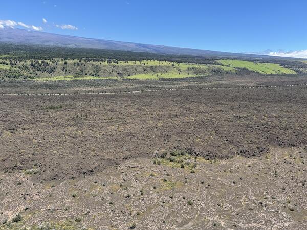
An aerial view of the Kaoiki fault on the south flank of Mauna Loa. Grassy slopes mark this fault, with Mauna Loa lava flows in the foreground and the slope of Mauna Loa in the background. This fault is prominently visible while driving Highway 11 in the Kaʻū Desert area of Hawaiʻi Volcanoes National Park. USGS photo by K. Mulliken.
Sources/Usage: Public Domain. View Media Details
Media
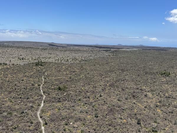
As USGS Hawaiian Volcano Observatory traversed under the volcanic plume from Kīlauea summit where it was transported downwind into the Kaʻū Desert area of Hawaiʻi Volcanoes National Park, they captured this view of the Maunaiki shield and Kaʻū Desert trail. Maunaiki is the low-profile shield in the left side of the image, with other Kīlauea Southwest Rift Zone vents visible in the background in the right side of the image. USGS photo by K. Mulliken.
Sources/Usage: Public Domain. View Media Details
Media
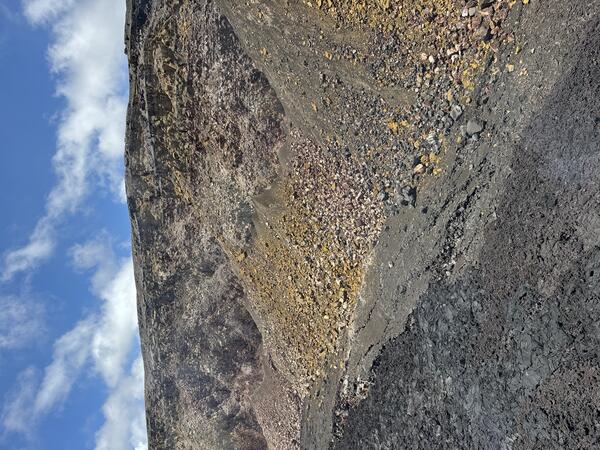
A view of Halemaʻumaʻu crater wall near the south sulphur bank area, where the basalt has been altered and weathered by long-term degassing in this area, causing the pastel colors of discoloration. Lava flows from the 2024-ongoing lava fountaining eruption in Halemaʻumaʻu are visible in the foreground and have been slowly filling in the crater, covering Halemaʻumaʻu crater wall incrementally over time. USGS photo by K. Mulliken.
Sources/Usage: Public Domain. View Media Details