
Photo & Video Chronology — Surveying the tephra cone on Halemaʻumaʻu crater rim
By Hawaiian Volcano Observatory
June 5, 2026
For over a year, after each fountaining episode at Kīlauea's summit, USGS Hawaiian Volcano Observatory geologists have surveyed the elevation along a transect across the new pu‘u (cone) on the western margin of Halema‘uma‘u that has formed from the fallout of the lava fountains.
Media
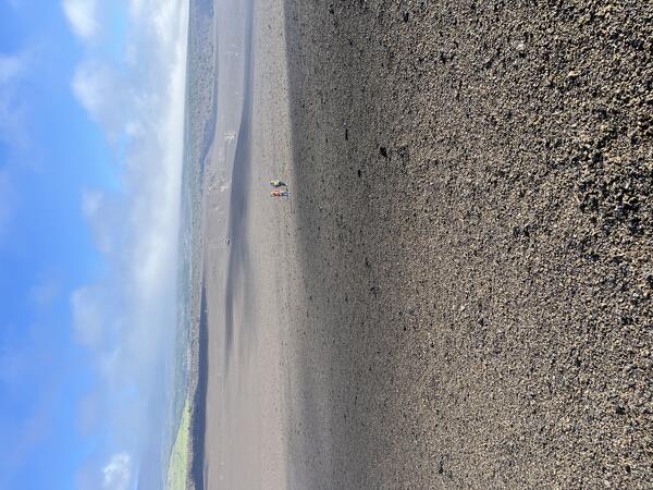
For over a year, after each fountaining episode at Kīlauea's summit, USGS Hawaiian Volcano Observatory geologists have surveyed the elevation along a transect across the new pu‘u on the western margin of Halema‘uma‘u. These repeat measurements across the same set of points, spaced about 330 feet (100 meters) apart, track the growth and changes of the pu‘u. On June 5, 2026, the post-episode 48 survey was completed. This photo was taken partway up the pu‘u on its northern side, looking north. Two geologists have just completed a measurement and are walking to the next measurement site. Prior to the eruption this area had ‘ōhi‘a trees and other vegetation, similar to the vegetation coverage seen in the distance on the right. Tephra from the past 18 months has covered the landscape and the vegetation. USGS photo by N. Deligne
Sources/Usage: Public Domain. View Media Details
Media
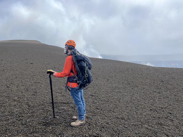
A USGS Hawaiian Volcano Observatory geologist surveys the elevation at a point along a transect across the new Pu‘u, formed from tephra fallout from the ongoing eruption at Kīlauea's summit. At each repeat measurement site, data is collected for at least 4 minutes. The geologist is on the south side of the Pu‘u and is looking north towards its summit. He is wearing personal protective equipment, including a gas mask. The estimated gas emission rate between episodes is currently between 1,000 and 5,000 tons sulfur dioxide per day. The gas mask allows the geologist to safely retreat if the wind blows the volcanic plume in their direction. USGS photo by N. Deligne.
Sources/Usage: Public Domain. View Media Details
Media
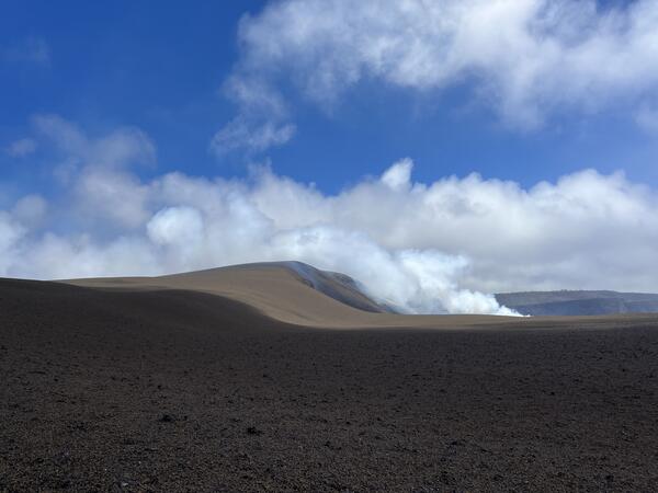
This view is of the cone (pu‘u) that has formed in the predominant downwind direction (southwest) of the north and south vents during the ongoing eruption at Halema‘uma‘u at the summit of Kīlauea. This photo is south of the southwest corner of Halema‘uma‘u and is looking to the north-northwest. The north and south vents are out of view in the photo, but the degassing plume from these vents is visible as it rises up over the cone. USGS photo by N. Deligne.
Sources/Usage: Public Domain. View Media Details