



Volcano Watch — A thank you letter to the HVO field technicians
Did you feel that earthquake? Time to check the location and magnitude. Do you need to find out how much Kīlauea summit region has repressurized since the last eruption? You can check tiltmeter data in about three clicks. Is the eruption forecast window open? Turn on those livestreaming cameras to see if lava is flowing.
Volcano Watch is a weekly article and activity update written by U.S. Geological Survey Hawaiian Volcano Observatory scientists and affiliates.
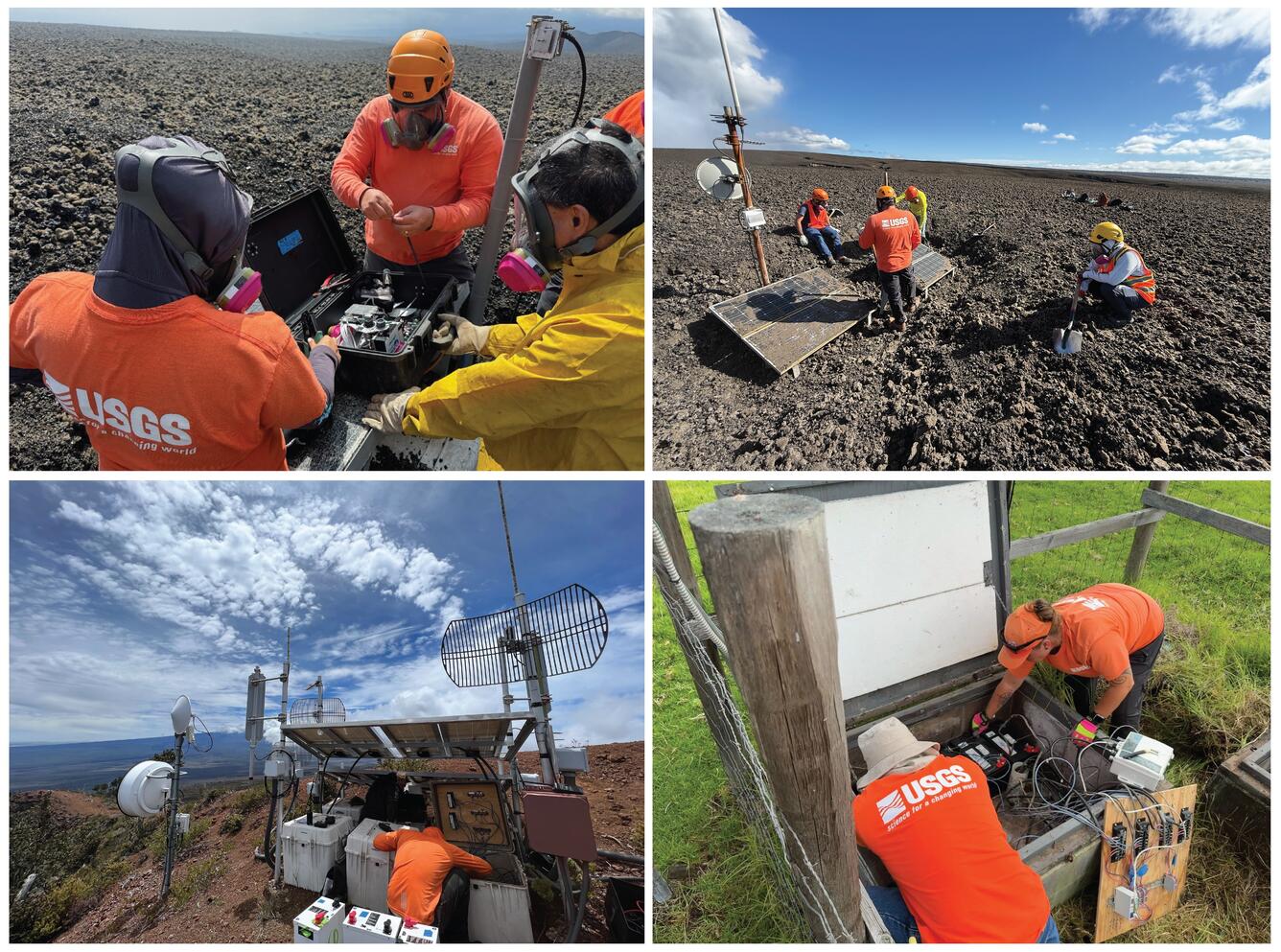
Real-time data is at the fingertips of anyone curious enough to look. From keiki to kūpuna, enthusiasts to experts: anyone can check the status of Hawaii’s volcanoes through volcano monitoring data streams that are available in near real-time on the USGS Hawaiian Volcano Observatory (HVO) website. HVO serves the community by sharing this scientific data and spreading hazard awareness. The hazard assessments, prompt forecasts, continuous monitoring, and scientific research all start at the same point: an instrument on or in the ground recording data.
There are multiple disciplines needed to monitor a volcano, which means a wide variety of instruments must be deployed. Seismometers, GPS, tiltmeters, gas detectors, and webcams are all necessary to capture the full scope of volcanic activity. HVO operates a real-time sensor network of all types of instruments, 24 hours a day, to track unrest and subtle changes in volcanic activity.
All of this accessible data relies on the work of the field technician, electronics, and information technology (IT) teams. They are the backbone of HVO. Without them, not only would experts have no data to interpret, but all of the convenient information available publicly with just a few clicks would be nonexistent.
Their importance begins with the essential monitoring infrastructure they design and build—creating efficient solutions to keep instruments powered in remote areas and telemetered so real-time data can be accessed from anywhere. These locations depend heavily on where activity is occurring, or the type of data needed. Seismometers must be dispersed around where earthquakes occur so triangulation can accurately pinpoint a hypocenter. Gas sensors need to be downwind of where volcanic gas is emitted. Tiltmeters must be spaced across magma chambers and rift zones to best capture magma movement.
The wide variety of station needs and the difficult terrain of islands built from lava flows means the tech team is constantly traversing rugged, remote, and physically demanding landscapes. Whether crossing a desert of ʻaʻā, pushing through dense rainforest tangled with roots, ferns, and fallen trees, or traversing a brand-new glassy tephra deposit, the HVO technicians find a way to get a sensor on the ground, powered, and telemetered so data can be immediately interpreted.
But instruments only fulfill their purpose if they remain functional, which requires continuous maintenance, troubleshooting, and hardening. Every windstorm, lightning strike, lava fountain, flood, or fire can take out a station critical for monitoring. This continuous list of tasks can only be completed by trained field technicians. Constant changes in volcanic activity, shifting weather, and routine upgrades mean the team must constantly coordinate and prioritize essential logistics so scientists and the community can monitor what matters most to stay informed and safe.
As Hurricane Lala approached the Island of Hawaiʻi last week, HVO field technicians and IT staff tested the generator at a critical monitoring data relay tower and ensured that it had enough fuel to operate if the power went out. With continuing power outages following Hurricane Lala, field technicians have been making daily trips to refuel the generator and ensure that crucial volcano monitoring data continues to flow.
Next time you listen to a scientist provide updates on ongoing volcanic activity in Hawaii, see a map showing the locations of earthquakes in a seismic swarm, or check the livestreaming cameras at Kīlauea summit for lava, take a moment to appreciate the team that works every day to keep the data flowing. They may not be on television giving interviews or at an overlook sharing information with the public, but they are in the field: likely fixing an antenna so that a thousand-foot lava fountain doesn’t block the radio path and leave us blind to nearby seismometers needed to detect possible changes in volcanic activity.
Thank you, to HVO’s team of technicians. From a data analyst who would have nothing to monitor without you.
Volcano Activity Updates
Kīlauea has been erupting episodically within the summit caldera since December 23, 2024. Its USGS Volcano Alert level is ADVISORY.
Episode 53 of lava fountaining at the summit occurred on August 12–13. Summit region inflation since the end of episode 53 indicates that another fountaining episode is likely; current forecasts indicate that episode 54 could begin between August 22-26 and could coincide with another storm as indicated by the National Weather Service. As the situation develops, please refer to official sources for updated information, including the National Weather Service, Hawaiʻi Volcanoes National Park, and County of Hawaii Civil Defense Agency. No unusual activity has been noted along Kīlauea’s East Rift Zone or Southwest Rift Zone.
Mauna Loa is not erupting. Its USGS Volcano Alert Level is at NORMAL.
Four earthquakes were reported felt in the Hawaiian Islands during the past week: a M4.1 earthquake 16 km (9 mi) SSE of Honaunau-Napoopoo at 23 km (14 mi) depth on August 17 at 9:24 a.m. HST, a M3.0 earthquake 12 km (7 mi) W of Volcano at 7 km (4 mi) depth on August 15 at 2:32 p.m. HST, a M3.7 earthquake 11 km (6 mi) SSW of Volcano at 30 km (19 mi) depth on August 15 at 12:32 p.m. HST, and a M3.4 earthquake 44 km (27 mi) WSW of Kailua-Kona at 36 km (22 mi) depth on August 15 at 7:09 a.m. HST.
HVO continues to closely monitor Kīlauea and Mauna Loa.
Please visit HVO’s website for past Volcano Watch articles, Kīlauea and Mauna Loa updates, volcano photos, maps, recent earthquake information, and more. Email questions to askHVO@usgs.gov.