



Kīlauea recently underwent its 56th lava fountaining episode since December 2024. This is just the most-recent eruptive activity from one of the world’s most active volcanoes. While frequent eruptions add new land to Kīlauea, lava flows and tephra deposits can also bury older erupted material. This can make it difficult to unravel the history of such an active volcano.
Volcano Watch is a weekly article and activity update written by U.S. Geological Survey Hawaiian Volcano Observatory scientists and affiliates. Today's article is written by HVO geologist Drew Downs.
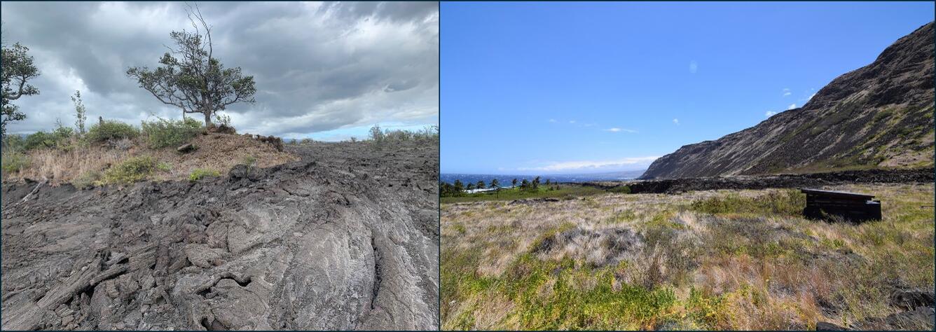
Volcanoes along continental margins, such as the west coast of North and South America, have varying levels of volcanic activity. Many are slow growing and studies into their past eruptions commonly reveal ages for lava flows, pyroclastic flows, and tephra deposits that reach back hundreds of thousands of years, if not longer.
Kīlauea, and Mauna Loa, on the other hand, are frequently active and often repave their surfaces with new lava flowing downhill. At Kīlauea, the long-lived Puʻuʻōʻō eruption on the middle East Rift Zone covered 144 km2 (55.6 mi2) of the landscape over 35 years of activity from 1983–2018. Maunaulu also covered large parts of the middle East Rift Zone to the coast from 1969–1974.
The current lava fountaining activity that has produced 56 episodes since December 2024, along with the preceding summit eruptions from December 2020 through September 2023, have filled in the inner caldera with lava flows that are hundreds of yards (meters) thick. This has effectively obscured many of the structures formed during the caldera collapse in 2018. Additionally, tephra from the lava fountains that is dispersed downwind has covered large areas of the upper Southwest Rift Zone under multiple yards (meters) of tephra.
For those wishing to understand the eruptive processes of even the recent past of Kīlauea, this can be challenging in places near the summit and rift zones due to frequent activity. For those wishing to study the more ancient past, this is all but impossible except for a few localized outcrops. A series of maps of the entire State of Hawaii were published in 2021, with a single map sheet for the Island of Hawaiʻi showing that nearly 90% of the surface of Kīlauea has been repaved by eruptive activity over the past 1,500 years.
There are ways to peer into the older history of the volcano—the stacked lava flow and tephra deposits from past eruptions—to help unravel its past activity. Drilling holes deep into the subsurface is one way the older stratigraphy can be sampled for further study. Much of what we know about the oldest ages and volcanic evolution come from rocks accessed only through drilling. Researchers from the University of Hawaiʻi at Mānoa, and their collaborators, analyzed rocks from the 1.1 mile (1.7 km) deep drill core from the East Rift Zone. They calculated ages that indicate Kīlauea was undergoing vigorous shield building by at least 200,000 years ago.
A deep (0.7 mile, 1.2 km) core was also drilled at the summit of Kīlauea in 1979, typically referred to as the Keller Well, to help understand the caldera structure and hydrothermal system over an active magma reservoir. While the cores from these drill holes provide invaluable samples and data, they are limited in that they are a single point and cannot track the downhill extent of eruptive products.
Lava flows also provide their own islands of refuge that preserve fauna, flora, and the rocks beneath. These areas of preserved life and older rock are called kīpuka. They really stand out in places where new lava just flowed, as these kīpuka tend to be a green forested patches in an otherwise black and barren landscape. Investigating the many kīpuka that can form in a lava flow field like that of Puʻuʻōʻō provide clues into past activity that might otherwise have been covered.
The ancient history of Kīlauea, and even some of the eruptions from just a few hundred years ago, may never be understood in great detail. However, there are places to look for clues into the past eruptive activity from this ever-growing volcano. And if there is one lesson that we can take away from the frequent activity of Kīlauea, it is that Earth’s landscape is dynamic, with hidden clues to its past scattered throughout.
Volcano Activity Updates
Kīlauea has been erupting episodically within the summit caldera since December 23, 2024. Its USGS Volcano Alert level is ADVISORY.
Episode 56 of lava fountaining in Halema'uma'u at the summit of Kīlauea occurred for six hours on November 5, 2026. The summit region switched from deflationary to inflationary tilt at the end of fountaining and the forecast window for episode 57 fountaining is November 21-24. Summit sulfur dioxide emissions during pauses between episodes are in the range of several thousand tonnes per day. No unusual activity has been noted along Kīlauea’s East Rift Zone or Southwest Rift Zone.
Mauna Loa is not erupting. Its USGS Volcano Alert Level is at NORMAL.
No earthquakes were reported felt in the Hawaiian Islands during the past week.
HVO continues to closely monitor Kīlauea and Mauna Loa.
Please visit HVO’s website for past Volcano Watch articles, Kīlauea and Mauna Loa updates, volcano photos, maps, recent earthquake information, and more. Email questions to askHVO@usgs.gov.