
Detecting a Grassland Invader, Above and Below Ground
Invasive plants are rapidly transforming the prairie grasslands of the Southern Great Plains. Researchers supported by the South Central CASC are turning to innovative tools to better detect these species, map their spread, and assess their impacts, both above and below the soil.
From the Mississippi River to the Rocky Mountains, the rolling prairie grassland ecosystems of the Southern Great Plains support unique grassland wildlife and rich vegetation. However, in recent years, invasive plants have proliferated, damaging biodiversity, altering ecosystem functions, and imposing significant and expensive challenges to grassland management. Lespedeza cuneata (L. cuneata), a highly invasive legume, is one of the most aggressive invasive plants in this region. Recognizing the need to curb its spread and impacts, South Central CASC-supported researchers have worked to improve how the plant is detected and mapped.
A prairie puzzle: using seasonal clues to spot invasives
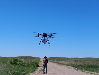
Invasive plants tend to stand out in their environment. Because of this, remote sensing, a data collection method where images are captured remotely from satellites or aircraft, is widely used as a cost-effective method to map species’ locations. However, studies using remote sensing to monitor invasives have primarily focused on gathering images from a specific moment in time and, as a result, don’t always capture how the plants may change throughout the growing season.
A recent publication describes how researchers from Oklahoma State University and The Nature Conservancy, funded by the South Central CASC, aimed to develop a unique remote sensing approach for L. cuneata that incorporates the plant’s seasonal variability. Using the Tallgrass Prairie Preserve in Oklahoma as a case study, the team found that the plant’s seasonal growth patterns were noticeably different than those of nearby native species. By combining these lifecycle variables with high-resolution satellite data, they were able to significantly improve their ability to detect the invasive plant in the vast grasslands it occupies.
As above, so below: the hidden microbial communities beneath invaded grasslands
Understanding and preserving grassland ecosystems requires taking a look beneath the soil surface. The microbial (bacterial and fungal) communities living belowground play a key role in supporting the ecosystems above, mainly by driving nutrient cycles and breaking down organic materials. However, most studies that examine the impacts of invasives tend to focus on how they alter aboveground ecosystem characteristics, and those that have looked beneath the soil surface have generally been conducted at small or experimental scales.
In a recent study, researchers from Oklahoma State University, Bridgewater State University, and The Nature Conservancy, supported by the South Central CASC and NASA, evaluated whether remote sensing could be used to predict the belowground properties (including both chemical composition and microbial communities) in invaded grassland ecosystems. Using airborne and satellite-based imaging spectroscopy to map L. cuneata, they found a clear link between the invasive plant and its belowground microbial communities: as the plant became more abundant, soil properties changed.
Both of these studies demonstrate how innovative uses of remote sensing can be applied to effectively map invasive species such as L. cuneata at fine spatial resolutions and large spatial scales. This research is crucial for monitoring the spread of the invasive plant and for supporting more effective and ecologically informed land management across the Southern Great Plains.
This research was funded by the South Central CASC project Optimizing Invasive Plant Management in Grasslands with Remote Sensing and Climate Sciences.