



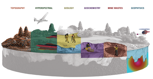
An infographic that highlights the ways that the Earth Mapping Resources Initiative (Earth MRI) gathers multiple types of data, including: topography, geology, geochemistry, geophysics, borehole information, hyperspectral imagery, mine waste and more.
Eliza Malakoff
Eliza Malakoff works on science communication for the USGS Geology, Energy and Minerals Mission Area, helping to deliver science and data to decision-makers and the public.
Eliza works on a wide range of communications to increase visibility of geology, energy and minerals science and to deliver scientific information to the public and other stakeholders. Her work is particularly focused on building webpages and online products, and visual communication products such as infographics and data visualizations. Previously, Eliza conducted research on river processes as a Masters student. She also has over a decade of experience in environmental and outdoor education and has held fieldwork positions across the United States.
Science and Products
Earth MRI Methods and Data Infographic
An infographic that highlights the ways that the Earth Mapping Resources Initiative (Earth MRI) gathers multiple types of data, including: topography, geology, geochemistry, geophysics, borehole information, hyperspectral imagery, mine waste and more.
Science and Products
Earth MRI Methods and Data Infographic
An infographic that highlights the ways that the Earth Mapping Resources Initiative (Earth MRI) gathers multiple types of data, including: topography, geology, geochemistry, geophysics, borehole information, hyperspectral imagery, mine waste and more.
An infographic that highlights the ways that the Earth Mapping Resources Initiative (Earth MRI) gathers multiple types of data, including: topography, geology, geochemistry, geophysics, borehole information, hyperspectral imagery, mine waste and more.