
Earth MRI Methods and Data Infographic
By Earth Mapping Resources Initiative (Earth MRI)
March 2025 (approx.)
Detailed Description
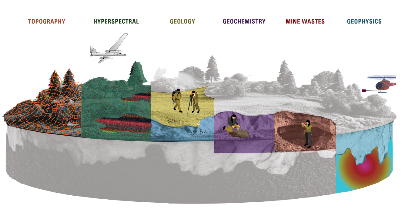
An infographic that highlights the ways that the Earth Mapping Resources Initiative (Earth MRI) gathers multiple types of data, including: topography, geology, geochemistry, geophysics, borehole information, hyperspectral imagery, mine waste and more.
Sources/Usage
Public Domain.
Related

Assessing Mineral Resources
The Mineral Resources Program is the Nation’s primary provider of impartial estimates of known and undiscovered mineral resources. We study the full life cycle of mineral commodities, including critical minerals, to inform decisions about where and how to develop mineral resources.
Related
Assessing Mineral Resources
The Mineral Resources Program is the Nation’s primary provider of impartial estimates of known and undiscovered mineral resources. We study the full life cycle of mineral commodities, including critical minerals, to inform decisions about where and how to develop mineral resources.