
Kayla M Rexer
Kayla is a Biologist with the Fort Collins Science Center’s Ecoinformatics and Wildlife Technology (ECOTECH) Branch.
Projects:
- Surface Disturbance and Reclamation Tracking Tool (SDARTT) digitizing team lead
- GIS support and ArcGIS Online application development
Science and Products
The Ecoinformatics and Wildlife Technology (ECOTECH) Research Group
The Ecoinformatics and Wildlife Technology (ECOTECH) team is a multidisciplinary group that unites expertise in biology, ecology, statistics, data science, and technology to deliver integrated scientific, hardware, and software solutions for modernizing natural resource science. ECOTECH leverages longstanding relationships with partners and draws upon intimate knowledge of both user needs and...

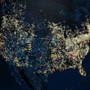
Surface Disturbance and Reclamation Tracking Tool (SDARTT)
The Bureau of Land Management (BLM) and the United States Geological Survey (USGS) have partnered to create the Surface Disturbance Analysis and Reclamation Tracking Tool (SDARTT). SDARTT is to be the national repository for and analysis tool of disturbance data pertaining to public land operations for the BLM. Users will upload disturbance and reclamation data to SDARTT to map, analyze, and...
Science and Products
The Ecoinformatics and Wildlife Technology (ECOTECH) Research Group
The Ecoinformatics and Wildlife Technology (ECOTECH) team is a multidisciplinary group that unites expertise in biology, ecology, statistics, data science, and technology to deliver integrated scientific, hardware, and software solutions for modernizing natural resource science. ECOTECH leverages longstanding relationships with partners and draws upon intimate knowledge of both user needs and...
Surface Disturbance and Reclamation Tracking Tool (SDARTT)
The Bureau of Land Management (BLM) and the United States Geological Survey (USGS) have partnered to create the Surface Disturbance Analysis and Reclamation Tracking Tool (SDARTT). SDARTT is to be the national repository for and analysis tool of disturbance data pertaining to public land operations for the BLM. Users will upload disturbance and reclamation data to SDARTT to map, analyze, and...