
Hydrologic Units of the United States
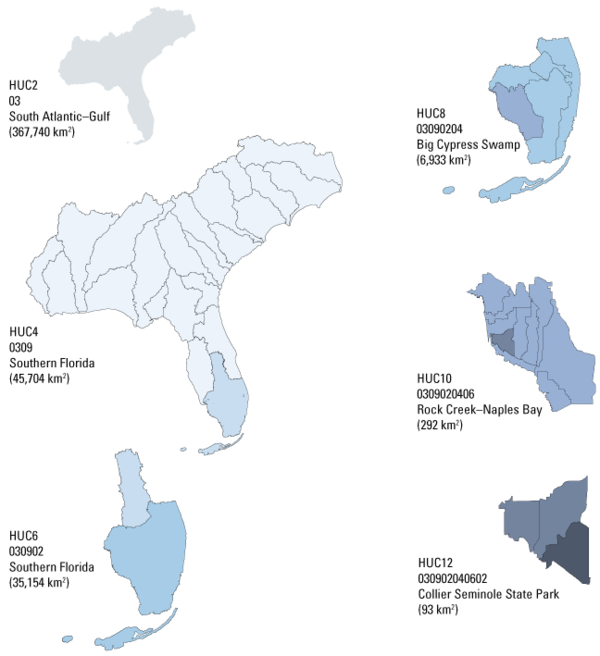
The U.S. Geological Survey uses a depiction and classification scheme for hydrologic units known as hydrologic unit codes (HUCs). HUCs generally represent catchments, and river basins are represented by a unique series of numbers with successively smaller hydrologic units nested inside of larger ones. Digits are added as hydrologic units become smaller, such that a 2-digit HUC encompasses multiple 4-digit HUCs, and a 4-digit HUC encompasses multiple 6-digit HUCs, etc. Visit the Hydrologic Units of the United States website to learn more and explore HUCs through interactive maps.
Although in practice, HUCs represent river basins, they are formally administrative units, and not always natural watersheds. As such, HUCs can depict human-created drainages and diversions or arbitrary breaks in connected flow systems.