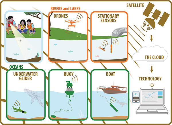
Hydrologic Technician Kim Campo deploys a buoy at Fresh Pond in Cambridge, MA with sensors to monitor water temperature, wind speed/direction, and blue-green algae
Hydrologic Technician Kim Campo deploys a buoy at Fresh Pond in Cambridge, MA with sensors to monitor water temperature, wind speed/direction, and blue-green algaeHydrologic Technician Kim Campo deploys a buoy at Fresh Pond in Cambridge, MA with sensors to monitor water temperature, wind speed/direction, and blue-green algae. Nearby continuous water quality monitoring station is 422302071083801.
Spring 2024 Photo Contest Winner: Meghan Santos, Where We Work category