Mount Hood's June 5, 2021 Earthquake
Normal faulting? No change in volcanic hazard? Cascades Volcano Observatory geophysicists describe how they interpret earthquake data using the June 5, 2021 Magnitude 3.9 earthquake at Mount Hood as an example.
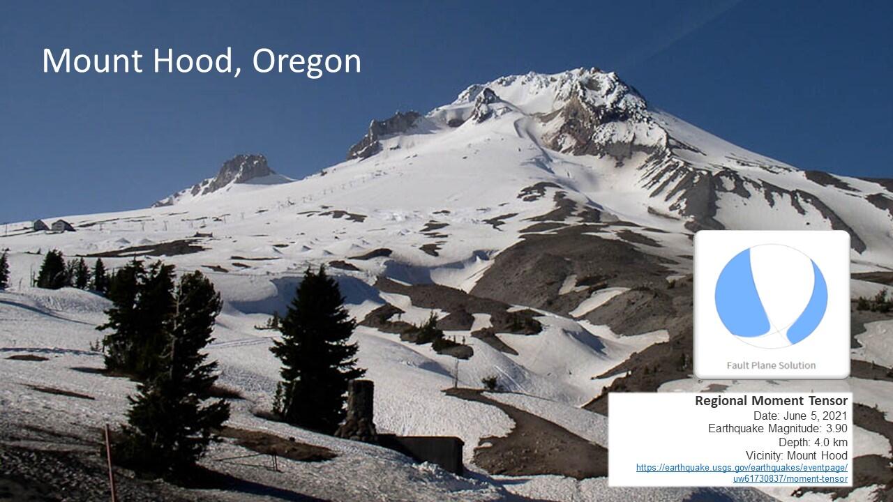
On June 5, 2021, there was a Magnitude 3.9 earthquake at Mount Hood. It was preceded by several foreshocks and followed by small aftershocks that have decreased in number over time. While the earthquakes occurred at the volcano (~4 km or ~2.5 mi south of the summit), the Cascades Volcano Observatory issued an Information Statement saying there was no change in volcanic hazard at Mount Hood at that time.
To understand how this conclusion was reached, let’s unpack something seismologists call “fault-plane solutions” or “beachballs” because… well…, they graphically look like beachballs.
Within a fraction of a second after an earthquake is detected on a seismic network, computers begin processing the strength of the seismic wave, when it arrived at a station, and the polarity, or what the first motion of the seismogram was. There are three options for a polarity, up (compressional), down (dilational) or ambiguous. The computers draw up a mathematical representation of the forces causing the earthquake rupture and whether the movement was shearing or tearing, opening or closing, or some combination thereof. The visual shorthand for the source model is a "beachball" like this one for the M3.9 earthquake.
The pattern on the beachball indicates the type of movement that caused the earthquake. In this case, the pattern is characteristic of what one would see for a “normal” fault. As compared to other faults, like reverse and strike-slip faults, normal faults are those in which the block of rock above the fault slides downward relative to the block below. This type of faulting occurs in response to forces that tend to pull Earth’s crust apart, known as extensional forces. Normal faulting is often observed in the western U.S. Basin and Range Province, which stretches from Arizona to northern Oregon. At Mount Hood, there is an active zone of normal faults that extends both to the south and to the north of the volcano, as described by the Oregon Department of Geology & Mineral Industries (DOGAMI) in this USGS Field Trip Guide to Mount Hood (Report 2017–5022–G). Previous swarms of earthquakes at Mount Hood, very similar to this most recent activity, have had “beachball” patterns indicative of normal faulting and have occurred with orientations that roughly parallel the regional fault zone.
Had the June 5 earthquake been caused by movement of magma, the beachball would likely have looked different. Magma movement commonly changes the forces exerted on the crust, and the earthquakes caused by those forces depart from those that would be expected regionally. Such departures from the types of earthquakes expected in this region in response to regional forces acting on the crust were observed at at Mount St. Helens prior to its 2004 eruption and were attributed to recharge of the magmatic system (article).