
NEW TNMCorps Mapping Challenge for Schools in CA & NV!
TNMCorps Mapping Challenges continue on the Pacific coast with a new challenge for schools in California and Nevada! This is an excellent challenge for Peer Reviewers and Advanced Editors since all the existing points have already been edited, but there are many points needing to be reviewed. Don’t forget to look for missing schoo
This challenge is slightly different than our previous schools challenges in that this one also includes postsecondary schools. Features in this challenge include General Schools, Elementary Schools, Middle Schools, High Schools, Colleges / Universities, and Technical / Trade Schools.
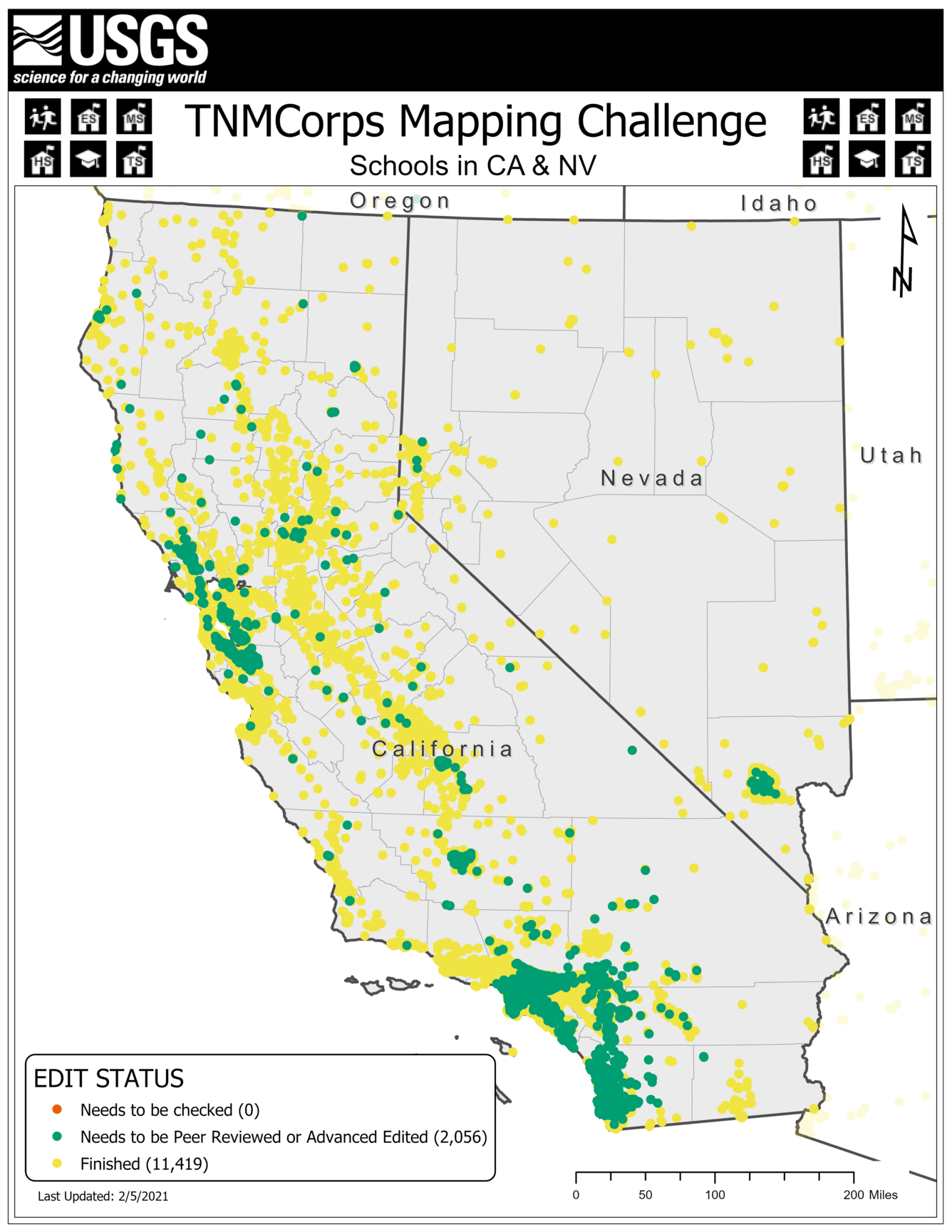
Not sure what each point color means?
These colors are part of our tiered editing process and signal to other editors that a point has passed through a specific tier. Our November 2018 newsletter has an article titled Editor Roles and Point Colors that describes this process further.

Tips and tricks for this challenge:
Existing Schools
- Volunteers can locate existing schools by using the dropdown filters on the web editor’s edit tab to filter by feature type and edit status.
- Remember we are not collecting preschools, kindergartens, or childcare facilities.
- If you come across an existing point for a childcare, preschool, or kindergarten, please document your findings in the ‘Comment’ field and delete the point. No need to click “Save” first.
- If you come across a school no longer in operation, document your findings in the ‘Comment’ field and delete the point.
- If a school has moved from one building to another, do not delete the point and recreate it on the new building. Instead, click and drag to move the existing point to the new building.
- If a school has permanently closed (i.e., it has not relocated) but a new school opened in the same building, do not delete the point. Instead, update the name, symbol, and attribute information of the existing point to match the new school.
- If a postsecondary entity lists multiple campuses on their website, make sure each campus has a point and include the campus name in the point’s ‘Name’ field.
- The same applies for primary and secondary schools.
Missing Schools
- To search for missing schools, volunteers can search the web editor for each school listed on a district website to see if they have a point.
- Use the web editor’s search tab to search for the school’s name or address.
- If the school does not yet have a point, locate the correct building in aerial imagery and place a point for the school on the center of the building.
- If a point does already exist, review the point’s geographic location, symbol, and attribute information against the school’s website and make any adjustments necessary.
- Be sure and check nearby points for duplicates as well.
School Symbols
- Remember that if a postsecondary institution offers associates degrees, it’s considered a college / university. If the highest credentials offered are job-specific training certificates, then it’s a technical / trade school.
- See the newsletter article titled Technical Community Colleges vs. Trade Schools (May 2017) for more on how to differentiate between the two.
- The school’s staff directory or school supply lists are a good way to verify which grades a primary or secondary school serves since these are often broken out by grade levels.
- Check out our Structures List, Structures Definitions, or this decision tree for guidance on symbols.
- NCES is also good for confirming grade levels.
Possible Sources
- Remember to find an authoritative source (e.g., a school or district website) for each feature. Do not rely solely on information in aggregate lists.
- The California Department of Education has a school directory that lists the name and address of each school, grade levels served, and whether the school is open or has since closed.
- The Nevada Department of Education lists websites for all the school districts in the state.
- It also has a downloadable directory of private schools.
Proper Point Placement
- Place a college / university point on the college’s administration building.
- See this section of the User Guide for tips on editing college / university points.
- If a technical / trade school is in a strip mall (which is often the case for smaller schools), try to find where in the building the school is located and position the point on this portion of the building.
- The following newsletter articles walk you through the process of using aerial imagery to find the correct building on which to place a point.
- Aerial Photo Interpretation Part 10: Colleges / Universities (May 2019)
- Aerial Photo Interpretation Part 9: Schools (March 2019)
- For additional tips on positioning schools Blast from the Past Part 2: Past Newsletter Articles (September 2020)
If you have any questions during the mapping process, reach out to us at nationalmapcorps@usgs.gov and someone will be happy to assist! Thank you for all that you do, and happy mapping!