An official website of the United States government
Here's how you know
Official websites use .gov
A .gov website belongs to an official government organization in the United States.
Secure .gov websites use HTTPS
A lock () or https:// means you’ve safely connected to the .gov website. Share sensitive information only on official, secure websites.
This morning's overflight revealed a weak to moderately active pond of lava bubbling within the fissure 8 cone, but no visible supply of lava from fissure 8 into the channel. The perched channel and braided sections downstream were essentially crusted over with some incandescence noted. Active flow in the channel was observed immeidately west Kapoho Crater.
During this morning's overflight, HVO geologists observed low levels of lava fountaining within the fissure 8 spatter cone and crusted lava in the spillway and channel downstream. The significance of this change is not yet clear. Eruptions can wax and wane or pause for days to weeks before returning to high levels of lava discharge. New outbreaks in the area of the active fissures could also occur in the near future.
There were small active lava ooze outs at the coast in the vicinity of the former Kapoho Bay and Ahalanui, and the laze plume was greatly diminished. Active lava is close to the Pohoiki boat ramp but did not advanced significantly toward it over the weekend.
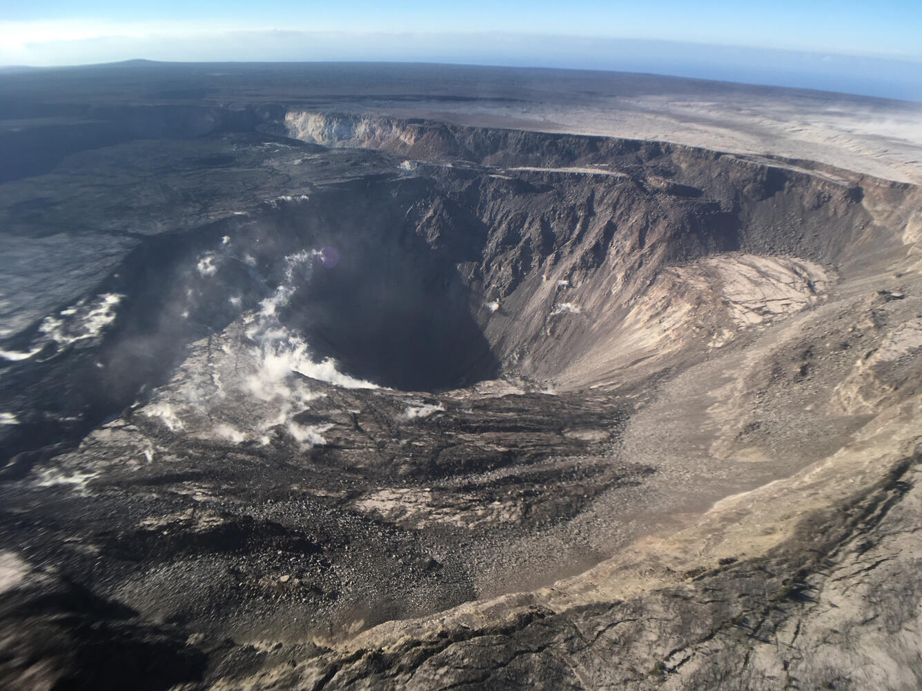
Kīlauea's summit remains quiet following the most recent collapse event on August 2 at 11:55 a.m. HST. This quiet is a significant departure from the pattern of episodic seismicity and continuous deformation over the past several months, with very low rates of seismicity continuing today. Deformation at the summit as measured by tiltmeter and GPS instruments slowed and virtually stopped between August 4 and 5. This view of Halema‘uma‘u is toward the southeast.
High-elevation view of Halema‘uma‘u and the larger Kīlauea Crater from this morning's overflight, with Mauna Loa in the background. HVO and NPS Jaggar Museum are located on bluffs at the far side of the crater in the center of the view. Note the smoke plume from a still-burning brushfire on the lower flank of Mauna Loa.
This photo shows a portion of the Crater Rim Drive that led from the east to the Halema‘uma‘u parking area, which slid into the growing crater weeks ago. Note a slump block located below and near where the road ends at Halema‘uma‘u. The September 1982 lava flow can be seen in the top of the photograph.
Get Our News
These items are in the RSS feed format (Really Simple Syndication) based on categories such as topics, locations, and more. You can install and RSS reader browser extension, software, or use a third-party service to receive immediate news updates depending on the feed that you have added. If you click the feed links below, they may look strange because they are simply XML code. An RSS reader can easily read this code and push out a notification to you when something new is posted to our site.