U.S. flag

An official website of the United States government

Photo and Video Chronology – Kīlauea – June 10, 2021

June 10, 2021

Kīlauea's summit is no longer erupting; lava supply to the Halemaʻumaʻu lava lake has ceased and sulfur dioxide emissions have decreased to near pre-eruption background levels. HVO field crews—equipped with specialized safety gear—monitor for new changes from within the closed area of Hawai‘i Volcanoes National Park with NPS permission.

HVO scientists collect detailed data to assess hazards and understand evolving processes at Kīlauea's summit, all of which are shared with the National Park Service and emergency managers. Access to this hazardous area is by permission from, and in coordination with, Hawai‘i Volcanoes National Park.

June 8, 2021 — Kīlauea

Kīlauea summit on June 8


On June 8, 2021, the USGS Hawaiian Volcano Observatory conducted a routine helicopter overflight and fieldwork at the summit of
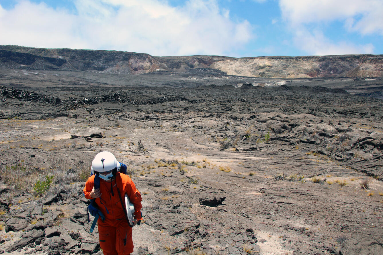
On June 8, 2021, the USGS Hawaiian Volcano Observatory conducted a routine helicopter overflight and fieldwork at the summit of Kīlauea. Here, a geophysicist returns to the helicopter after making Global Positioning Systems (GPS) measurements. These surveys measure small changes in the ground surface caused by subsurface magma movement. This scientist carries a GPS antenna along with a field backpack with essential gear, including food, water, and a field first aid kit. USGS photo by C. Parcheta.
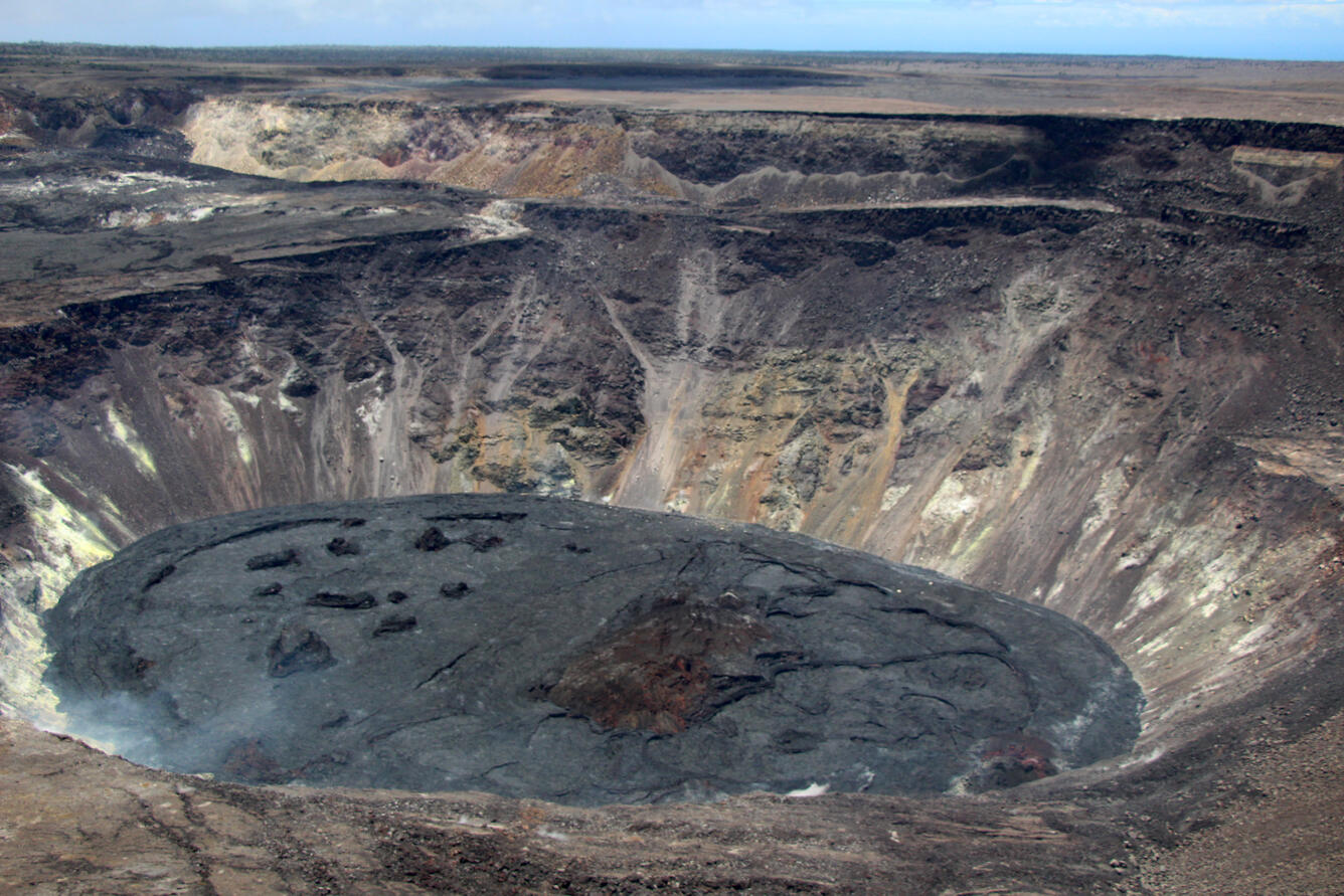
A view of the crusted over lava lake within Halema‘uma‘u at Kīlauea summit
A view of the crusted over lava lake within Halema‘uma‘u at Kīlauea summit, taken during a helicopter overflight on June 8, 2021. No incandescence (red lava) has been visible on the solidified lava lake surface for over two weeks. Light degassing continues in a few areas around the margin of the lava lake, mainly along the north crater wall (bottom left). USGS photo taken by C. Parcheta, looking to the south.
A view of the southwest crater wall of Halema‘uma‘u from the down-dropped at the summit of Kīlauea
A view of the southwest crater wall of Halema‘uma‘u from the down-dropped at the summit of Kīlauea. The lava lake surface within Halema‘uma‘u, blocked by the lava in the foreground, continues to emit a diffuse volcanic gas plume (center). Prior to the 2018 summit collapse, the lava surface in the foreground use to be at the same elevation as the crater rim in the upper left-hand side of the photo. USGS photo taken by C. Parcheta on June 8, 2021.

Get Our News

These items are in the RSS feed format (Really Simple Syndication) based on categories such as topics, locations, and more. You can install and RSS reader browser extension, software, or use a third-party service to receive immediate news updates depending on the feed that you have added. If you click the feed links below, they may look strange because they are simply XML code. An RSS reader can easily read this code and push out a notification to you when something new is posted to our site.