An official website of the United States government
Here's how you know
Official websites use .gov
A .gov website belongs to an official government organization in the United States.
Secure .gov websites use HTTPS
A lock () or https:// means you’ve safely connected to the .gov website. Share sensitive information only on official, secure websites.
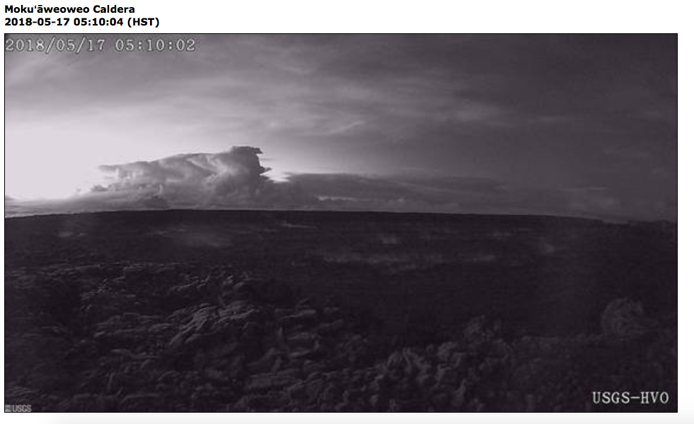
View of this morning's eruption plume from the Overlook crater nearly an hour after the event started. This image is from the webcam located on the north rim of Moku‘āweoweo Caldera near the summit of Mauna Loa Volcano. This image was recorded at 5:10 a.m. HST. At about 04:15 a.m. HST, an explosion from the Overlook crater at Kīlauea Volcano's summit produced an eruption column that reached at least 30,000 ft. above sea level. The plume was blown by wind toward the northeast. This resulted in ash fall at the Hawaiian Volcano Observatory, and nearby Volcano Village and the Volcano Golf and Country Club Subdivsion.
At 7:45 a.m. HST, view of Halema‘uma‘u crater from the visitor viewing area in front of the Jaggar Muesum, Hawai‘i Volcanoes National Park. A light coating of ash on the Park's interpretative sign resulted from ash falling to the ground from explosive events of the past day. Note the contrast of the plume rising from the Overlook vent this morning (background) with the eruption column that erupted during explosive activity in May 1924 (middle photograph on sign).
At 7:45 a.m. HST, only traces of ash (dark areas on white rail) remain on this fence in the Volcano Golf and Country Club Subdivsion, located 4 km (2.5 mi) from the Overlook crater in Hawai‘i Volcanoes National Park.
Cracks widen in lower East Rift Zone, Kīlauea Volcano
Aerial view of ground cracks on Pohoiki Road during an overflight of the eruptive fissure area at about 7 a.m. HST. Cracks continued to open and widen, some with horizontal and vertical offsets, in the area during the past 24 hours. These cracks are caused by the underlying intrusion of magma into the lower East Rift Zone.
HVO geologist next to cracks on Nohea Street in Leilani Estates this morning. These cracks expanded significantly in the past day. Note the vertical offset across the cracks.
At about 07:00 a.m. HST, Fissure 17 as shown from the air. The HVO field crew reported that the spattering height and intensity at Fissure 17 seemed to have intensified slightly from yesterday, but the length of active spattering in the fissure is shorter. The overall vigor of Fissure 17 appears to have dropped over the past two days, accompanying a stalling of the Fissure 17 flow front.
The Fissure 17 flow front has slowed substantially with only small amounts of pasty "toothpaste" lava oozing out from the flow front. However lava continues to be erupted from the active fissure. This lava appears to be accumulating within the flow and has widened the flow margins slightly.
Video of small explosions at Fissure 17 yesterday, May 16
Video: For the past several days, intermittent small explosions have occurred at the west end of Fissure 17. These explosions throw large pieces of spatter to a height of about 150 m (500 ft).
New fissure erupts between fissures 3 and 7, Leilani Estates
At 3:00 p.m. HST, aerial view of a new erupting fissure (21, located between fissure 3 and 7) and lava flow in Leilani Estates. This view is toward the west. HVO geologists will track the changing activity through the night.
Get Our News
These items are in the RSS feed format (Really Simple Syndication) based on categories such as topics, locations, and more. You can install and RSS reader browser extension, software, or use a third-party service to receive immediate news updates depending on the feed that you have added. If you click the feed links below, they may look strange because they are simply XML code. An RSS reader can easily read this code and push out a notification to you when something new is posted to our site.