An official website of the United States government
Here's how you know
Official websites use .gov
A .gov website belongs to an official government organization in the United States.
Secure .gov websites use HTTPS
A lock () or https:// means you’ve safely connected to the .gov website. Share sensitive information only on official, secure websites.
Breakouts remain active on flow field, changes to ocean entry lava delta
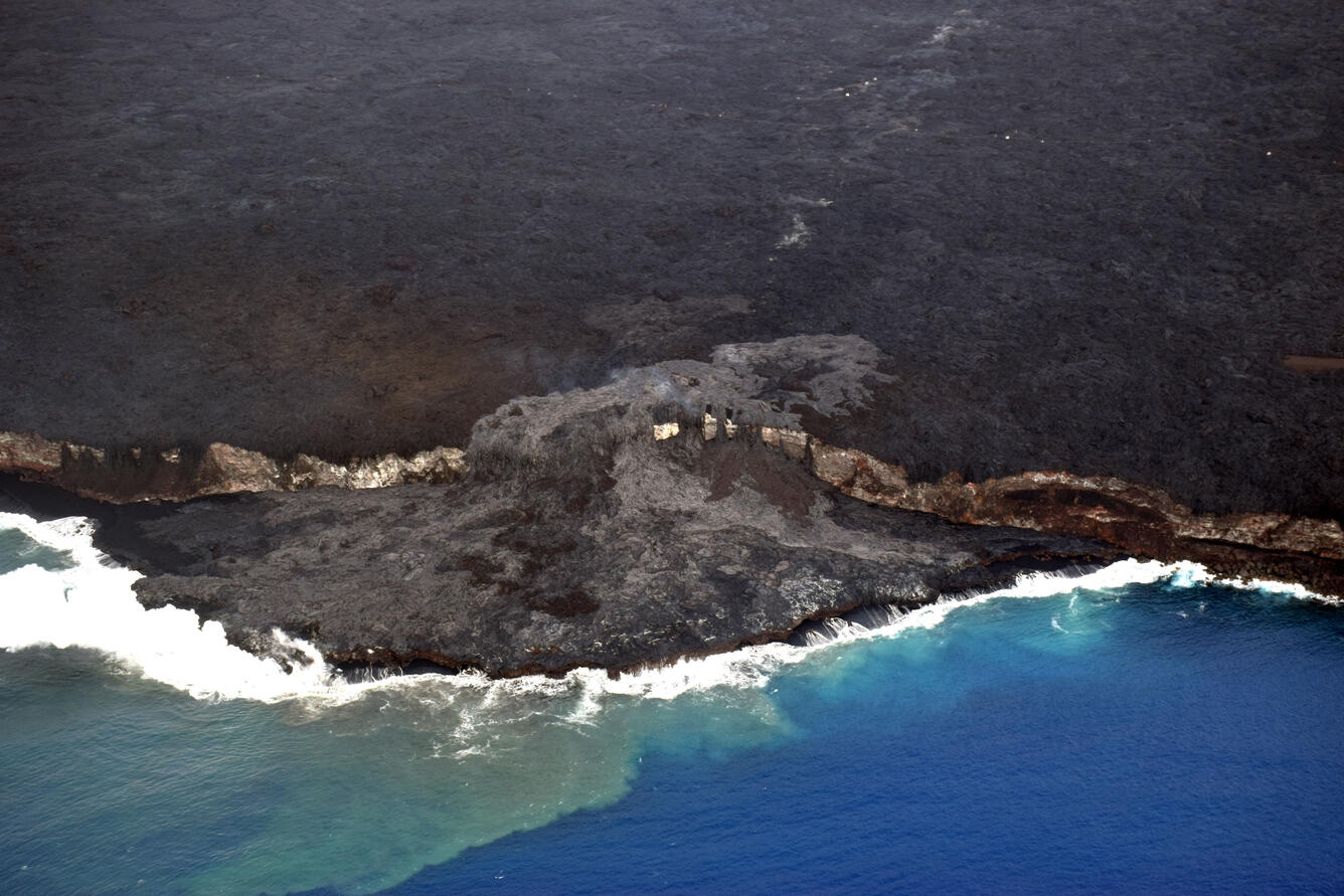
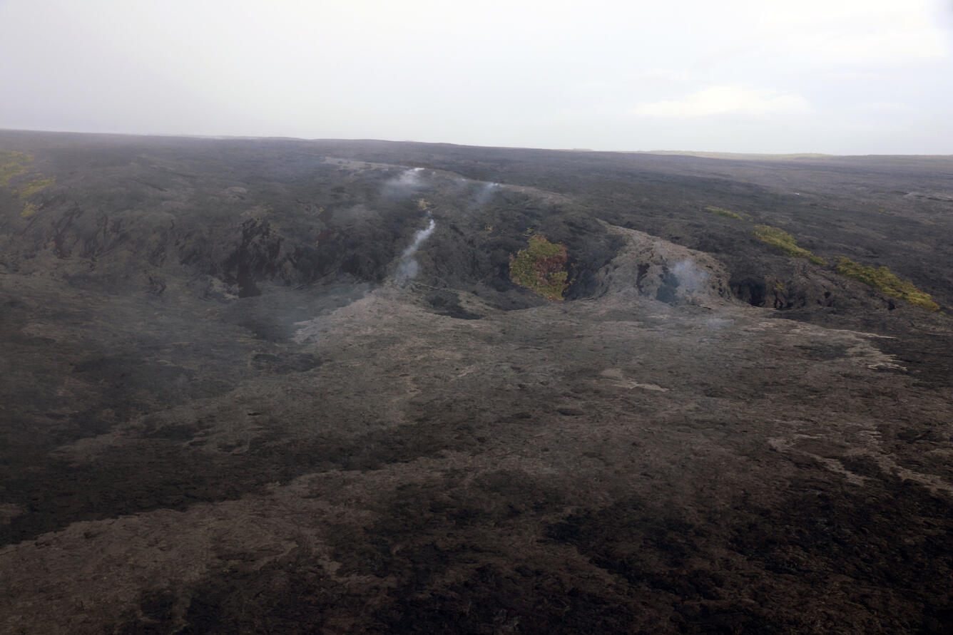
Surface breakouts (light in color) remain active on the upper coastal plain. These breakouts are fed by both the main eastern tube—left of the kipuka and below the tube's fume trace on the pali—and from the eastern June 26 breakout branch, visible to the right of the kipuka. The leading edge of the coastal plain breakouts is on the western (left) flow margin and is approximately 1.3 km (0.8 mi) from the closest section of the emergency road. At the Kamokuna ocean entry, recent breakouts near the edge of the cliff (lighter in color) have been spilling onto the lava delta (foreground) for the past few weeks, resurfacing almost the entire area of the delta. The misty day obscured a view of Pu‘u ‘Ō‘ō, which, on a clear day, would be visible on the skyline in the center of the photo.
Today (October 12), the Kamokuna lava delta was measured at roughly 11 acres (4.5 hectares) in size. Over the past two months, several lava tube breakouts on the sea cliff have spilled lava onto the delta. On the delta, ‘A‘ā (darker color) and pāhoehoe (lighter color) flows have resurfaced much of the area in the past few weeks, covering the many surface cracks noted in previous photos. Although the cracks are no longer visible, subsurface cracks still remain, as does the hazard of delta instability. The area directly upslope of the ocean entry is hazardous as well, with ground fracturing and lava tube breakouts occurring over the past few months.
A view of the upper coastal plain breakouts on the episode 61g flow field. The majority of the active surface flows on the coastal plain are being fed by the June 26 breakout branch on the eastern margin of the flow field (right). A smaller area of active lava in the upper western flow field (left) is being fed from a breakout of the main 61g lava tube near the base of the pali.
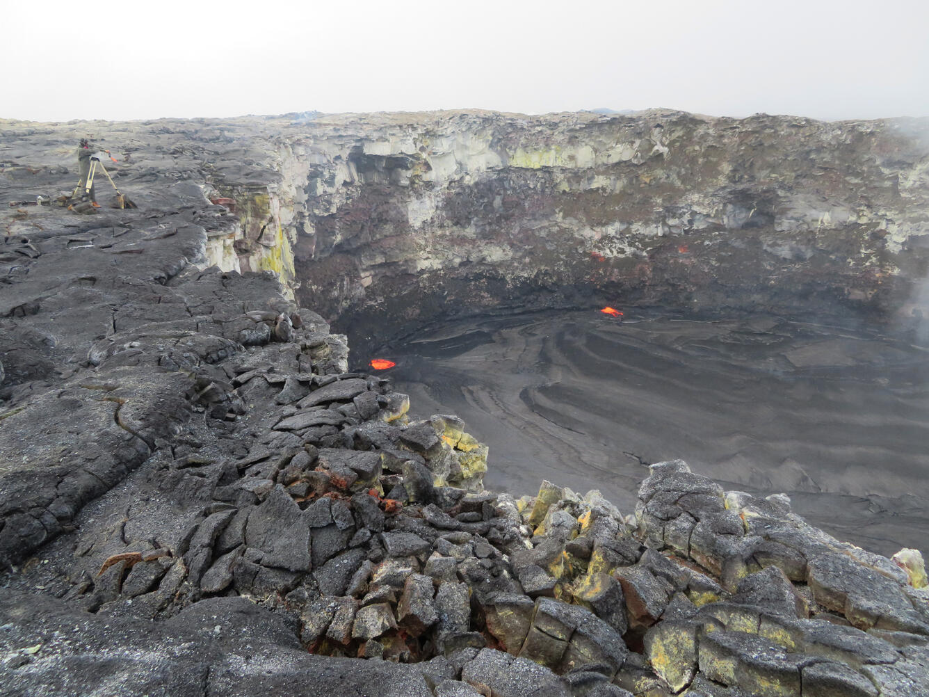
HVO geologists relocate a time-lapse camera on the rim of the west pit lava pond in the Pu‘u ‘Ō‘ō crater. Over the past several months, the camera has been slowly tilting downward due to soft, altered ground beneath it, and the general instability of the rim. The new location, about 20 m (yards) to the south, appears to be more stable and less altered. Weak spattering was visible in the west pit lava pond (at the incandescent area near the center of the image) today.
Get Our News
These items are in the RSS feed format (Really Simple Syndication) based on categories such as topics, locations, and more. You can install and RSS reader browser extension, software, or use a third-party service to receive immediate news updates depending on the feed that you have added. If you click the feed links below, they may look strange because they are simply XML code. An RSS reader can easily read this code and push out a notification to you when something new is posted to our site.