
Evaluation of Groundwater Resources in the Adelaida Area of San Luis Obispo County, California
Stakeholders in San Luis Obispo County are concerned that the increased demand for water use has, and will continue to, affect groundwater levels and availability in the Adelaida area. To address stakeholder concerns, the County of San Luis Obispo Board of Supervisors has asked the USGS to conduct a comprehensive evaluation of groundwater resources of the Adelaida area.
Groundwater refers to the water found beneath the Earth's surface. This water is essential for human consumption and is stored in underground reservoirs known as aquifers. Groundwater can be extracted by drilling wells and utilizing pumps to get the water out for use. Effective management and sustainable use of groundwater ensure a reliable and sustainable water supply for our various needs.
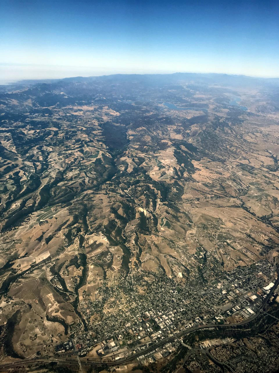
The Adelaida area is an unincorporated part of San Luis Obispo County, California, where groundwater is the primary source of water. Over the past decades, there has been an increase in the percentage of irrigated land, an increase in vineyards as a percentage of agricultural land use, and an increase in population. Historical and future changes in water demand and climate may increase the demand for groundwater in the Adelaida area. There is concern among stakeholders that the increasing demand for water is negatively affecting groundwater availability.
Recognizing the need for a thorough assessment of the area's groundwater resources, the San Luis Obispo County Flood Control and Water Conservation District (District) engaged with the U.S. Geological Survey (USGS) to conduct a comprehensive evaluation of the historical and present-day hydrologic conditions of the Adelaida area.
Problem
The geology of the Adelaida area is almost entirely comprised of consolidated sedimentary rocks in the highlands of northwestern San Luis Obispo County. The California Department of Water Resources (DWR) has not defined the highlands of the Adelaida area as a groundwater basin; therefore, the area is not subject to California Sustainable Groundwater Management Act (SGMA) regulations.
Prior to this study, publicly available hydrogeologic and hydrologic data (such as well-yield, water quality, or groundwater levels) were limited throughout the Adelaida area, and no investigation of the groundwater resources or water-bearing units of the aquifer system had been completed.
Stakeholders in San Luis Obispo County have a specific need to evaluate and understand historic and current hydrologic and hydrogeologic conditions in the Adelaida area to plan for potentially increasing water demands within the context of sustainable water use in the county.
Benefits to stakeholders
This study will benefit water managers, stakeholders and potential future studies by:
- Improving understanding of the aquifer system, including identifying water-bearing units and quantifying available groundwater resources
- Evaluating the historical and current impacts of groundwater use
- Advancing monitoring networks in the county for groundwater, surface-water, and water-quality data
- Providing a more thorough understanding of hydrogeological controls on water availability
Approach and Status
The study includes five general work tasks to be completed over several years:
Task 1 - Compile and review existing hydrologic and geologic data
This task was initiated in February 2020 and continued through March 2021. The USGS compiled and reviewed existing hydrologic, geologic, climatic, geographic, and land use data sets. This work identified spatial, temporal, and vertical gaps in data helped guide development of later project tasks. Selected hydrologic data, geologic maps, and land use maps compiled as part of task 1 are available in the Interactive Map.
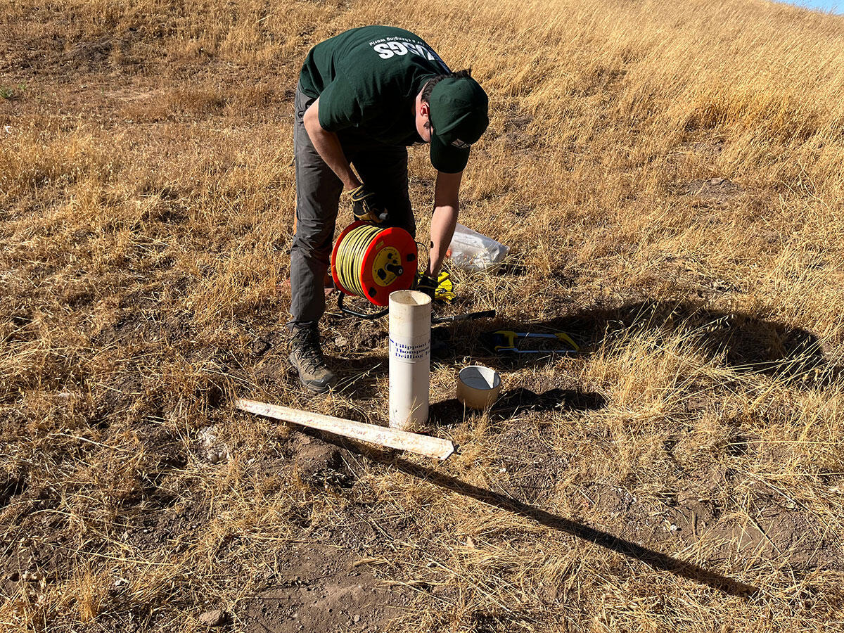
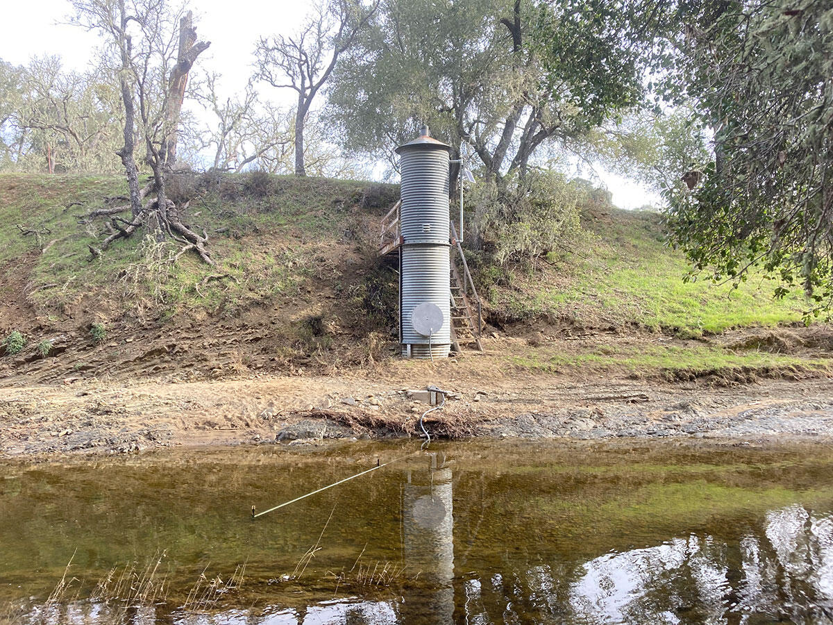
Task 2 - Collect new groundwater and surface water data
This task was initiated in January 2022 and continued through December 2024. Groundwater levels, surface-water flow data, and water quality data collected as part of this task provided an understanding of present-day Adelaida area hydrology. All data are available on the USGS Water Data for the Nation (WDFN) database and can be accessed in the Interactive Map.
Task 3 - Conduct an integrated analysis of the hydrogeologic system
This task started in December 2024 and is ongoing. The Adelaida area hydrogeologic system will be evaluated using historical data compiled as part of task 1, groundwater and surface-water data collected as part of task 2, estimates of water-balance components, and construction of a three-dimensional (3D) hydrogeologic framework. Conceptual and quantitative evaluations of the aquifer system will be conducted. The conceptual work will include a characterization of the spatial (regional and local), vertical (depth dependent), and temporal (historical to present) availability of groundwater. The quantitative work will include an estimation of the components of the hydrologic water budget; estimates of agricultural pumping from land use maps; estimates of domestic pumping from population; identification of areas of recharge and discharge; evaluation of groundwater availability with respect to changes in climate, land use, and water use; and determining the influence of geologic fractures, faults, and folds on groundwater and surface-water flow, if possible.
Water-balance components for 1896–2024 are locally calibrated from the USGS Basin Characterization Model. The results from this work will show where, when, and how hydrologic components of interest have changed, most notably recharge and runoff. Locally-calibrated BCM results for the Adelaida area are published in a USGS data release.
The 3D hydrogeologic framework is a representation of the geometry and extent of water-bearing units in the Adelaida area and will be used to help characterize hydrologic conditions within the aquifer system. The framework will be developed using airborne electromagnetic (AEM) survey data, geologic maps, and subsurface lithology and geophysical data from wells.
Task 4 - Produce interpretive investigation reports and associated data releases
This task started in December 2024 and is ongoing. An interpretive USGS investigations report characterizing the hydrogeologic system of the Adelaida area will be published. This report will provide stakeholders with a summary of information learned as part of this project. The report will synthesize historical and present-day hydrologic conditions, groundwater availability, water‑quality analysis, hydrologic budget estimates, and the influence of local hydrogeology on groundwater flow. A USGS data release (or multiple data releases, if appropriate) will archive any data or information not suitable for inclusion in the USGS WDFN database.
A separate interpretive report documenting the development of the 3D hydrogeologic framework and utilization of AEM data is anticipated to be published, along with a USGS data release (or multiple data releases, if appropriate).
Task 5 – Stakeholder outreach and engagement
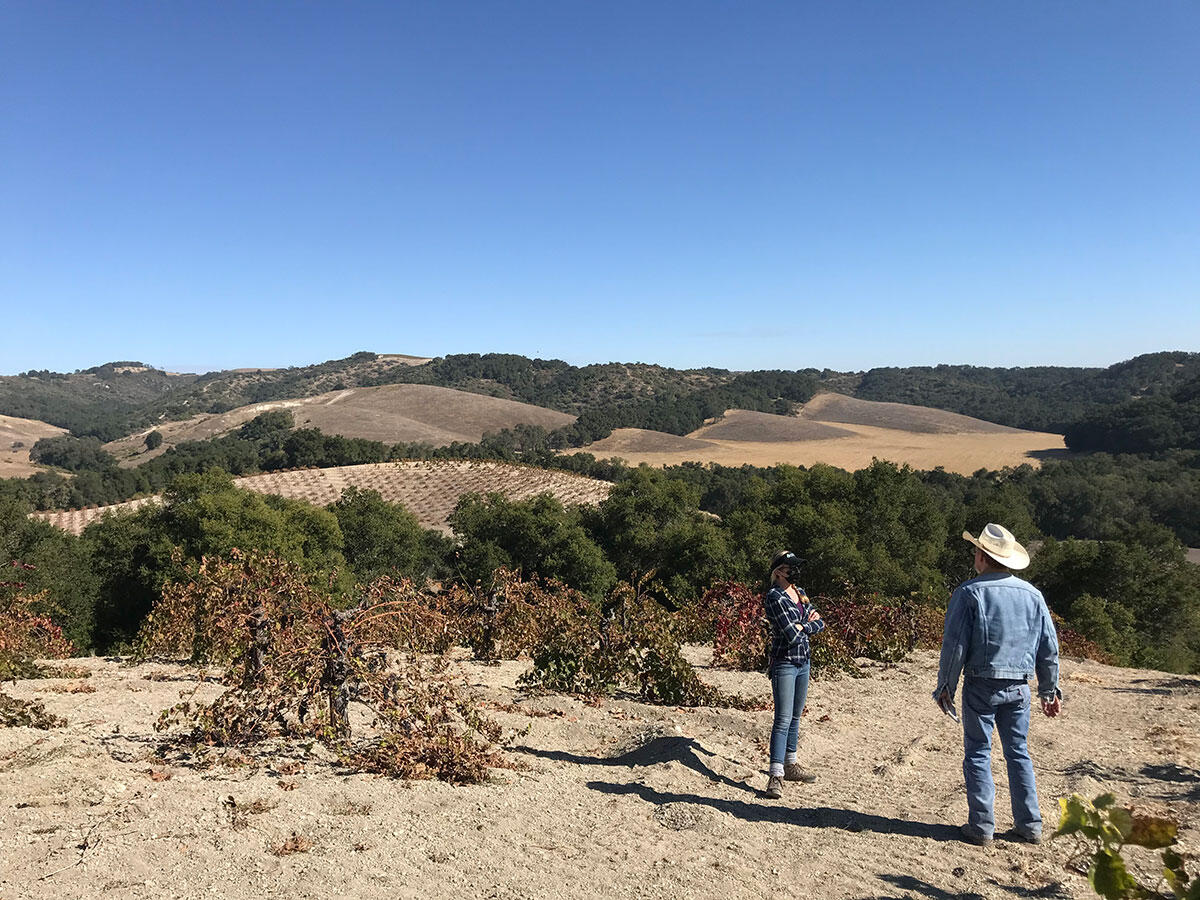
This task started in February 2020 and is ongoing. Public outreach has consisted of conversations with landowners about participation in data collection efforts, informal presentations with interested stakeholders, and informational community meetings. Four informational community meetings were held between 2020 and 2024 to inform stakeholders of data collection progress and other project updates. Presentation information and recordings for each meeting are available at the District project website. A final community meeting will be held after publication of the final USGS investigations report. Public outreach and community meetings were facilitated with support from the Upper Salinas-Las Tablas Resource Conservation District.
Stakeholders in San Luis Obispo County are concerned that the increased demand for water use has, and will continue to, affect groundwater levels and availability in the Adelaida area. To address stakeholder concerns, the County of San Luis Obispo Board of Supervisors has asked the USGS to conduct a comprehensive evaluation of groundwater resources of the Adelaida area.
Groundwater refers to the water found beneath the Earth's surface. This water is essential for human consumption and is stored in underground reservoirs known as aquifers. Groundwater can be extracted by drilling wells and utilizing pumps to get the water out for use. Effective management and sustainable use of groundwater ensure a reliable and sustainable water supply for our various needs.
The Adelaida area is an unincorporated part of San Luis Obispo County, California, where groundwater is the primary source of water. Over the past decades, there has been an increase in the percentage of irrigated land, an increase in vineyards as a percentage of agricultural land use, and an increase in population. Historical and future changes in water demand and climate may increase the demand for groundwater in the Adelaida area. There is concern among stakeholders that the increasing demand for water is negatively affecting groundwater availability.
Recognizing the need for a thorough assessment of the area's groundwater resources, the San Luis Obispo County Flood Control and Water Conservation District (District) engaged with the U.S. Geological Survey (USGS) to conduct a comprehensive evaluation of the historical and present-day hydrologic conditions of the Adelaida area.
Problem
The geology of the Adelaida area is almost entirely comprised of consolidated sedimentary rocks in the highlands of northwestern San Luis Obispo County. The California Department of Water Resources (DWR) has not defined the highlands of the Adelaida area as a groundwater basin; therefore, the area is not subject to California Sustainable Groundwater Management Act (SGMA) regulations.
Prior to this study, publicly available hydrogeologic and hydrologic data (such as well-yield, water quality, or groundwater levels) were limited throughout the Adelaida area, and no investigation of the groundwater resources or water-bearing units of the aquifer system had been completed.
Stakeholders in San Luis Obispo County have a specific need to evaluate and understand historic and current hydrologic and hydrogeologic conditions in the Adelaida area to plan for potentially increasing water demands within the context of sustainable water use in the county.
Benefits to stakeholders
This study will benefit water managers, stakeholders and potential future studies by:
- Improving understanding of the aquifer system, including identifying water-bearing units and quantifying available groundwater resources
- Evaluating the historical and current impacts of groundwater use
- Advancing monitoring networks in the county for groundwater, surface-water, and water-quality data
- Providing a more thorough understanding of hydrogeological controls on water availability
Approach and Status
The study includes five general work tasks to be completed over several years:
Task 1 - Compile and review existing hydrologic and geologic data
This task was initiated in February 2020 and continued through March 2021. The USGS compiled and reviewed existing hydrologic, geologic, climatic, geographic, and land use data sets. This work identified spatial, temporal, and vertical gaps in data helped guide development of later project tasks. Selected hydrologic data, geologic maps, and land use maps compiled as part of task 1 are available in the Interactive Map.
Task 2 - Collect new groundwater and surface water data
This task was initiated in January 2022 and continued through December 2024. Groundwater levels, surface-water flow data, and water quality data collected as part of this task provided an understanding of present-day Adelaida area hydrology. All data are available on the USGS Water Data for the Nation (WDFN) database and can be accessed in the Interactive Map.
Task 3 - Conduct an integrated analysis of the hydrogeologic system
This task started in December 2024 and is ongoing. The Adelaida area hydrogeologic system will be evaluated using historical data compiled as part of task 1, groundwater and surface-water data collected as part of task 2, estimates of water-balance components, and construction of a three-dimensional (3D) hydrogeologic framework. Conceptual and quantitative evaluations of the aquifer system will be conducted. The conceptual work will include a characterization of the spatial (regional and local), vertical (depth dependent), and temporal (historical to present) availability of groundwater. The quantitative work will include an estimation of the components of the hydrologic water budget; estimates of agricultural pumping from land use maps; estimates of domestic pumping from population; identification of areas of recharge and discharge; evaluation of groundwater availability with respect to changes in climate, land use, and water use; and determining the influence of geologic fractures, faults, and folds on groundwater and surface-water flow, if possible.
Water-balance components for 1896–2024 are locally calibrated from the USGS Basin Characterization Model. The results from this work will show where, when, and how hydrologic components of interest have changed, most notably recharge and runoff. Locally-calibrated BCM results for the Adelaida area are published in a USGS data release.
The 3D hydrogeologic framework is a representation of the geometry and extent of water-bearing units in the Adelaida area and will be used to help characterize hydrologic conditions within the aquifer system. The framework will be developed using airborne electromagnetic (AEM) survey data, geologic maps, and subsurface lithology and geophysical data from wells.
Task 4 - Produce interpretive investigation reports and associated data releases
This task started in December 2024 and is ongoing. An interpretive USGS investigations report characterizing the hydrogeologic system of the Adelaida area will be published. This report will provide stakeholders with a summary of information learned as part of this project. The report will synthesize historical and present-day hydrologic conditions, groundwater availability, water‑quality analysis, hydrologic budget estimates, and the influence of local hydrogeology on groundwater flow. A USGS data release (or multiple data releases, if appropriate) will archive any data or information not suitable for inclusion in the USGS WDFN database.
A separate interpretive report documenting the development of the 3D hydrogeologic framework and utilization of AEM data is anticipated to be published, along with a USGS data release (or multiple data releases, if appropriate).
Task 5 – Stakeholder outreach and engagement
This task started in February 2020 and is ongoing. Public outreach has consisted of conversations with landowners about participation in data collection efforts, informal presentations with interested stakeholders, and informational community meetings. Four informational community meetings were held between 2020 and 2024 to inform stakeholders of data collection progress and other project updates. Presentation information and recordings for each meeting are available at the District project website. A final community meeting will be held after publication of the final USGS investigations report. Public outreach and community meetings were facilitated with support from the Upper Salinas-Las Tablas Resource Conservation District.