
Task 2 - Geologic Mapping of the Great Lakes States
The area encompassed by Task 2 comprises the states that border the Great Lakes, including Minnesota, Wisconsin, Michigan, Illinois, Indiana, Ohio, Pennsylvania, and New York. The primary objective of Task 2 is to develop an improved understanding of the Quaternary geology of the Great Lakes region. This work involves a combination of detailed (“cornerstone”) mapping efforts and subsurface characterization. The project seeks to increase communication and collaboration of USGS personnel with State geological surveys. The USGS is a member of the Great Lakes Geologic Mapping Coalition (GLGMC) and has a long history of collaboration/coordination with these States on matters pertaining to Quaternary geology.
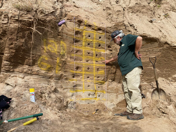
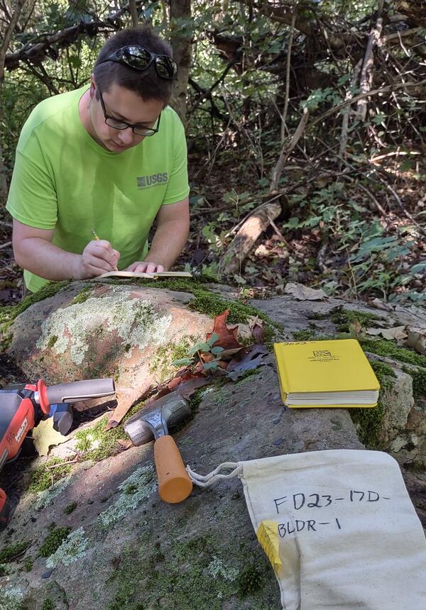
Scientists from the Florence Bascom Geoscience Center perform field work in support of Task 2 of the Quaternary Geologic Mapping of the Glaciated Regions Project.
The area encompassed by Task 2 comprises the states that border the Great Lakes, including Minnesota, Wisconsin, Michigan, Illinois, Indiana, Ohio, Pennsylvania, and New York. The primary objective of Task 2 is to develop an improved understanding of the Quaternary geology of the Great Lakes region. This work involves a combination of detailed (“cornerstone”) mapping efforts and subsurface characterization. The project seeks to increase communication and collaboration of USGS personnel with State geological surveys. The USGS is a member of the Great Lakes Geologic Mapping Coalition (GLGMC) and has a long history of collaboration/coordination with these States on matters pertaining to Quaternary geology.
Scientists from the Florence Bascom Geoscience Center perform field work in support of Task 2 of the Quaternary Geologic Mapping of the Glaciated Regions Project.