



The U.S. Geological Survey and Bureau of Land Management launched an updated version of the Land Treatment Exploration Tool.
The Land Treatment Exploration Tool quickly summarizes a vast amount of information in an easily digestible format and bridges the gap between data and management decisions.
New features include:
- The addition of line and boxplot charts for on-the-ground monitoring data
- The inclusion of special status species in the Site Characterization Report
- The addition of iNaturalist species observations
- New and updated data sources
The U.S. Geological Survey partners with the Bureau of Land Management (BLM) to enhance and maintain the Land Treatment Digital Library and the Land Treatment Exploration Tool that facilitates rapid decision making by resource managers on public lands.
A Sample Page of the Site Characterization Report Displaying the New BLM Terrestrial Monitoring Data Charts:
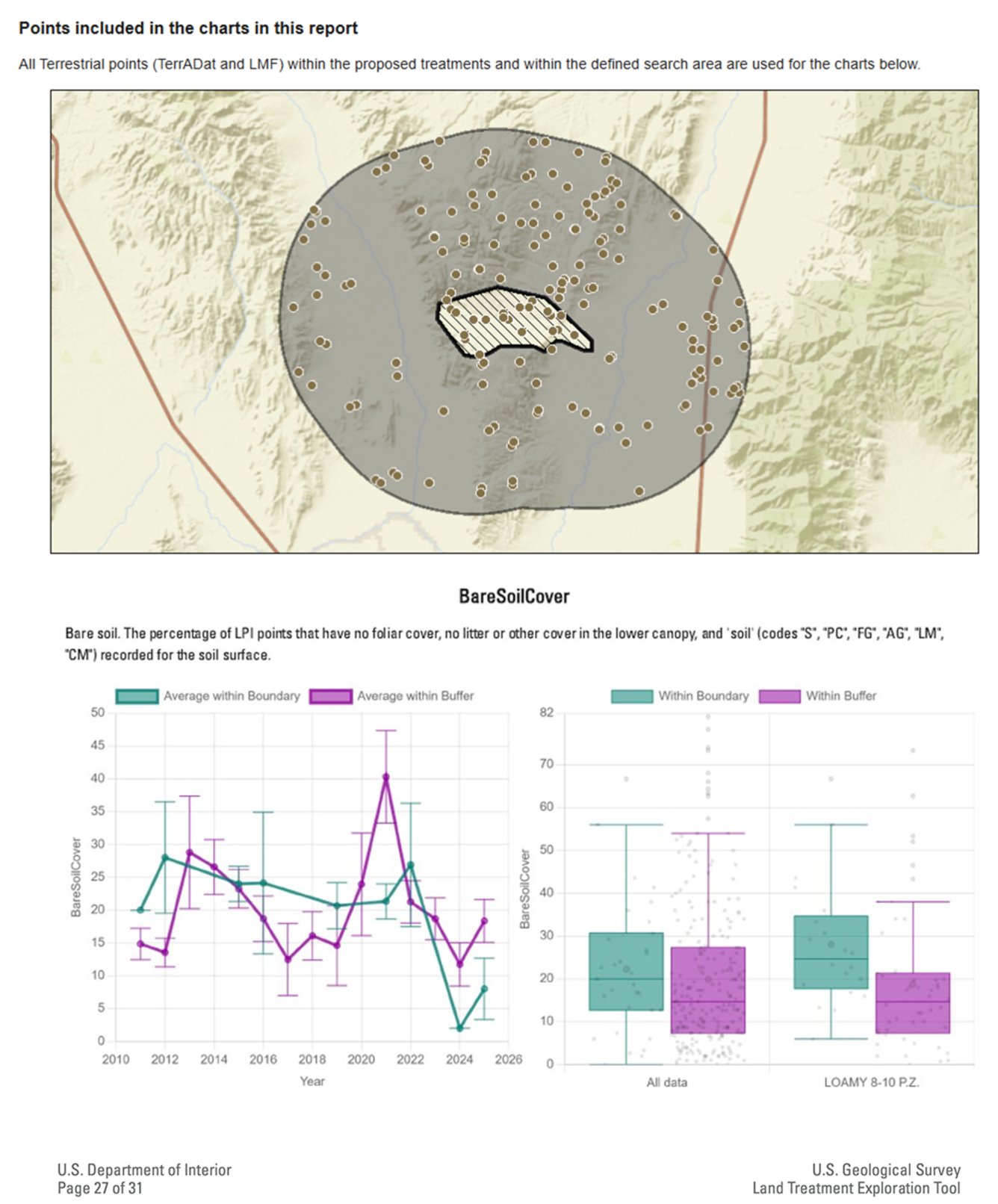
The charts display data from within the user defined boundary (seafoam green in bottom panels, hatched area in top panel), and within a buffered search distance nearby (fuchsia in bottom panels, shaded grey in top panel). The boxplot charts are further displayed by ecological site with the plots sampled on the Loamy 8-10 site description. Charts can be created for any of the relevant data columns in the BLM dataset and included in the Site Characterization Report. The chart creation and interaction function can be found within the Monitoring Tab.
A Sample Page of the Site Characterization Report Displaying the New BLM iNaturalist Observation Summary Table:
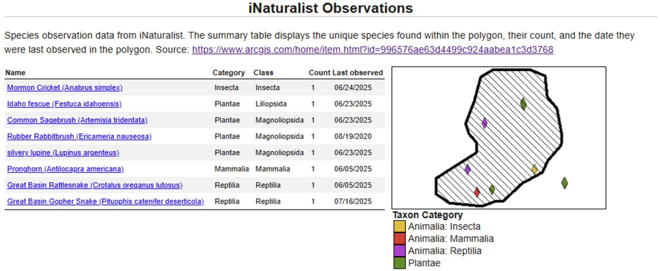
An example of species observation data from the iNaturalist section included in the Site Characterization Report. The initial view of the data and pop-up capabilities are shown in the Site History Tab. The summary table displays the unique species found within the polygon, their count, and the date they were last observed in the polygon.
Updated Data Sources Include:
Related

LTDL and LTET Team (FRESC)
Wildlife Ecology and Habitat Restoration Team

Land Treatment Exploration Tool
Related
LTDL and LTET Team (FRESC)
Wildlife Ecology and Habitat Restoration Team