
New User’s Guide to Updated Hydrographic Framework
The National Hydrography Dataset Plus High Resolution (NHDPlus HR) is a powerful suite of geospatial datasets that enable scientists to map and study watersheds and rivers across the 48 Contiguous United States (CONUS).
U.S. Geological Survey (USGS) New England Water Science Center Research Hydrologist Rich Moore was the lead author on a new user’s guide for a suite of geospatial datasets in cooperation with the U.S. EPA Office of Water and the USGS National Geospatial Program.
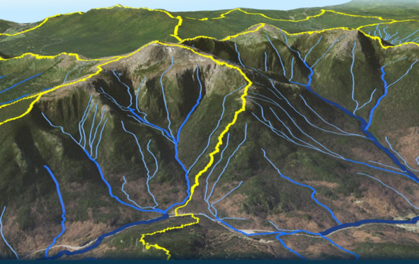
NHDPlus HR combines digital geospatial data of watershed boundaries, topography, and detailed river and stream maps to depict a comprehensive network of the inland waters of the United States. These integrated geospatial datasets serve as a seamless national network of streams and elevation to help water scientists better understand how water moves across the landscape. Additionally, precipitation, temperature and average streamflow data for each stream segment are included. This detailed information is useful in calculating streamflow estimates, assessing changes in aquatic habitats, predicting flooding, and estimating water quality. Moreover, the data within this high-resolution map are used to model water availability and the risk and impacts of flood and drought. Whether at a local or national scale, this tool can be used in managing habitat, flood planning, and water quality studies and management.
The newly published NHDPlus HR guide is more user-friendly and refined than the former 2019 version. It contains more comprehensive information about the suite of geospatial datasets and USGS’ continued efforts to improve the data, including connecting erroneously isolated stream networks.
In 2006, USGS developed the first version of the NHDPlus by combining topographic and stream network data. In 2016, USGS began updating the framework to include more attributes and have a higher resolution. The most updated version (NHDPlus HR) increases the number of national features from 2.7 million to 23.9 million for CONUS and it is at a detailed 1:24,000-scale or better. NHDPlus HR is available or used in other USGS mapping tools such as the National Map Viewer, the National Map Downloader, or StreamStats.
Please visit our publication page for more information.