
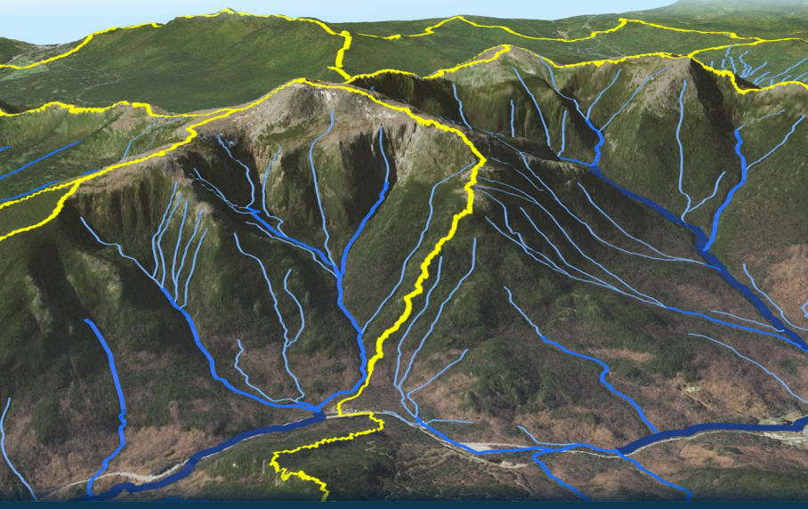
NHDPlus High Resolution Streams and Hydrologic Unit Boundaries of the Presidential Range, New Hampshire

Detailed Description
This image was created by using data from the U.S. Geological Survey’s (USGS) The National Map, including USGS 3D Elevation Program elevation data and orthoimagery from the U.S. Department of Agriculture and the USGS. It showcases the Presidential Range, New Hampshire -- NHDPlus High Resolution (NHDPlus HR) streams and hydrologic unit boundaries.
Streams are represented as blue lines, whose thicknesses and hues indicate ranges of estimated mean annual flow: thin, light-colored lines indicate flow less than 2 cubic feet per second (ft3/s); lines of medium thickness and hue indicate flow from 2 to 15 ft3/s; and thick, dark blue lines indicate flow greater than 15 ft3/s. Thick yellow lines are 12-digit hydrologic unit boundaries. Catchments associated with each flowline are not shown.
Sources/Usage
Public Domain.