



A Culvert Sizing Tool for Vermont StreamStats
Vermont currently (2025) manages nearly 15,000 culverts, many of which are undersized and classified as being in urgent, critical, or poor condition. After large flooding events, stream crossing structures are frequently replaced in kind with little ability to integrate best available topography and design flows. The USGS, in cooperation with Vermont Agency of Transportation (VTrans), is updating Vermont’s watershed boundary dataset using lidar and developing an on-demand culvert‑sizing tool to support faster, more consistent, and flood‑resilient preliminary culvert designs. This work aims to reduce the vulnerability of Vermont’s ~15,000 undersized or aging culverts by providing improved on-demand basin delineations that will produce better flood flow data and hydraulic geometry estimates to support preliminary culvert designs through the USGS StreamStats application for Vermont.
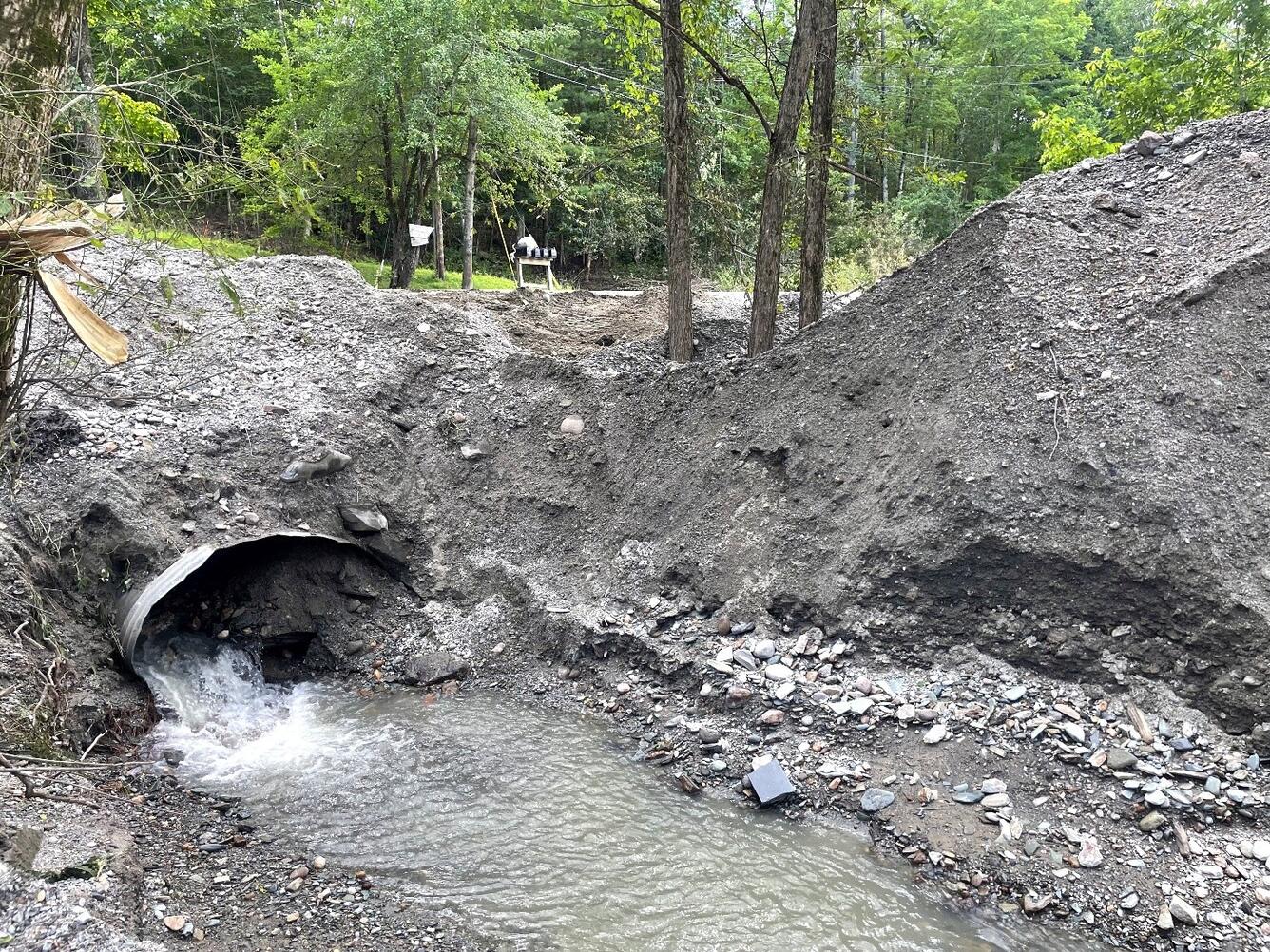
Vermont has many undersized or aging culverts that leave towns vulnerable to road washouts and costly flood damage. Communities and VTrans need fast, consistent, science‑based tools to improve the delineation of watersheds to better calculate flood flows and decrease the time needed to design flood resilient culverts, especially after storms, when decisions must be made quickly. This project improves the accuracy of flood flow estimations through improved basin delineations and provides preliminary culvert sizing guidance for municipalities to better protect roads, reduce emergency repair costs, and plan upgrades proactively.
The project delivers two key products:
• New lidar‑derived watershed boundaries integrated into USGS StreamStats to provide more accurate statewide drainage area mapping and estimation of flood flows, especially for small watersheds.
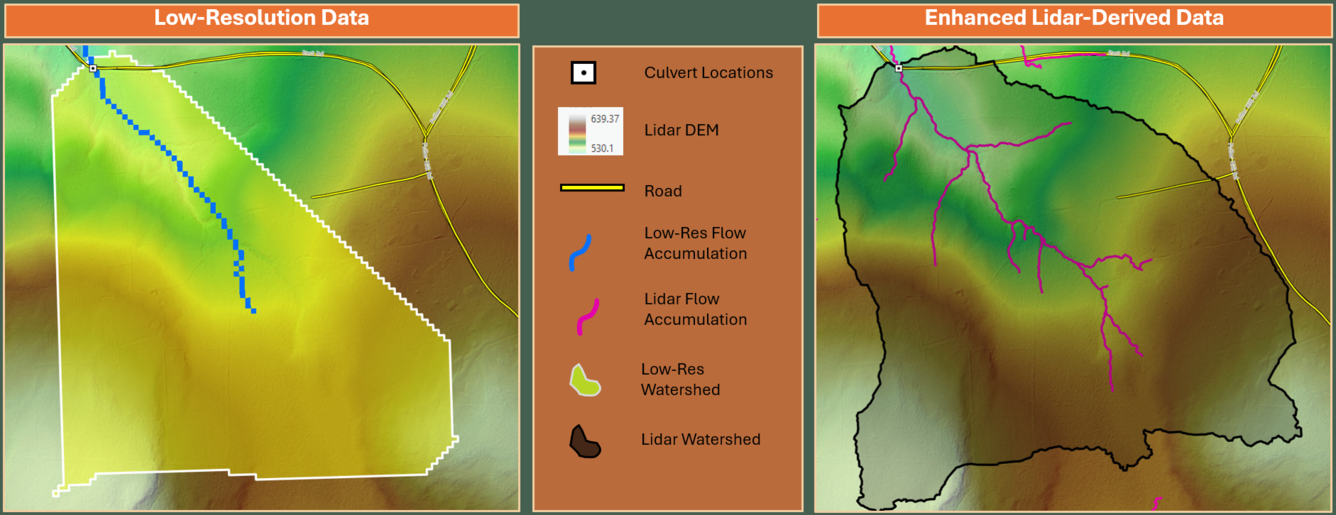
• An on‑demand culvert sizing tool within USGS StreamStats that calculates preliminary culvert dimensions at any selected stream crossing, using the new lidar-derived watershed boundaries, estimated flood flows, inlet-control hydraulic equations, and VTrans design standards. The tool will also include an updated statewide bankfull width equation from VTrans (Lindley and others, 2025).
Users will be able to select a culvert location within the StreamStats application and receive an automatically generated report containing watershed characteristics, estimated design discharges, preliminary culvert dimensions, and guidance to support planning and preliminary engineering decisions. The tool will improve estimates of flood flows, support design consistency, accelerate post-flood infrastructure assessments, and encourage the design of more resilient culverts across Vermont.
Vermont currently (2025) manages nearly 15,000 culverts, many of which are undersized and classified as being in urgent, critical, or poor condition. After large flooding events, stream crossing structures are frequently replaced in kind with little ability to integrate best available topography and design flows. The USGS, in cooperation with Vermont Agency of Transportation (VTrans), is updating Vermont’s watershed boundary dataset using lidar and developing an on-demand culvert‑sizing tool to support faster, more consistent, and flood‑resilient preliminary culvert designs. This work aims to reduce the vulnerability of Vermont’s ~15,000 undersized or aging culverts by providing improved on-demand basin delineations that will produce better flood flow data and hydraulic geometry estimates to support preliminary culvert designs through the USGS StreamStats application for Vermont.
Vermont has many undersized or aging culverts that leave towns vulnerable to road washouts and costly flood damage. Communities and VTrans need fast, consistent, science‑based tools to improve the delineation of watersheds to better calculate flood flows and decrease the time needed to design flood resilient culverts, especially after storms, when decisions must be made quickly. This project improves the accuracy of flood flow estimations through improved basin delineations and provides preliminary culvert sizing guidance for municipalities to better protect roads, reduce emergency repair costs, and plan upgrades proactively.
The project delivers two key products:
• New lidar‑derived watershed boundaries integrated into USGS StreamStats to provide more accurate statewide drainage area mapping and estimation of flood flows, especially for small watersheds.
• An on‑demand culvert sizing tool within USGS StreamStats that calculates preliminary culvert dimensions at any selected stream crossing, using the new lidar-derived watershed boundaries, estimated flood flows, inlet-control hydraulic equations, and VTrans design standards. The tool will also include an updated statewide bankfull width equation from VTrans (Lindley and others, 2025).
Users will be able to select a culvert location within the StreamStats application and receive an automatically generated report containing watershed characteristics, estimated design discharges, preliminary culvert dimensions, and guidance to support planning and preliminary engineering decisions. The tool will improve estimates of flood flows, support design consistency, accelerate post-flood infrastructure assessments, and encourage the design of more resilient culverts across Vermont.