USGS Response to August 2025 Milwaukee Floods
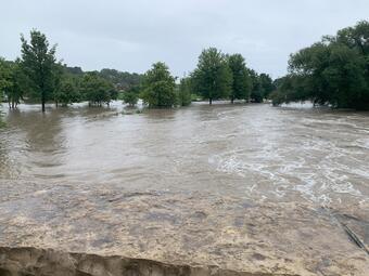
A severe storm system brought up to 14 inches of rainfall to the Milwaukee, Wisconsin area on August 9–10, 2025, triggering widespread flooding across local waterways.
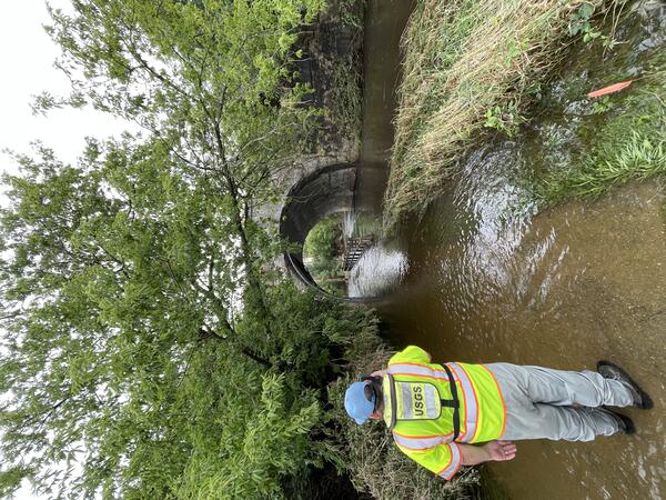
In the hours and days that followed, nearly 20 U.S. Geological Survey (USGS) specialists from five offices mobilized to assess impacts on stream conditions and critical monitoring infrastructure.
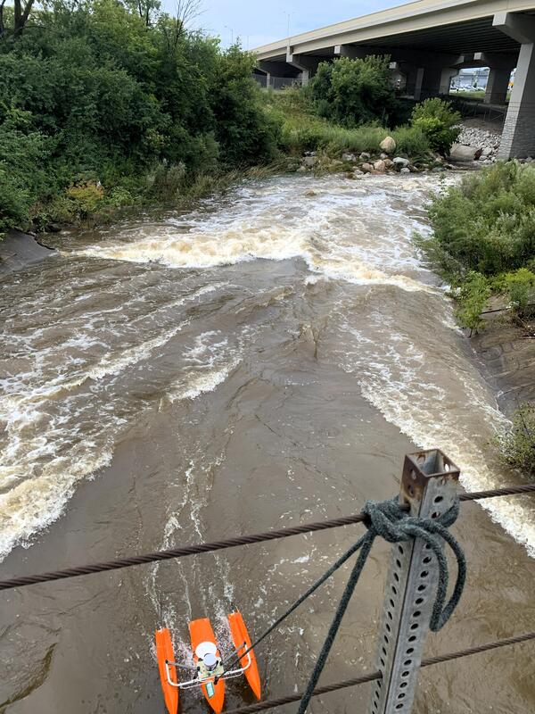
As soon as conditions were safe, USGS crews began field operations—some within hours of the storm’s passage. Teams completed 18 high-water streamflow measurements across 12 flooded monitoring sites, providing essential data for understanding rapidly changing hydrologic conditions.
They also conducted eight high-water-mark assessments in support of development of indirect discharge measurements needed to characterize the full magnitude of the flood event.
Results from this work showed that provisional flood data exceeded maximum gage height and/or flow measurements at eight sites, indicating that several locations experienced peak conditions beyond previously recorded levels.
USGS personnel simultaneously evaluated storm-related damage to monitoring equipment.
Thanks to swift field response, two severely damaged streamgages were repaired and restored to full operation, ensuring uninterrupted delivery of real-time water data used by emergency managers, local partners, and the public.
This coordinated effort demonstrates the commitment, expertise, and preparedness of USGS scientists and technicians in providing timely, reliable hydrologic information during and after major flood events—information that supports public safety and informed decision-making across the region.