Upper Midwest Water Science Center
Home
Our USGS Upper Midwest Water Science Center priority is to continue the important work of the Department of the Interior and the USGS, while also maintaining the health and safety of our employees and community. Based on guidance from the White House, the CDC, and state and local authorities, we are shifting our operations to a virtual mode and have minimal staffing within our offices. If you need additional assistance, please contact Center Director John Walker at jfwalker@usgs.gov.
Current conditions in MI, MN, and WI

Explore real-time streamflow, groundwater, and water-quality conditions and access data with our interactive map application.
View conditionsMessage from the Director
Learn more about the Upper Midwest Water Science Center from John Walker, our Center Director.
Read moreNews
Surface-Air Mercury Fluxes and a Watershed Mass Balance in Forested and Harvested Catchments
Forest soils can act as repositories for atmospherically deposited mercury, yet forestry practices can influence mercury mobility and fluxes, food web dynamics, and bioaccumulation processes.
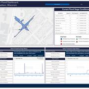
USGS Unveils Mobile Flood Tool for the Nation
The U.S. Geological Survey announced Friday the completion of a new mobile tool that provides real-time information on water levels, weather and flood forecasts all in one place on a computer, smartphone or other mobile device.
USGS Crews Measure Major Flooding in Lower Michigan
U.S. Geological Survey field crews are measuring record flooding on the Tittabawassee River in Midland, Michigan, following a heavy rainfall event.
Publications
Groundwater-quality and select quality-control data from the National Water-Quality Assessment Project, January 2017 through December 2019
Groundwater-quality environmental data were collected from 983 wells as part of the National Water-Quality Assessment Project of the U.S. Geological Survey National Water Quality Program and are included in this report. The data were collected from six types of well networks: principal aquifer study networks, which are used to assess the quality...
Kingsbury, James A.; Bexfield, Laura M.; Arnold, Terri; Musgrove, MaryLynn; Erickson, Melinda L.; Degnan, James R.; Tesoriero, Anthony J.; Lindsey, Bruce D.; Belitz, KennethPublic and private tapwater: Comparative analysis of contaminant exposure and potential risk, Cape Cod, Massachusetts, USA
BackgroundHumans are primary drivers of environmental contamination worldwide, including in drinking-water resources. In the United States (US), federal and state agencies regulate and monitor public-supply drinking water while private-supply monitoring is rare; the current lack of directly comparable information on contaminant-mixture exposures...
Bradley, Paul; LeBlanc, Denis R.; Romanok, Kristin; Smalling, Kelly; Focazio, Michael J.; Cardon, Mary C.; Clark, Jimmy; Conley, Justin M.; Evans, Nicola; Givens, Carrie E; Gray, James L.; Gray, L. Earl; Hartig, Phillip C.; Higgins, Christopher P.; Hladik, Michelle; Iwanowicz, Luke R.; Loftin, Keith; McCleskey, R. Blaine; McDonough, Carrie A.; Medlock-Kakaley, Elizabeth; Weis, Christopher P.; Wilson, Vickie S.Assessment of groundwater trends near Crex Meadows, Wisconsin
Crex Meadows Wildlife Area (Crex) is a 30,000-acre property in Burnett County, Wisconsin. Crex is managed by the Wisconsin Department of Natural Resources (WDNR) with the goal of providing public recreation opportunities while also protecting the quality of native ecological communities and species on the property. The WDNR’s management strategy...
Haserodt, Megan J.; Fienen, Michael N.