
USGS scientists explore how open-source tools can support better flood prediction and research
By Upper Midwest Water Science Center
December 8, 2025
How can we monitor more rivers, more affordably, without sacrificing data quality?
Media
Sources/Usage: Public Domain. View Media Details
USGS scientists, including Upper Midwest Water Science Center hydrologists, recently joined the Stroud Water Research Center for a hands-on ORCA workshop to explore how open-source tools can support better flood prediction and research.
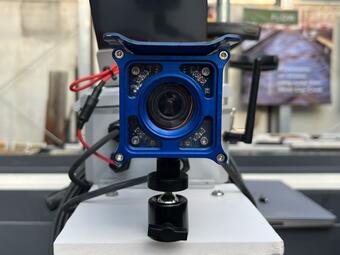
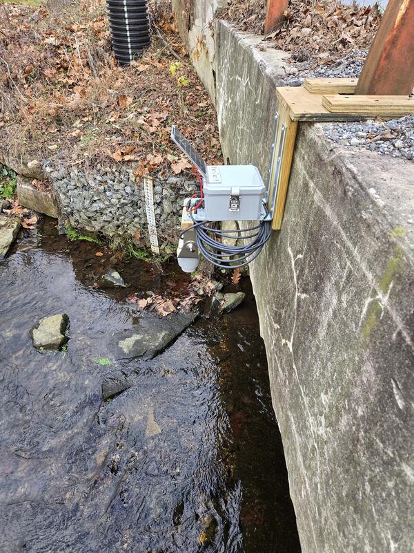
Scientists and engineers at Stroud Water Research Center, working with the USGS have developed the Open-Source River Camera and Altimetry (ORCA) system; a compact, low-power tool that can be quickly mounted on bridges to measure, record, and report river levels in near real-time using cellular or LoRaWAN telemetry paired with cloud computing resources.
The ORCA system:
- Helps fill gaps between existing USGS streamgages
- Can be deployed at multiple sites to expand monitoring coverage
- Uses open-source hardware, enabling anyone to use and adapt the design
- Sends photos and data to the cloud for near real-time viewing
“Open source hardware is an important part of water monitoring technologies because it enables rapid, transparent innovation supported by a global community. The flexibility to integrate new sensors and validate performance can often simplify data collection efforts without constraints sometimes experienced by proprietary systems.”
— Bill Selbig, Research Hydrologist, USGS Upper Midwest Water Science Center
Media
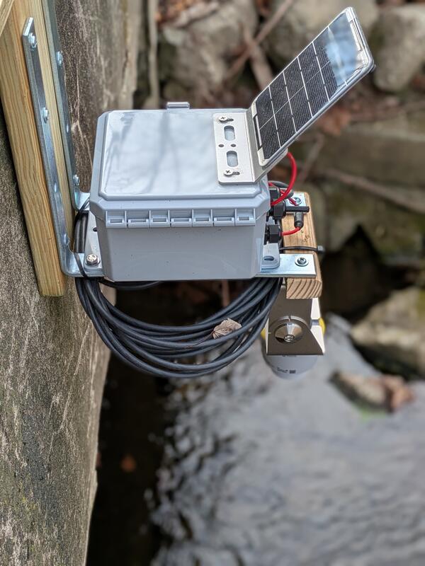
Close-up view of the ORCA deployed on White Clay Creek, Pennsylvania.
Sources/Usage: Public Domain. View Media Details
Media
The ORCA unit was designed for rapid deployment on bridges.
Sources/Usage: Public Domain. View Media Details