



The Issue:
The Washington State Department of Transportation (WSDOT) maintains many roads and bridges that either abut or cross dynamic gravel-bedded rivers. The design and maintenance of these structures often requires assessing sediment transport and river channel dynamics. However, the transport of sand and gravel as bedload, and the channel change that results from that transport, remains costly and difficult to measure or model.
How USGS helped:
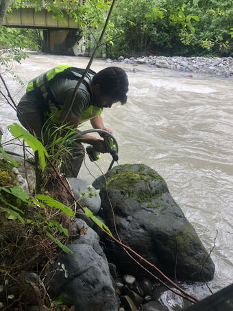
The USGS partnered with WSDOT to assess the utility of several methods that may provide better or less expensive information about bedload transport and channel change. Those methods include seismic and passive acoustic sensors as potential bedload transport surrogates and repeat topographic surveys as a means of characterizing sediment storage and planform channel dynamics.
Problem:
Assessments of bedload transport and channel change are integral parts of the design and maintenance of Washington State Department of Transportation infrastructure that abut or cross large gravel-bedded rivers. Direct measurements of these processes can be time-intensive and costly, and assessments are often based on empirical models with large uncertainties.
Objectives:
The objective of this project is to assess the utility of several relatively low-cost monitoring methods that may provide improved information about bedload transport and channel change conditions in project areas.
Relevance and Benefits:
This work will improve understanding about the relative strengths and potential utility of the various methods as applied tools, supporting WSDOT's efforts to improve river assessments related to infrastructure management and restoration efforts.
Approach:
This work will test three monitoring methods:
- Seismic monitoring of bedload
- Passive acoustic monitoring of bedload (hydrophones)
- Assessments of topographic change based on repeat topographic surveys
The first two methods are both potential surrogates for bedload transport rates, and may provide a better understanding of the timing and relative intensity of transport. The third method provides direct information about sediment storage and planform changes over time, which may be directly relevant to project goals in and of themselves, and can also help constrain integrated bedload transport rates between surveys.
The following rivers were selected for bedload monitoring, using the methods listed:
- Glacier Greek, Washington: seismic, hydrophones, and repeat topography
- Methow River, Washington: hydrophones, repeat topography
- Big Wood River, Idaho: hydrophones
- Skagit River, Washington: hydrophones

The Issue:
The Washington State Department of Transportation (WSDOT) maintains many roads and bridges that either abut or cross dynamic gravel-bedded rivers. The design and maintenance of these structures often requires assessing sediment transport and river channel dynamics. However, the transport of sand and gravel as bedload, and the channel change that results from that transport, remains costly and difficult to measure or model.
How USGS helped:
The USGS partnered with WSDOT to assess the utility of several methods that may provide better or less expensive information about bedload transport and channel change. Those methods include seismic and passive acoustic sensors as potential bedload transport surrogates and repeat topographic surveys as a means of characterizing sediment storage and planform channel dynamics.
Problem:
Assessments of bedload transport and channel change are integral parts of the design and maintenance of Washington State Department of Transportation infrastructure that abut or cross large gravel-bedded rivers. Direct measurements of these processes can be time-intensive and costly, and assessments are often based on empirical models with large uncertainties.
Objectives:
The objective of this project is to assess the utility of several relatively low-cost monitoring methods that may provide improved information about bedload transport and channel change conditions in project areas.
Relevance and Benefits:
This work will improve understanding about the relative strengths and potential utility of the various methods as applied tools, supporting WSDOT's efforts to improve river assessments related to infrastructure management and restoration efforts.
Approach:
This work will test three monitoring methods:
- Seismic monitoring of bedload
- Passive acoustic monitoring of bedload (hydrophones)
- Assessments of topographic change based on repeat topographic surveys
The first two methods are both potential surrogates for bedload transport rates, and may provide a better understanding of the timing and relative intensity of transport. The third method provides direct information about sediment storage and planform changes over time, which may be directly relevant to project goals in and of themselves, and can also help constrain integrated bedload transport rates between surveys.
The following rivers were selected for bedload monitoring, using the methods listed:
- Glacier Greek, Washington: seismic, hydrophones, and repeat topography
- Methow River, Washington: hydrophones, repeat topography
- Big Wood River, Idaho: hydrophones
- Skagit River, Washington: hydrophones