SEABOSS 3.0 Reaches New Milestone with Successful Testing
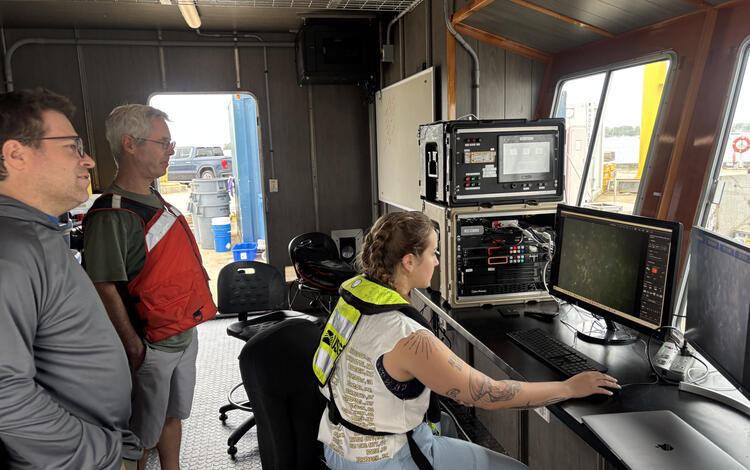
The next generation of the Seabed Observation and Sampling System—SEABOSS 3.0—is steadily coming to life. Building on months of cross‑center planning and knowledge sharing, the Woods Hole Coastal and Marine Science Center team recently hosted Pacific Coastal and Marine Science Center ocean engineer Gerry Hatcher for a week of instrument assembly, refinement, and testing in Woods Hole, MA.
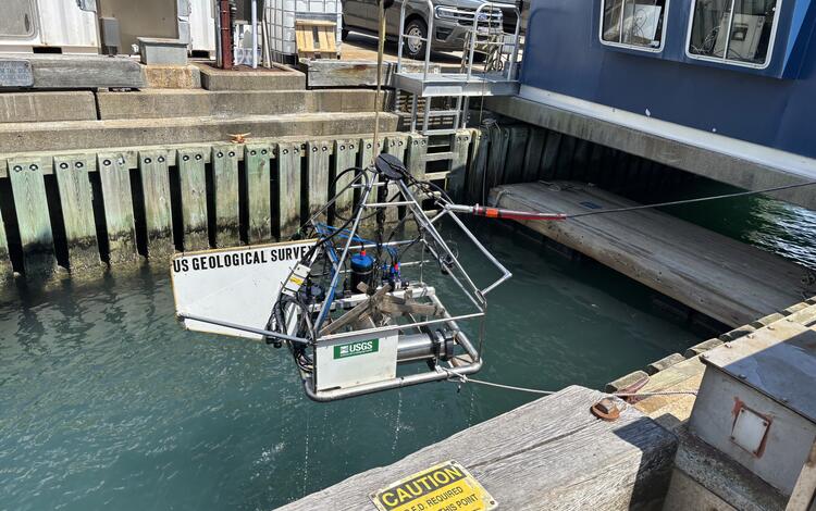
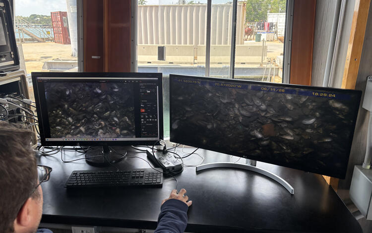
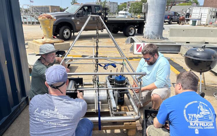
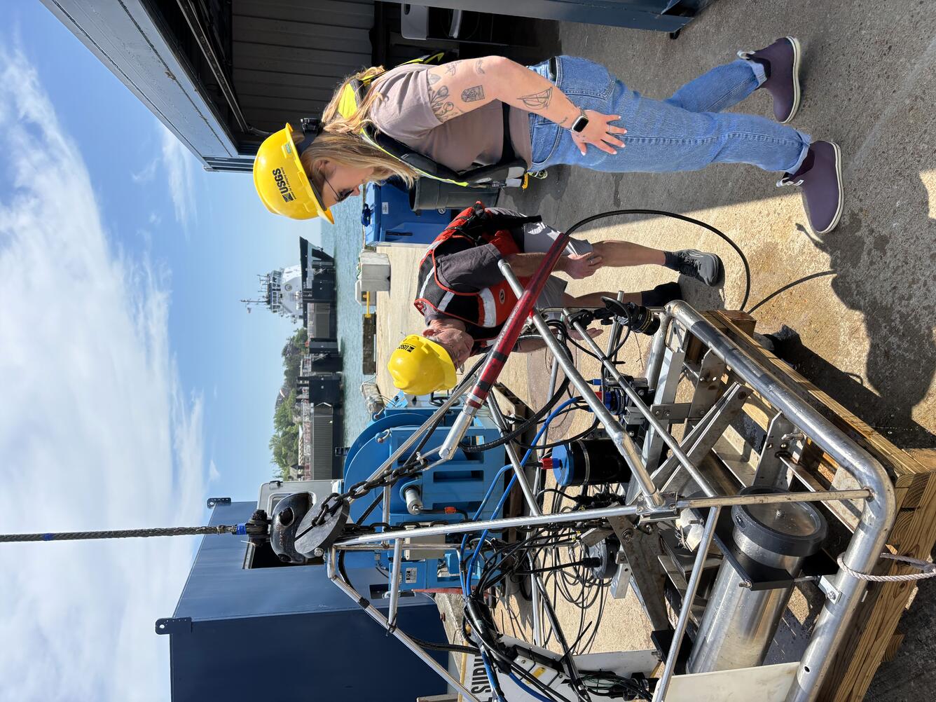
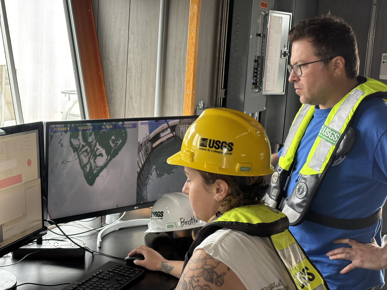
SEABOSS is a long‑used USGS system that collects seafloor images, videos, and sediment samples, supporting research on natural hazards and offshore resources. SEABOSS 3.0 is an updated version of this system that extends these capabilities into deeper water (up to 500 meters) through the integration of fiber‑optic technology and upgraded camera systems, improving speed, resolution, and reliability.
SEABOSS 3.0 development kicked off last year, when Woods Hole Coastal and Marine Science Center (WHCMSC) scientists traveled to the Pacific Coastal and Marine Science Center (PCMSC) in Santa Cruz, California to learn about their seafloor imaging equipment—the Benthic Observation camera Sled, or BOBSled—and to gain expertise from USGS ocean engineer Gerry Hatcher.
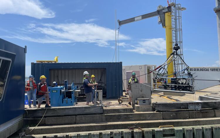
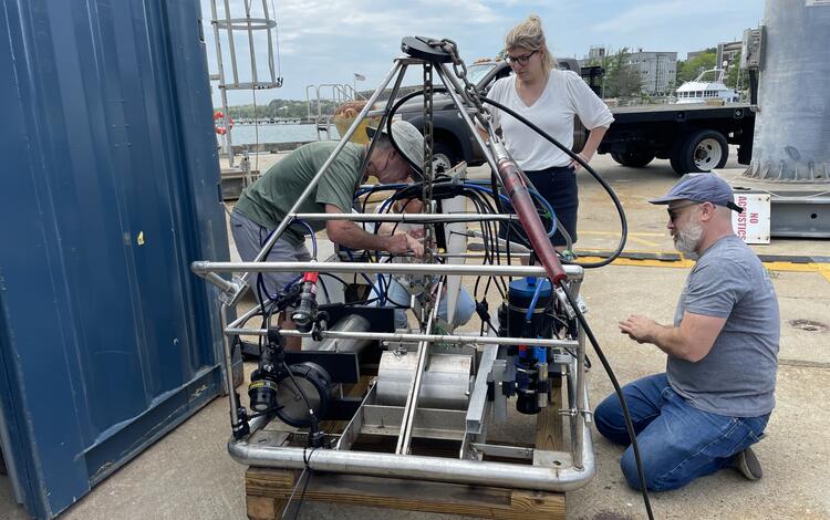
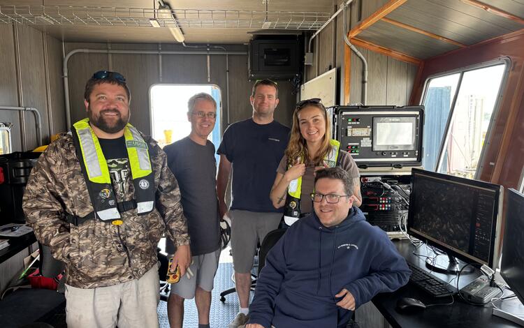
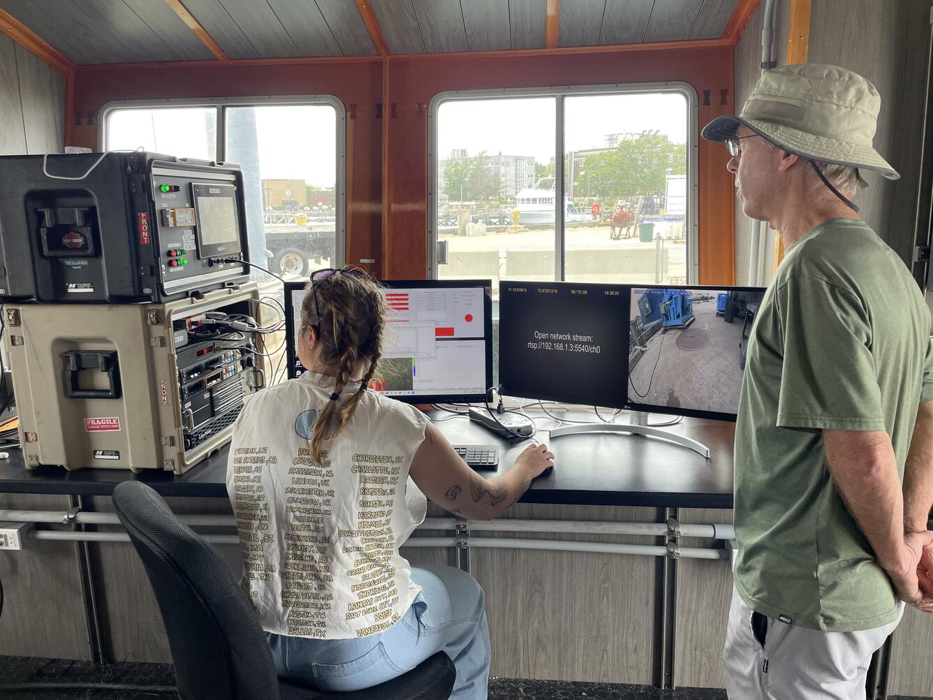
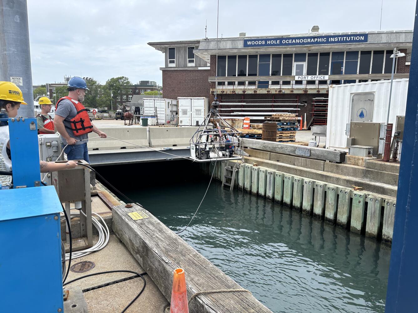
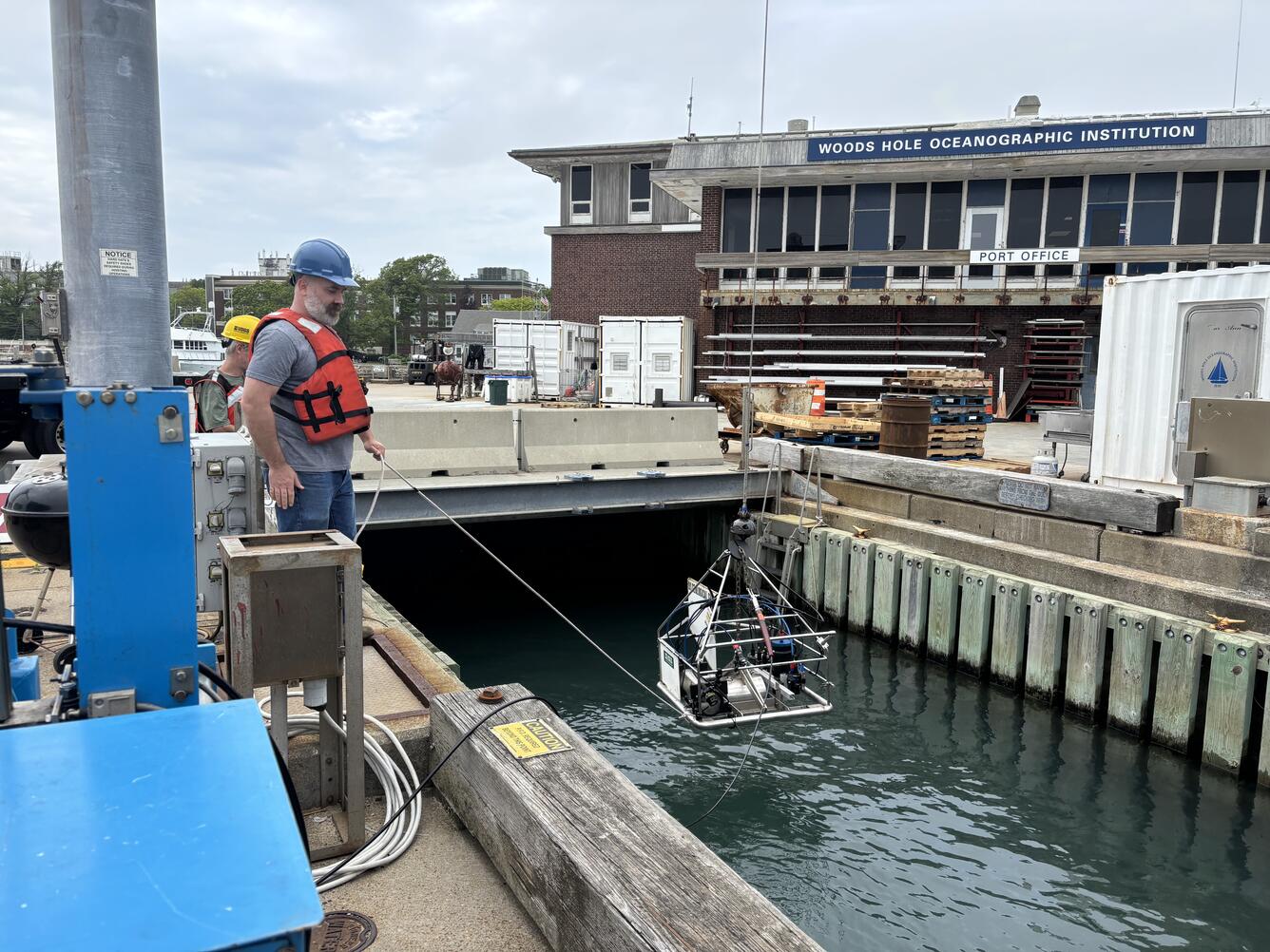
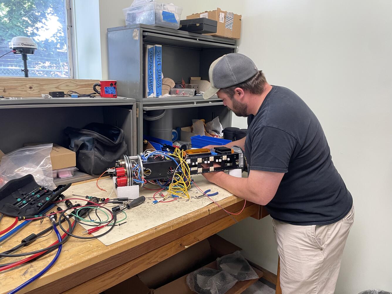
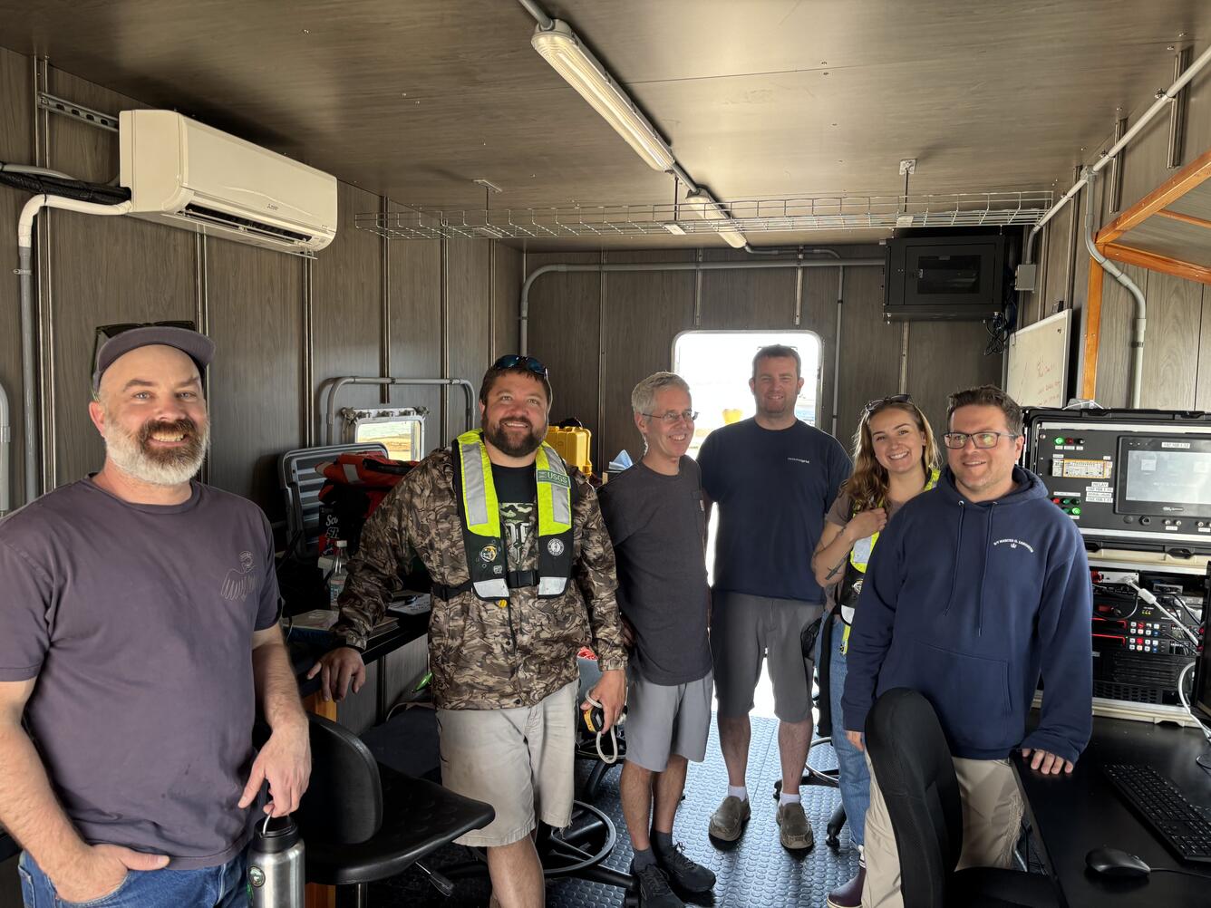
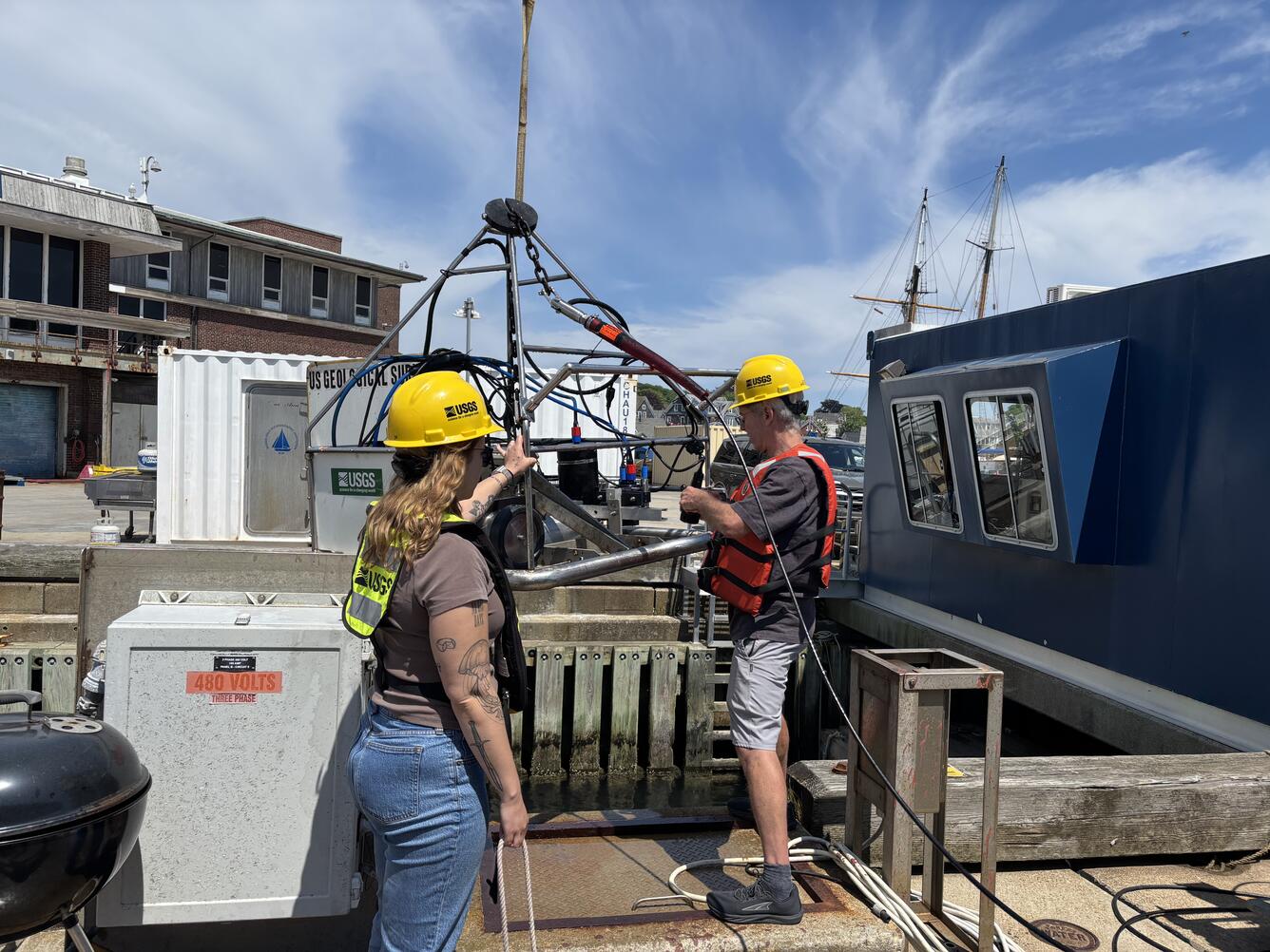
Using what they learned from that visit, the Woods Hole scientists, with Gerry’s continued advisement, spent the next year developing and refining the instrument. In early June 2026, Gerry joined colleagues, including Seth Ackerman, Eric Moore, Pat Berube, Alex Nichols, Lee Vanderveen, and Laura Brothers—in Woods Hole, Massachusetts to test the new instrument for the first time. The team successfully ran the system in a test well at the Wood Hole Oceanographic Institution, evaluated camera performance, and assessed how the frame handled during deployment. The successful tests mark a major milestone for the project.
Moving forward, the SEABOSS 3.0 development team will continue to fine-tune the instrument and prepare the system for sea trials on the R/V Tioga in late summer 2026. Once complete, the new instrument will support a wide variety of research to better understand and map our Nation’s seafloor, including characterizing the surface of the seafloor in the Gulf of Maine in upcoming work with the Office of Naval Research.
SEABOSS 3.0 represents much more than a new piece of equipment—it’s a testament to the power of collaboration across the USGS Coastal and Marine Hazards and Resources Program. By blending engineering expertise, field experience, and cross‑center innovation, the team is building a tool that will expand the reach of USGS research and improve our understanding of the seafloor.