
Get Ready to Explore a Little Deeper: SEABOSS 3.0 is Coming
The SEABOSS—used to collect images, videos, and samples of the seafloor—is being updated to improve overall capabilities and allow for deep water deployment up to 500 meters. These enhancements are inspired by cross-center knowledge sharing, continuing a long history of collaboration within the USGS Coastal and Marine Hazards and Resources Program to develop new systems and advance capabilities.
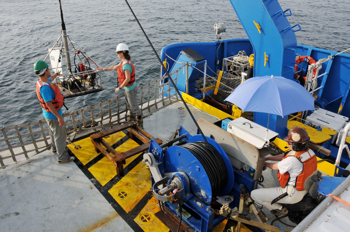
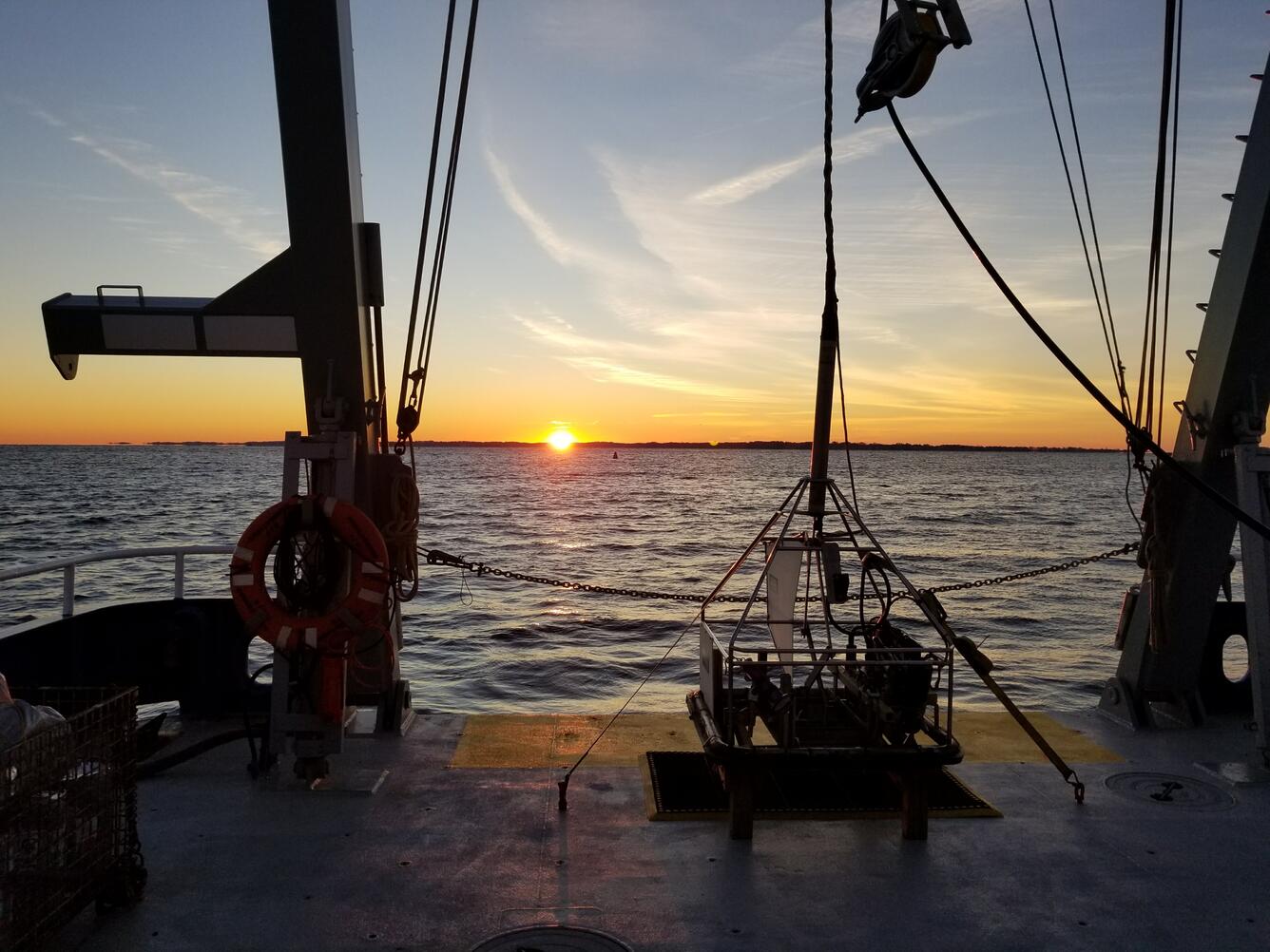
The USGS designed the Seabed Observation and Sampling System (SEABOSS) to collect images, videos, and samples of the seafloor. These images and samples are essential to the study of sedimentary environments and biological habitats, as well as to the interpretation of side-scan sonar and multibeam imagery, the most common tools used for mapping the seafloor. This information helps define the geologic framework of the seafloor and provides a base for a wide range of USGS research.
Since the initial development of SEABOSS in the early 1990’s, modern technologies have been incorporated to advance its capabilities. SEABOSS 3.0 is being designed to accommodate research in deeper water. This work is being done in partnership with the Bureau of Ocean Energy Management (BOEM) as part of a study to characterize the surface of the seafloor in the largely unexplored Gulf of Maine.
“These deeper environments include offshore lease areas for development and exploration, historic fishing grounds, and seabed that could host deep sea coral. We just don’t know what’s down there because we haven’t seen it yet! We need SEABOSS 3.0!” said Laura Brothers, a USGS research geologist and lead of the project.
This update is a big undertaking. The goal is to develop a system using fiber optic cable that is capable of deploying to depths of 300-500 meters (about 984-1,640 feet). The fiber optics will allow for high-resolution bottom video and images to be acquired at higher speeds, with high fidelity—enabling scientists to better characterize the surface of the seafloor. The sediment sampling grabber will continue to collect relatively undisturbed seafloor samples, tying the imagery to a physical sample—a significant feature.


To begin the process, scientists and technologists from the Woods Hole Coastal and Marine Science Center (WHCMSC) in Woods Hole, Massachusetts, including Seth Ackerman, Pat Berube, Eric Moore, Alex Nichols, and Lee Vanderveen, traveled to the Pacific Coastal and Marine Science Center (PCMSC) in Santa Cruz, California to learn about their seafloor imaging and sampling instrument—the Benthic Observation camera Sled, or BOBSled. Gerry Hatcher, an ocean engineer at the PCMSC, spent the week sharing the knowledge he accrued over his long career and even gave the Woods Hole team a tutorial on working with fiber optic cable.
“It was an extraordinarily helpful week for us to spin up on their BOBSled system setup, brainstorm how to leverage the resources they have into our new system, and learn from their vast knowledgebase on everything from system design to camera setting to working with fiber optic cable,” said Seth Ackerman, a geologist with the Woods Hole center and a member of the SEABOSS 3.0 team.
Now back at home, the SEABOSS 3.0 team will use the BOBSled framework as the basis for this update—deciding which components they can use, and which need to be upgraded. Development is planned to finish in fall 2025 and will be followed by field testing. It will be exciting to see this updated piece of equipment in action.


USGS scientists and technologists create many of the devices we use to conduct various research activities, like characterizing and mapping the seafloor. By developing innovative systems and operating these in conjunction with high-resolution mapping tools, we are able to produce detailed maps of the seafloor, understand the processes that change the seafloor, and explore our Nation’s offshore potential.


