
NEW TNMCorps Mapping Challenge for Ambulances in Washington and Oregon!
WA and OR are coming up on the Topo production schedule, so we’re sticking to those states, this time with a focus on ambulances! Again, we'll be focusing on points with no edit history, but you will also encounter some points that will need to be peer reviewed or advanced edited. Don’t forget to also check for missing ambulance points and delete any points representing closed facilities.
Contents
Base Map
As you can see from the map below, a decent amount of work has already been completed for these states. However, that was quite a long time ago, and if we overlay the points with no edit history (see below), there’s still a good amount of work yet to be done!
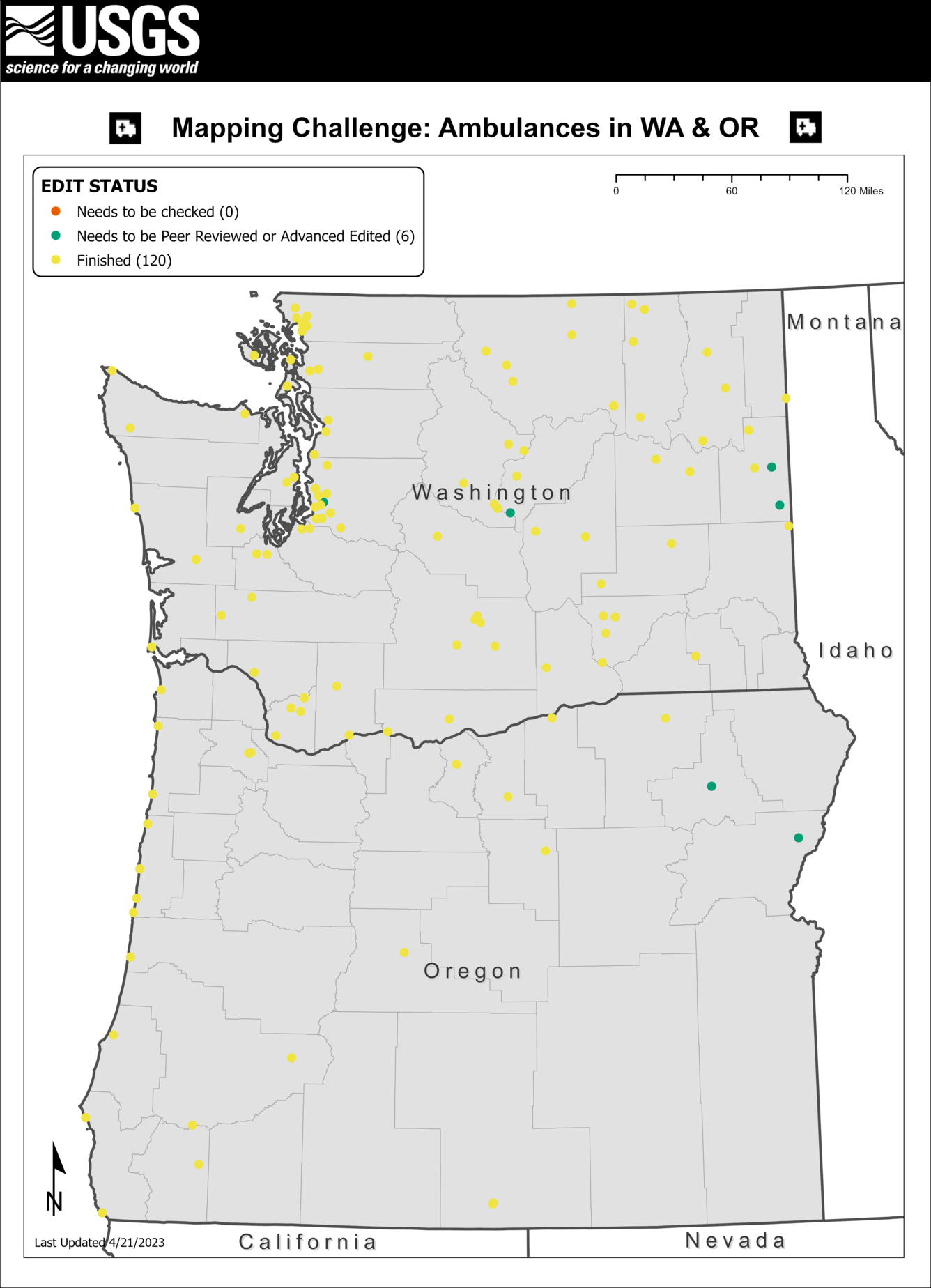
Points with No Edit History
This challenge includes points with no edit history. These are points that were edited prior to the launch of our current application in August 2016. You can identify points with no edit history by highlighting the point and then clicking on the “View History” button in the edit panel. A message saying “This feature has not been edited” will appear in the lower righthand corner. See the Yellow Points with no Edit History?? article in our July 2021 newsletter and the Edited Points without an Edit History article in our March 2018 newsletter for more information on these types of points.

Not sure what each point color means?
Each point in the editor has a colored border. These colors are part of our tiered editing process and signal to other editors that a point has passed through the upper tiers and does not need to be edited again. Our November 2018 newsletter has an article titled Editor Roles and Point Colors that describes this process further.

Tips and Tricks for this challenge:
Before diving into this challenge, we highly recommend reviewing the following resources:
-
Social Media as an Authoritative Source (July 2020 Newsletter page 5)
When adding new ambulance points to the map, or editing those that might already exist, ask yourself the following questions:
-
Does the point you’re adding or editing represent an ambulance station that is currently open and active?
-
Does the ambulance station have the correct name?
-
Does the ambulance station’s address match information published by an authoritative source?
-
Is the point in the correct location?
Confirm Names and Addresses with Authoritative Sources
Remember to find an authoritative source for each feature before entering names and addresses. Do not enter addresses posted on commercial mapping services (e.g. Google™) unless they have also been confirmed via an authoritative source. If you cannot confirm a complete physical address for a feature, it is also acceptable to enter cross streets (e.g., “Smith Boulevard and Cherry Lane”) or even just the name of the nearest road (e.g., “Main Street”). Refer to the Name and Address Formatting Guide for more on how to correctly format ambulance service addresses. If you’re unsure of how to format Puerto Rican addresses specifically, you can reference other features edited by USGS staff (yellow points) or Advanced Editors (purple points).
Here are some examples of various authoritative sources for EMS and ambulance services in Washington and Oregon:
Washington
-
Washington State Department of Health list of EMS Services by County (Even with lists like this published by reputable sources, we still recommend tracking down a source published by the entity itself, whether it’s an official website, or just a Facebook page.)
Oregon
Proper Point Placement
When editing ambulance services, be sure to zoom in all the way and, if necessary, click-and-drag the point to center it on the correct building.
-
Refer to this newsletter article titled Aerial Photo Interpretation Part 6: Ambulance Services (July 2018 Newsletter page 8) for guidance on identifying these features using aerial imagery.
Questions?
If you have any questions about the editing process, reach out to us at nationalmapcorps@usgs.gov. Thanks for helping us out, and happy mapping!