U.S. flag

An official website of the United States government

Images

Images

Filter Total Items: 243
View from the top of a ridge looking down on the Green River. Rafts are parked in a shady creek inlet flooded by the high water.
View of the boats and river from a lunch hike vista

Most of our views were from the river level, where you are intimately connected to subtleties in flow, wind, and temperature. It was a welcome opportunity to view the river from above and gain context. We stopped here on the last full day on the river.

Most of our views were from the river level, where you are intimately connected to subtleties in flow, wind, and temperature. It was a welcome opportunity to view the river from above and gain context. We stopped here on the last full day on the river.

 A person is holding a small glass vial full of clear liquid in their fingers.
Anya collected a Golden Stonefly with a pseudoscorpion attatched

Anya Metcalf was the insict expert on this trip. We started pointout out and catching bugs for her to identify. This one crawled across camp during our podcast recording. It turned out to be a Golden Stonefly with a small pseudoscoprion attached to the mandlible using the fly for dispersal.

Anya Metcalf was the insict expert on this trip. We started pointout out and catching bugs for her to identify. This one crawled across camp during our podcast recording. It turned out to be a Golden Stonefly with a small pseudoscoprion attached to the mandlible using the fly for dispersal.

A view from a ridge looking over the Green river and other bluffs.
The last camp sunset over the Green River

The last night, as we neared Desolation Canyon, the bluffs got taller. Since the Green River is calmer here, it reflected the colors of the sunset. I was so worried about making it before the sun went down that I climbed the peak in my chaco sandals, a decision I regretted the next day since my foot were banged up.

The last night, as we neared Desolation Canyon, the bluffs got taller. Since the Green River is calmer here, it reflected the colors of the sunset. I was so worried about making it before the sun went down that I climbed the peak in my chaco sandals, a decision I regretted the next day since my foot were banged up.

A line of rafts float on flat water with lots of foam. Tan tall cliffs are along the side of the river.
Our boats drift on calm, foamy water next to massive bluffs

The Green River in the Uinta basin is fairly flat, so it carries a lot of foam. The foam often follows the fastest part of the river, with is ties to the shape of the channel and the curve of the river. From this level, you can sense subltle changes in the plant like, flow speed, temperature, water clarity, and fauna.

The Green River in the Uinta basin is fairly flat, so it carries a lot of foam. The foam often follows the fastest part of the river, with is ties to the shape of the channel and the curve of the river. From this level, you can sense subltle changes in the plant like, flow speed, temperature, water clarity, and fauna.

View from inside a tent looking out of the open door as the landscape.
The last sunrise from my tent illuminates the nearby cliffs

The final morning view from my text as the sun rose from the east and illuminated cliffs on the west. This trip was so wonderful and exceeded all of our expectations, it was hard to go back to reality.

The final morning view from my text as the sun rose from the east and illuminated cliffs on the west. This trip was so wonderful and exceeded all of our expectations, it was hard to go back to reality.

Six rafts are parked by the river's edge, getting loaded down with supplies.
Six rafts are parked by the river's edge, getting loaded down with sup

We camped on a 20-30 ft. tall hill our last night, so shuttling kitchen gear up and down from the rafts was no easy task.

USGS hydrologic technician Nick Hammond poses for a photograph on the bow of a SCREE raft.
USGS scientist sitting on a raft on the Green River

Nicholas Hammond is soaking up the views on his last day on the river. Photograph taken by Ben Capelin (SCREE).

USGS Ecologist Anya Metcalfe rows her raft amidst the bubbles on the Green River.
USGS scientist rowing a raft on the Green River.

Although we were all hoping it would never end, the final day on the river was a bittersweet reminder of the amazing experiences we had in the Uinta Basin.

Although we were all hoping it would never end, the final day on the river was a bittersweet reminder of the amazing experiences we had in the Uinta Basin.

Panoramic view of a canyon of the green river with tents and the morning sun reflecting on rock walls
Sunrise in canyon country from our last campsite

Early morning panorama of cliffs that signal the start of Desolation Canyon. This was our last, and probably most spectacular, campsite of this section of Uinta Basin. It was approximately 9 miles from our take-out at Sand Wash.

Early morning panorama of cliffs that signal the start of Desolation Canyon. This was our last, and probably most spectacular, campsite of this section of Uinta Basin. It was approximately 9 miles from our take-out at Sand Wash.

A tent is pitched on a ledge overlooking the Green River.

This was our final campsite before we left the river, approximately 9 miles upstream of Sand Wash. The scenery was beginning to transition from the flat and expansive Uinta basin to the high canyon walls that were upcoming in Desolation-Gray.

This was our final campsite before we left the river, approximately 9 miles upstream of Sand Wash. The scenery was beginning to transition from the flat and expansive Uinta basin to the high canyon walls that were upcoming in Desolation-Gray.

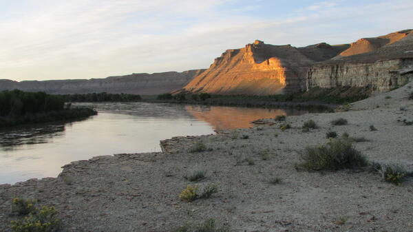
Light hits bluff over river at sunrise.
Sunrise lights the bluffs as this expedition leg nears its end.

On our last day of the expedition the landscape was dominated by the Green River Formation, famous for its fish fossils (although none were found in camp).

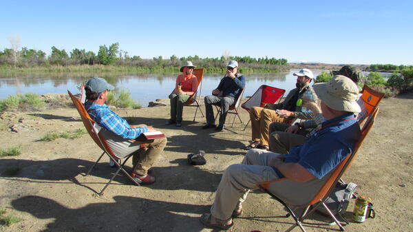
People seated in a circle talking.
Tom leads a discussion of Powell's legacy and the West's future.

An integral part of each segment of the expedition is a recorded dialogue in which participans reflect on such things as Powell's legacy, the future of the West in light of water and energy issues, and what personal growth has occurred as a result of the expedition.

An integral part of each segment of the expedition is a recorded dialogue in which participans reflect on such things as Powell's legacy, the future of the West in light of water and energy issues, and what personal growth has occurred as a result of the expedition.

A properly rigged cataraft on the banks of the Green River in the Uintah Basin
A properly rigged cataraft on the banks of the Green River
Sunset highlights distant cliffs beyond the river while a man in white shirt perches on cliff in foreground
Sunset highlights distant cliffs beyond the river

Our last evening on this section of river, exploring the cliffs and buttresses of the Uinta Basin. One of our team member pauses on heavily banded member of the Green River Formation with distant cliffs glowing in the setting sun

Our last evening on this section of river, exploring the cliffs and buttresses of the Uinta Basin. One of our team member pauses on heavily banded member of the Green River Formation with distant cliffs glowing in the setting sun

Panorama with rafts framed by cliffs of the Uinta formation near Desert Spring Wash
Panoramic vista of rafts on brown water below red and white cliffs

Although this section of the Green River in the Uinta basin lies between sections of dramatic red-stone cliffs of Ladore and Desolation Canyons, we did experience some profound geology. These cliffs are near the start of Desolation Canyon to the south.

Although this section of the Green River in the Uinta basin lies between sections of dramatic red-stone cliffs of Ladore and Desolation Canyons, we did experience some profound geology. These cliffs are near the start of Desolation Canyon to the south.

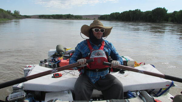
Guy in hat rowing raft.
Prof. Tom Minckley got the SCREE ball floating two years ago.

Starting two years ago, Professor Tom Minckley, from the University of Wyoming geology department, conceived and organized the Sesquicentennial Colorado River Exploring Expedition (SCREE), also known as the Powell 150 expedition. The USGS joined as a partner last year.

Starting two years ago, Professor Tom Minckley, from the University of Wyoming geology department, conceived and organized the Sesquicentennial Colorado River Exploring Expedition (SCREE), also known as the Powell 150 expedition. The USGS joined as a partner last year.

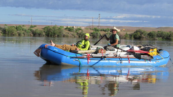
Two guys in raft smiling at camera.
Graham (L) wrote a song and Pat (R) sketched the landscape.

USGS geologist Graham Lederer (L) wrote a song about the expedition while floating down the river, and Professor Pat Likut (R), who teaches art at the University of Wyoming, did landscape sketches that he will later turn into oil paintings.

USGS geologist Graham Lederer (L) wrote a song about the expedition while floating down the river, and Professor Pat Likut (R), who teaches art at the University of Wyoming, did landscape sketches that he will later turn into oil paintings.

Man in green shirt and hood rows boat under blue skys
Ben Kraushaar (UWYO expedition film maker) oars his raft through Ouray

This calm section of river flows through a National Wildlife Refuge where we observed a great deal of wildlife, including beaver, peregrin falcons, waterfowl, a coyote, bighorn sheep and American white pelicans

This calm section of river flows through a National Wildlife Refuge where we observed a great deal of wildlife, including beaver, peregrin falcons, waterfowl, a coyote, bighorn sheep and American white pelicans

Hooded guy standing on raft with camera on tripod.
Ben Kraushaar is making a film about the expedition.

University of Wyoming grad student (media and communications) Ben Kraushaar is also an accomplished filmmaker, and is making a film of the expedition using both eyelevel shots and lofty drone aerials. He was instrumental in getting equipment of all types donated to the expedition.

University of Wyoming grad student (media and communications) Ben Kraushaar is also an accomplished filmmaker, and is making a film of the expedition using both eyelevel shots and lofty drone aerials. He was instrumental in getting equipment of all types donated to the expedition.

Was this page helpful?