
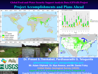
The Global Food-and-Water Security-support Analysis Data (GFSAD) Project held its 4th Workshop at the U. S. Geological Survey's (USGS) Flagstaff Science Center
By Western Geographic Science Center
September 2, 2025
The Global Food-and-Water Security-support Analysis Data (GFSAD) Project held its 4th Workshop @ the U. S. Geological Survey's (USGS) Flagstaff Science Center on August 18-19, 2025
Media
Sources/Usage: Public Domain. View Media Details
The workshop discussed progress made and plans ahead for production of 4 GFSAD cropland products for nominal years 2020 and 2025:
- Landsat-derived global cropland extent product @ 30 m (LGCEP30)
- Landsat-derived global rainfed and irrigated-area product @ 30 m (LGRIP30)
- Landsat-derived global cropping intensity product @ 30 m (LGCIP30)
- Landsat-derived global crop-type mapping @ 30 m (LGCTP30)
Extensive presentations and discussions took place. The workshop was attended by USGS, San Diego State University (SDSU), NASA, and Amazon. The workshop also included a 3- hour hands-on training on Amazon Web Services.
Related
To read more about the Global Food-and-Water Security-support Analysis Data (GFSAD) project please review some of the attached resources.
Global Food-and-Water Security-support Analysis Data (GFSAD)
Global Food-and-Water Security-support Analysis Data (GFSAD)
LGRIP30 and Map Visualization tool
LGRIP30 and Map Visualization tool

Global Food-and-Water Security-support Analysis Data (GFSAD)
The GFSAD is a NASA funded project (2023-2028) to provide highest-resolution global cropland data and their water use that contributes towards global food-and-water security in the twenty-first century. The GFSAD products are derived through multi-sensor remote sensing data (e.g., Landsat-series, Sentinel-series, MODIS, AVHRR), secondary data, and field-plot data and aims at documenting cropland...

GFSAD30 - Archives
Automated Cropland Classification Algorithm (ACCA) is rule-based methodology for classifying cropland areas as well irrigated versus rainfed croplands areas using satellite remote sensing data. The algorithm has been applied for Tajikistan and California.
Related
To read more about the Global Food-and-Water Security-support Analysis Data (GFSAD) project please review some of the attached resources.
Global Food-and-Water Security-support Analysis Data (GFSAD)
Global Food-and-Water Security-support Analysis Data (GFSAD)
LGRIP30 and Map Visualization tool
LGRIP30 and Map Visualization tool
Global Food-and-Water Security-support Analysis Data (GFSAD)
The GFSAD is a NASA funded project (2023-2028) to provide highest-resolution global cropland data and their water use that contributes towards global food-and-water security in the twenty-first century. The GFSAD products are derived through multi-sensor remote sensing data (e.g., Landsat-series, Sentinel-series, MODIS, AVHRR), secondary data, and field-plot data and aims at documenting cropland...
GFSAD30 - Archives
Automated Cropland Classification Algorithm (ACCA) is rule-based methodology for classifying cropland areas as well irrigated versus rainfed croplands areas using satellite remote sensing data. The algorithm has been applied for Tajikistan and California.