
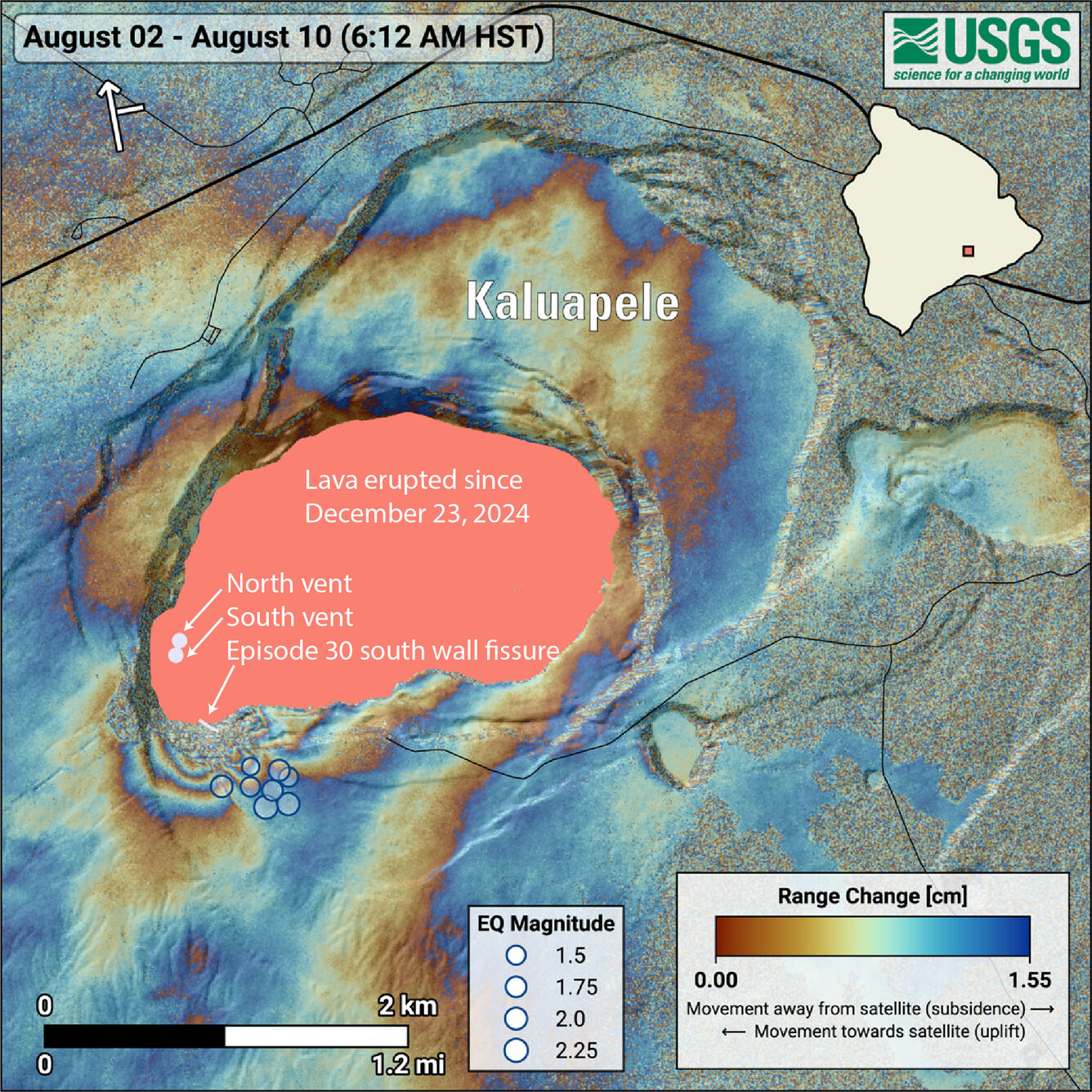
August 10, 2025—InSAR image of Kīlauea deformation associated with episode 30 of ongoing summit eruption
August 21, 2025
Media
Sources/Usage: Public Domain. View Media Details
This radar interferogram spanning episode 30 shows permanent ground movement near the new eruptive fissure on the south caldera wall and the area where the earthquakes took place. The ground moved southwest (toward the satellite, during its south-to-north flight) on one side of the fissure, and to the northeast (away from the satellite) on the other. This is shown by repeating color cycles called fringes (see December, 2024 Volcano Watch). The abrupt termination of some of the fringes suggests the ground moved along existing caldera ring faults and ground observations confirmed that new cracks were also created, extending well beyond the new fissure onto the rim of the crater. These observations indicate that the new fissure was fed by a shallow magma (less than half a mile or 1 km deep) that intersected the surface at and near the southern wall of Kaluapele.