
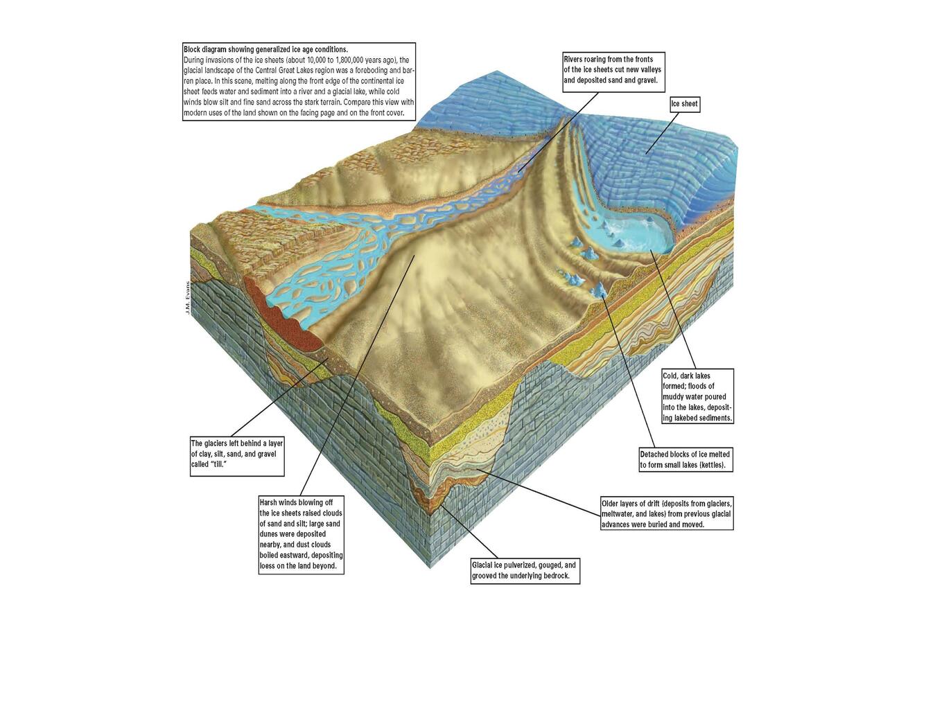
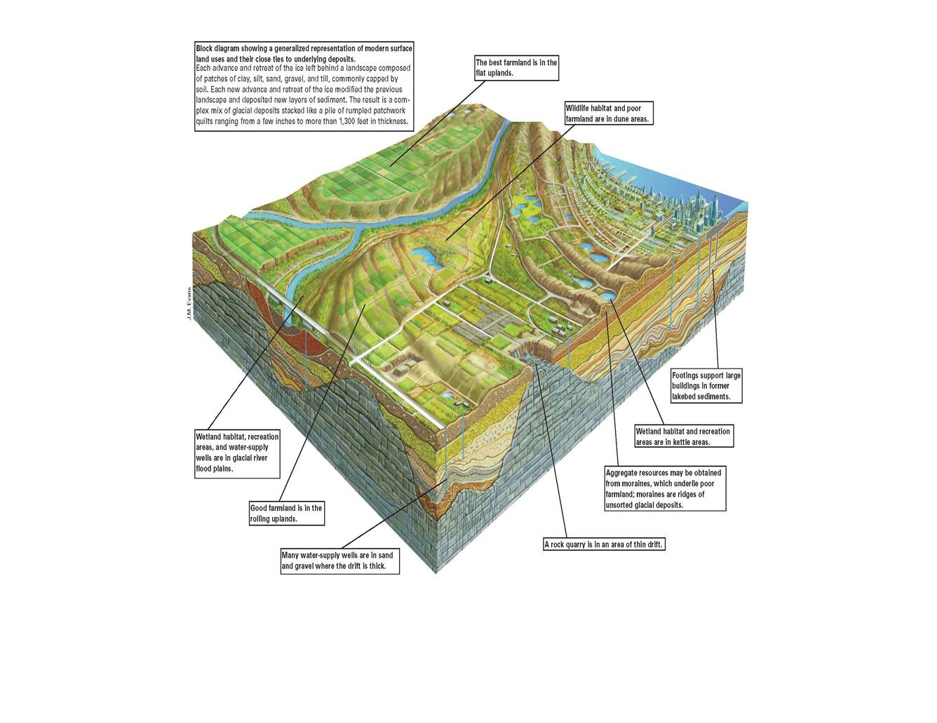
Ice age conditions compared to present day: a block diagram of the Central Great Lakes Region geology.
Detailed Description
This block diagram shows an artistic depiction of what ice age conditions would have been contrasted to current land use. The diagram also shows how the underlaying glacial deposits and rock layers are used today.
Sources/Usage
Public Domain.
Diagrams developed by J.M. Evans.
Central Great Lakes Geologic Mapping Coalition, Illinois State Geological Survey Indiana Geological Survey Michigan Geological Survey Division Ohio Division of Geological Survey U.S. Geological Survey, 1999, Sustainable Growth in America’s Heartland— 3-D Geologic Maps as the Foundation, U.S. Geological Survey Circular 1190.
Related
Great Lakes Geologic Mapping Coalition (GLGMC)
The Great Lakes Geologic Mapping Coalition (GLGMC) advances the understanding of the three-dimensional distribution of the glacial sediments that overlie the bedrock of the glaciated terrain of the Great Lakes Region. This region includes 8 U.S. States (Illinois, Indiana, Michigan, Minnesota, New York, Ohio, Pennsylvania, and Wisconsin) and the Canadian Province of Ontario.