
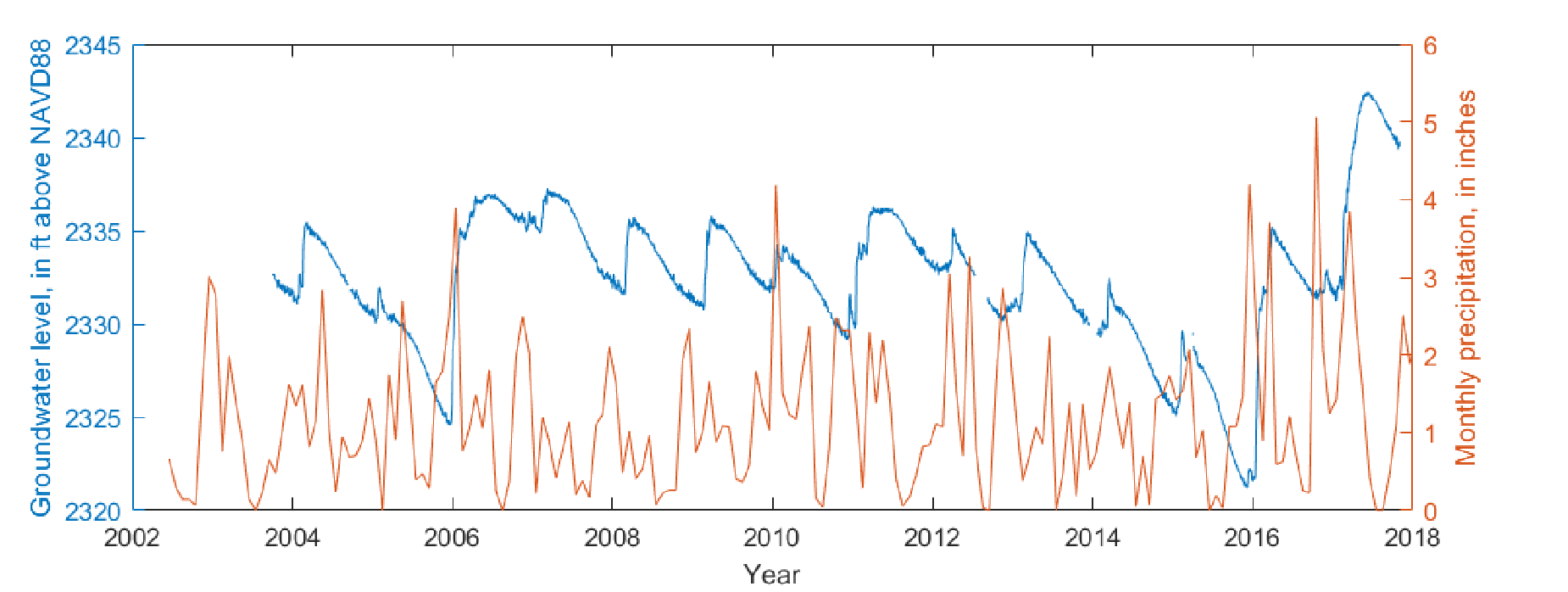
Groundwater levels and precipitation at a Climate Response Network site in Lincoln County, Washington

Detailed Description
Graph showing groundwater levels of Climate Response Network site in Lincoln County, Washington (USGS site 473442118162201) and monthly precipitation at a nearby weather station in Davenport, Washington (National Oceanic and Atmospheric Administration station ID USC00452007). Long and Konrad (2020) calculated a lag time of 4.4 months between precipitation peaks (early December) and annual groundwater peaks (mid-April) at this site (USGS Open-File Report 2020-1007).
Sources/Usage
Public Domain.