
Landsat Level-3 Dynamic Surface Water Extent of the Chesapeake Bay
Detailed Description
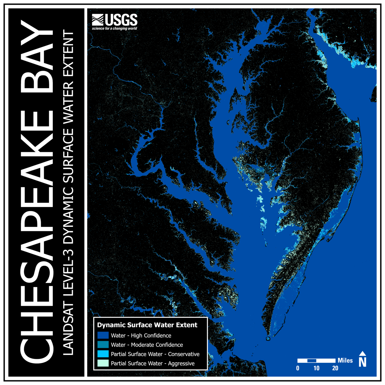
The Chesapeake Bay is roughly 200 miles (322 kilometers) in length and varies in width from a mere 4 miles (6.4 kilometers) near Aberdeen, Maryland, to 30 miles (48 kilometers) near Cape Charles, Virginia. The immense body of water has an average depth of 21 feet (6.4 meters), but it dips down to 174 feet (53 meters) at its deepest location near Bloody Point on Kent Island, Maryland. Fed by numerous tributaries that supply billions of gallons of freshwater each day, the Chesapeake Bay is linked to a vast network of aquatic and wetland ecosystems that support an impressive diversity of plants and wildlife.
The Chesapeake Bay is a complex system that faces numerous challenges, from pollution and habitat loss to water level fluctuations and land subsidence. The Landsat Level-3 Dynamic Surface Water Extent (DSWE) science product offers a powerful resource to help monitor some of these changes over time. The DSWE product identifies areas of surface water inundation, and it provides important information about the existence and condition of surface water. Different applications include hydrologic modeling, reservoir monitoring, wetland delineation, and flood mitigation and recovery. Learn more here:
Learn more about Level-3 Dynamic Surface Water Extent Science Product here and here.
This Collection 2 Level-3 Dynamic Surface Water Extent Science Product is a mosaic of 12 different Analysis Ready Data (ARD) tiles. The Interpreted Layer with All Masks Applied (INWAM) layer was used.
CONUS 027008, October 20, 2024
CONUS 027009, October 20, 2024
CONUS 027010, October 20, 2024
CONUS 028008, October 20, 2024
CONUS 028008, October 21, 2024
CONUS 028009, October 20, 2024
CONUS 028009, October 21, 2024
CONUS 028010, October 20, 2024
CONUS 028010, October 21, 2024
CONUS 029008, October 21, 2024
CONUS 029009, October 21, 2024
CONUS 029010, October 21, 2024
Sources/Usage
Public Domain.